Category:PEF map of Western Palestine (details of sheet 14)
Jump to navigation
Jump to search
Media in category "PEF map of Western Palestine (details of sheet 14)"
The following 14 files are in this category, out of 14 total.
-

-
 Historical map series for the area of al-Haditha, Ramle (1870s).jpg 739 × 743; 235 KB
-
 Historical map series for the area of al-Muzayri'a (1870s).jpg 740 × 744; 183 KB
-
 Historical map series for the area of Al-Tira, Ramle (1870s).jpg 740 × 744; 148 KB
-
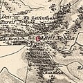 Historical map series for the area of Bayt Nabala (1870s).jpg 740 × 743; 237 KB
-
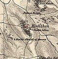
 Historical map series for the area of Dayr Abu Salama (1870s).jpg 739 × 743; 236 KB
-
 Historical map series for the area of Dayr Tarif (1870s).jpg 740 × 743; 195 KB
-
 Historical map series for the area of Jimzu (1870s).jpg 739 × 743; 257 KB
-
 Historical map series for the area of Majdal Yaba (1870s).jpg 740 × 744; 167 KB
-
 Historical map series for the area of Qula (1870s).jpg 740 × 744; 192 KB
-
 Historical map series for the area of Shilta (1870s).jpg 739 × 743; 202 KB
-
 Jutna and Durah in the Survey of Western Palestine 1880.14 (cropped).jpg 892 × 802; 347 KB
-
 Modiin1870s.jpg 1,094 × 1,046; 245 KB
-
 PEF map - BEIT NABALA.jpg 1,087 × 569; 175 KB
.jpg)
.jpg)
.jpg)
.jpg)
.jpg)
.jpg)
.jpg)
.jpg)
.jpg)
.jpg)
.jpg)
.jpg)

