Category:Owen Falls Dam
Jump to navigation
Jump to search
| Object location | | View all coordinates using: OpenStreetMap |
|---|
dam and lake  | |||||
| Upload media | |||||
| Instance of | |||||
|---|---|---|---|---|---|
| Location | White Nile | ||||
| Located in or next to body of water | |||||
| Operator |
| ||||
| Service entry |
| ||||
| Inception |
| ||||
| Nominal power capacity |
| ||||
| Drainage basin | |||||
 | |||||
Media in category "Owen Falls Dam"
The following 23 files are in this category, out of 23 total.
-
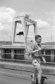
 Africa speaks - a story of adventure ... ((192-?)) (17755441528).jpg 2,880 × 1,670; 1.34 MB
-
-

-

-

-

-

-
 From top of Nalubaale Power Station.jpg 640 × 480; 125 KB
-
 JinjaBridge.jpg 286 × 160; 18 KB
-
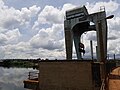
 JinjaDam.jpg 286 × 167; 13 KB
-
 Nalubaale ETM 2001-11-27.jpg 540 × 405; 83 KB
-
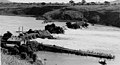 Owen Falls Dam construction.jpg 290 × 157; 16 KB
-
 Owen Falls Dam Jinja - Uganda - 1971.jpg 1,588 × 1,038; 1.71 MB
-
 Owen Falls Dam Jinja Oct 2019 Crane.jpg 4,608 × 3,456; 2.21 MB
-
 Owen Falls Dam Jinja Oct 2019 Dam structure 2.jpg 4,608 × 3,456; 2.85 MB
-
 Owen Falls Dam Jinja Oct 2019 Dam structure.jpg 4,608 × 3,456; 3.54 MB
-
 Owen Falls Dam Jinja Oct 2019 Road Restrictions.jpg 4,608 × 3,456; 3.34 MB
-
 Owen Falls Dam Jinja Oct 2019 View downstream.jpg 4,608 × 3,456; 2.67 MB
-
 Owen Falls Dam Jinja Okt 2019 Crane II.jpg 4,032 × 3,024; 2.69 MB
-
 Owen Falls Dam Jinja Okt 2019 Outlets.jpg 3,024 × 4,032; 2.25 MB
-
 Owen Falls Dam Jinja Okt 2019 Panorama.jpg 8,440 × 3,628; 6.61 MB
-
 Owen Falls Dam, Uganda-1 - by Nao Iizuka.jpg 1,024 × 681; 412 KB
-
 Owen Falls Dam, Uganda-2 - by Nao Iizuka.jpg 1,024 × 681; 515 KB
)_(17755441528).jpg)


