Category:Overhead power lines in North Yorkshire
Jump to navigation
Jump to search
Ceremonial counties of England: Buckinghamshire · Cambridgeshire · Cheshire · Cornwall · Cumbria · Dorset · Durham · East Riding of Yorkshire · Essex · Gloucestershire · Greater London · Greater Manchester · Hampshire · Hertfordshire · Kent · Leicestershire · Lincolnshire · Norfolk · North Yorkshire · Northamptonshire · Northumberland · Nottinghamshire · Oxfordshire · Shropshire · Somerset · South Yorkshire · Suffolk · Surrey · Tyne and Wear · Warwickshire · West Midlands · West Sussex · West Yorkshire · Wiltshire ·
City-counties:
Former historic counties:
Other former counties:
City-counties:
Former historic counties:
Other former counties:
Main category: Overhead power lines
Subcategories
This category has only the following subcategory.
Media in category "Overhead power lines in North Yorkshire"
The following 35 files are in this category, out of 35 total.
-
 20 kV switch and tap.jpg 4,608 × 3,456; 3.01 MB
-
 Approaching the junction - geograph.org.uk - 1707773.jpg 640 × 480; 189 KB
-
 Brotherton Ings - geograph.org.uk - 271384.jpg 640 × 480; 73 KB
-
 Caution sign on Wetherby Road (geograph 4342718).jpg 1,024 × 768; 214 KB
-
 Duck pond at Danebury Manor (geograph 6649873).jpg 4,608 × 3,456; 4.27 MB
-
 Electricity pylons, Wetherby Road, Rufforth, North Yorkshire (12th June 2013).JPG 2,176 × 3,872; 1.58 MB
-
 Electricity supply pole and boundary marker (geograph 6468433).jpg 737 × 800; 132 KB
-
 Farmland near Willow Garths Nature Reserve - geograph.org.uk - 2476134.jpg 1,600 × 1,200; 442 KB
-
 Footpath between Spofforth and Kirk Deighton (9th September 2020) 001.jpg 5,152 × 3,864; 4.08 MB
-
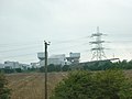 Kellingley (Selby) Colliery - geograph.org.uk - 2017388.jpg 800 × 600; 165 KB
-
 Lone Power Distribution Pole - geograph.org.uk - 399242.jpg 448 × 640; 88 KB
-
 Minor road towards Forden (geograph 2115461).jpg 800 × 600; 252 KB
-
 Minor Road Towards Willerby Wold - geograph.org.uk - 1330374.jpg 640 × 480; 65 KB
-
 Moor Lane, Langthorpe - geograph.org.uk - 371934.jpg 640 × 480; 47 KB
-
 Overhead power lines behind All Saints Church, Kirk Deighton (23rd April 2013).JPG 2,176 × 3,872; 1.24 MB
-
 Power lines by the Harland Way between Wetherby and Spofforth (3rd November 2018) 001.jpg 5,152 × 3,864; 6.38 MB
-
 Pump station on stilts - geograph.org.uk - 686478.jpg 640 × 427; 64 KB
-

-
 Sheep and pylons alongside the River Aire - geograph.org.uk - 2478023.jpg 1,024 × 768; 143 KB
-
 Sheep grazing on the north bank of the Aire - geograph.org.uk - 2478016.jpg 1,024 × 768; 180 KB
-
 Sheep on the north bank of the River Aire - geograph.org.uk - 4735125.jpg 1,024 × 768; 109 KB
-
 South Gare Breakwater - geograph.org.uk - 412353.jpg 640 × 480; 73 KB
-
 Sudforth Lane - geograph.org.uk - 6003740.jpg 1,280 × 960; 442 KB
-
 The barge "Wheldale" heading upstream - geograph.org.uk - 3405516.jpg 2,907 × 2,178; 1.36 MB
-
 Thief Lane - geograph.org.uk - 1403746.jpg 640 × 480; 76 KB
-
 Traffic lights on the south side of Stubbs Bridge - geograph.org.uk - 6003252.jpg 2,560 × 1,920; 2.36 MB
-
 Transmission Poles - geograph.org.uk - 1286189.jpg 427 × 640; 57 KB
-
 Under overhead cables - geograph.org.uk - 1323579.jpg 640 × 480; 119 KB
-
 Utility pole, Ashdale Lane, Kirk Deighton (9th September 2020).jpg 5,152 × 3,864; 4.58 MB
-
 Walking From Great Wood - geograph.org.uk - 265978.jpg 640 × 480; 101 KB
-

-
-
 Electricity Poles, Field of Rape - geograph.org.uk - 164130.jpg 480 × 640; 50 KB
-
 Electricity Poles, Sleddale - geograph.org.uk - 420948.jpg 640 × 427; 43 KB
-
 Electricity Transmission Poles - geograph.org.uk - 715500.jpg 480 × 640; 103 KB


.jpg)
.jpg)
.JPG)
.jpg)

_001.jpg)
_Colliery_-_geograph.org.uk_-_2017388.jpg)

.jpg)


.JPG)
_001.jpg)


.jpg)


