Category:Outcrops in Pennsylvania
Jump to navigation
Jump to search
States of the United States: Alabama · Alaska · Arizona · Arkansas · California · Colorado · Connecticut · Delaware · Florida · Georgia · Hawaii · Idaho · Illinois · Indiana · Iowa · Kansas · Kentucky · Louisiana · Maine · Maryland · Massachusetts · Michigan · Minnesota · Mississippi · Missouri · Montana · Nebraska · Nevada · New Hampshire · New Jersey · New Mexico · New York · North Carolina · North Dakota · Ohio · Oklahoma · Oregon · Pennsylvania · Rhode Island · South Carolina · South Dakota · Tennessee · Texas · Utah · Vermont · Virginia · Washington · West Virginia · Wisconsin · Wyoming
American Samoa
American Samoa
Subcategories
This category has the following 8 subcategories, out of 8 total.
Media in category "Outcrops in Pennsylvania"
The following 38 files are in this category, out of 38 total.
-
 Bald Eagle 522 Shade Gap.jpg 2,048 × 1,536; 836 KB
-
 Bartlett Mountain (10) (16198494545).jpg 5,184 × 3,456; 19.56 MB
-
 Bartlett Mountain (9) (15576064344).jpg 5,184 × 3,456; 20.74 MB
-
 Bedford-co-rt30-warrior.jpg 2,046 × 726; 280 KB
-
 Bedrock (8423721493).jpg 5,184 × 3,456; 16.64 MB
-
 Bob Webber Trail (12) (14597794444).jpg 5,184 × 3,456; 18.15 MB
-
 Bob Webber Trail (13) (14413174089).jpg 5,184 × 2,992; 14.74 MB
-
 Brallier Formation PA Turnpike MM138.JPG 2,048 × 1,536; 1.71 MB
-
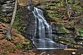 Bridal Veil Falls.jpg 2,048 × 1,365; 679 KB
-
 Casselman Fm I-76.jpg 2,048 × 1,536; 1.06 MB
-
 Catskill1.jpg 712 × 342; 267 KB
-
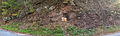
 Chert beds EverettPA.jpg 1,245 × 816; 502 KB
-
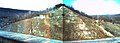
 Corriganville NewCreek pan.jpg 3,138 × 1,188; 1,005 KB
-
 Flickr - Nicholas T - Curvy.jpg 3,604 × 2,713; 6.86 MB
-
 Gettysburg Formation outcrop.jpg 2,593 × 781; 547 KB
-
 Grassy Hollow Road (6) (31059439124).jpg 5,184 × 3,456; 18.37 MB
-
 Half Dome Trail (1) (13962560034).jpg 3,456 × 4,274; 13.36 MB
-
 Junction fault 0112.jpg 2,560 × 1,920; 3.88 MB
-
 Juniata Fm Blacklog.jpg 2,048 × 1,300; 752 KB
-
 Keyser Formation 522.jpg 2,048 × 1,536; 1.03 MB
-

-

-
 Lehigh Gap Shawangunk Formation 2.jpg 1,024 × 680; 223 KB
-
 Leonard Harrison State Park boulders.jpg 2,048 × 1,536; 1.33 MB
-
 Leonard Harrison State Park Overlook 2.jpg 2,048 × 1,536; 1.3 MB
-
 Mahantango Formation Rt522 PA.jpg 4,168 × 1,213; 1.63 MB
-
 Milford Township Fanned.jpg 3,264 × 2,448; 5.63 MB
-
 Outcrops of Newark Supergroup Lutrell (1989) USGS Bulletin 1572.png 1,395 × 3,508; 1.8 MB
-
 PA Wayne county Newfoundland and Pine Grove gravel pit IMG 1907.JPG 3,456 × 5,184; 8.47 MB
-
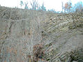
 Port Clinton, PA - bedrock outcrop.jpg 2,436 × 1,624; 2.24 MB
-
 Rays Hill Tunnel - Andrew Carnegie - 1880s-edit.jpg 1,753 × 1,146; 2.79 MB
-
 Reedsville Formation 522.jpg 2,048 × 1,536; 1.3 MB
-

-
 Rough Hill Trail (10) (36137338920).jpg 5,184 × 3,456; 19.31 MB
-

-
 Tuscarora Formation outcrop 1.jpg 768 × 512; 79 KB
-
 Weathering Limestone State College PA.jpg 1,500 × 1,000; 700 KB
-
 Wills Creek Formation 20211114.jpg 2,268 × 3,024; 5.39 MB

_(16198494545).jpg)
_(15576064344).jpg)
.jpg)
_(14597794444).jpg)
_(14413174089).jpg)


_(31059439124).jpg)
_(13962560034).jpg)


_15_(48353947387).jpg)
_16_(48353943987).jpg)


_(36137338920).jpg)


_USGS_Bulletin_1572.png)