Category:Oude stadhuis, Schiedam
Jump to navigation
Jump to search
| Object location | | View all coordinates using: OpenStreetMap |
|---|
 | |||||
| Upload media | |||||
| Instance of | |||||
|---|---|---|---|---|---|
| Location | Schiedam, South Holland, Netherlands | ||||
| Street address |
| ||||
| Located on street |
| ||||
| Heritage designation |
| ||||
 | |||||
|
This is a category about rijksmonument number 33128
|
| Address |
|
Subcategories
This category has only the following subcategory.
E
Media in category "Oude stadhuis, Schiedam"
The following 111 files are in this category, out of 111 total.
-

-
 Anker en oorspronkelijk gekleurd muurwerk - Schiedam - 20338101 - RCE.jpg 795 × 1,200; 207 KB
-
-
 Buitenzijde - Schiedam - 20022065 - RCE.jpg 1,200 × 952; 276 KB
-
 Detail anker - Schiedam - 20331214 - RCE.jpg 1,192 × 1,200; 311 KB
-
 Detail anker - Schiedam - 20331216 - RCE.jpg 1,196 × 1,200; 375 KB
-
 Detail anker - Schiedam - 20331217 - RCE.jpg 1,194 × 1,200; 321 KB
-
 Detail anker en houten balk - Schiedam - 20331210 - RCE.jpg 1,191 × 1,200; 351 KB
-
 Detail anker en natuurstenen blok - Schiedam - 20331219 - RCE.jpg 1,191 × 1,200; 368 KB
-
 Detail ijzerwerk boven raam - Schiedam - 20331203 - RCE.jpg 1,200 × 1,192; 246 KB
-
 Detail zandsteen met gele okerverf - Schiedam - 20331201 - RCE.jpg 1,197 × 1,200; 406 KB
-
 Exterieur - Schiedam - 20196428 - RCE.jpg 1,200 × 952; 249 KB
-
 Exterieur - Schiedam - 20196429 - RCE.jpg 1,200 × 946; 240 KB
-
 Gedeelte gevel met anker - Schiedam - 20331212 - RCE.jpg 1,190 × 1,200; 359 KB
-
 Gedeelte gevel met anker - Schiedam - 20331215 - RCE.jpg 1,194 × 1,200; 329 KB
-

-
 IJzerwerk boven raam - Schiedam - 20331206 - RCE.jpg 1,195 × 1,200; 282 KB
-
 Interieur begane grond, gang naar de raadzaal - Schiedam - 20331093 - RCE.jpg 1,192 × 1,200; 172 KB
-

-

-
 Interieur ruimte voor de raadzaal links - Schiedam - 20331098 - RCE.jpg 1,193 × 1,200; 243 KB
-

-

-

-
-

-
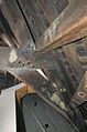
 Interieur stadhuis, trekanker in zijgevel - Schiedam - 20338061 - RCE.jpg 1,200 × 795; 132 KB
-
-

-
-
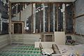
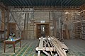
 Interieur stadhuis, zolder tijdens restauratie - Schiedam - 20338052 - RCE.jpg 795 × 1,200; 186 KB
-
 Interieur stadhuis, zolder, binnenkant voorgevel - Schiedam - 20338058 - RCE.jpg 1,200 × 859; 206 KB
-
 Interieur stadhuis, zolder, binnenkant voorgevel - Schiedam - 20338059 - RCE.jpg 1,200 × 795; 153 KB
-

-

-

-
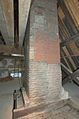
 Interieur stadhuistoren, aangegoten vloerplaat - Schiedam - 20338047 - RCE.jpg 1,200 × 795; 126 KB
-
 Interieur stadhuistoren, detail houtconstructie - Schiedam - 20338044 - RCE.jpg 1,200 × 795; 172 KB
-
 Interieur stadhuistoren, detail tafelment - Schiedam - 20338039 - RCE.jpg 1,200 × 795; 139 KB
-

-

-

-
 Interieur tegeltableau boven de ingang van de raadzaal - Schiedam - 20331094 - RCE.jpg 1,194 × 1,200; 284 KB
-
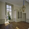
 Interieur voorkamer, links van de ingang - Schiedam - 20331095 - RCE.jpg 1,185 × 1,200; 255 KB
-

-
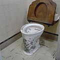
 Interieur, begane grond, toilet - Schiedam - 20331101 - RCE.jpg 1,196 × 1,200; 163 KB
-
 Interieur, begane grond, toilet - Schiedam - 20331102 - RCE.jpg 1,194 × 1,200; 193 KB
-
 Interieur, begane grond, toilet - Schiedam - 20331103 - RCE.jpg 1,193 × 1,200; 193 KB
-

-

-

-

-

-
-

-

-
-

-

-

-

-
-
 Interieur, datum van behang 1795 - Schiedam - 20331228 - RCE.jpg 1,192 × 1,200; 329 KB
-
 Interieur, detail van wandschildering in grijze kamer - Schiedam - 20374139 - RCE.jpg 1,200 × 1,200; 198 KB
-
 Interieur, hal bij de centrale ingang - Schiedam - 20374130 - RCE.jpg 1,200 × 1,200; 170 KB
-
 Interieur, horeca ruimte op begane grond - Schiedam - 20374145 - RCE.jpg 1,200 × 1,200; 157 KB
-
 Interieur, horeca ruimte op begane grond - Schiedam - 20374147 - RCE.jpg 1,200 × 1,200; 165 KB
-
 Interieur, kelder, overzicht gang - Schiedam - 20331105 - RCE.jpg 1,189 × 1,200; 159 KB
-
 Interieur, keuken op begane grond - Schiedam - 20374146 - RCE.jpg 1,200 × 1,200; 167 KB
-
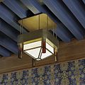 Interieur, lamp in de trouwzaal - Schiedam - 20374135 - RCE.jpg 1,200 × 1,200; 216 KB
-
 Interieur, overzicht horeca ruimte op begane grond - Schiedam - 20374148 - RCE.jpg 1,200 × 1,200; 160 KB
-

-
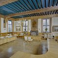 Interieur, overzicht trouwzaal - Schiedam - 20331099 - RCE.jpg 1,192 × 1,200; 233 KB
-
 Interieur, overzicht trouwzaal - Schiedam - 20374141 - RCE.jpg 1,200 × 1,200; 268 KB
-

-
 Interieur, overzicht van gang op begane grond - Schiedam - 20374144 - RCE.jpg 1,200 × 1,200; 211 KB
-
 Interieur, raadzaal, schilderstuk boven de schouw - Schiedam - 20331100 - RCE.jpg 1,193 × 1,200; 316 KB
-
 Interieur, roetafdruk op muur door behangsel - Schiedam - 20331232 - RCE.jpg 1,150 × 1,200; 391 KB
-

-

-
 Interieur, schouw in trouwzaal - Schiedam - 20374142 - RCE.jpg 1,200 × 1,200; 273 KB
-

-

-
-
-

-

-

-

-
-

-

-

-

-

-

-
 Interieur, trapopgang naar de kelder en raadzaal - Schiedam - 20331104 - RCE.jpg 1,194 × 1,200; 204 KB
-
 Interieur, voorgevel, venster met vouwblinden - Schiedam - 20338065 - RCE.jpg 795 × 1,200; 158 KB
-
 Interieur, wandlamp in de trouwzaal - Schiedam - 20374131 - RCE.jpg 1,200 × 1,200; 407 KB
-

-
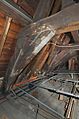
 Interieur, zolder, kapconstructie - Schiedam - 20331106 - RCE.jpg 1,200 × 1,200; 307 KB
-
 Naar tekening in Stedelijk Museum - Schiedam - 20196426 - RCE.jpg 1,200 × 933; 326 KB
-
 Nederland Schiedam 04.jpg 6,016 × 4,016; 6.29 MB
-
 Overzicht aansluiting Boterstraat-Grote Markt (Stadhuis) - Schiedam - 20196269 - RCE.jpg 1,200 × 1,197; 304 KB
-
 Schiedam, Netherlands - panoramio (14).jpg 2,048 × 1,148; 610 KB
-
 Stadswapen boven ingang aan de voorzijde - Schiedam - 20374151 - RCE.jpg 1,200 × 1,200; 335 KB
-
 Toren, aanbrengen van nieuwe houten zuilen - Schiedam - 20331222 - RCE.jpg 1,192 × 1,200; 261 KB
-
 Toren, detail van aanbrengen van nieuwe houten zuil - Schiedam - 20331225 - RCE.jpg 1,193 × 1,200; 225 KB
-
 Toren, detail van aanbrengen van nieuwe houten zuilen - Schiedam - 20331221 - RCE.jpg 1,190 × 1,200; 183 KB
-

-
 Zijgevel, anker en klampwerk - Schiedam - 20338098 - RCE.jpg 1,200 × 795; 216 KB


_-_Schiedam_-_20196269_-_RCE.jpg)
.jpg)


