Category:Oude Delft 73
Jump to navigation
Jump to search
| Object location | | View all coordinates using: OpenStreetMap |
|---|
house in Delft, Netherlands  | |||||
| Upload media | |||||
| Instance of | |||||
|---|---|---|---|---|---|
| Location | Delft, South Holland, Netherlands | ||||
| Street address |
| ||||
| Located on street | |||||
| Heritage designation |
| ||||
 | |||||
|
This is a category about rijksmonument number 11991
|
| Address |
|
Subcategories
This category has only the following subcategory.
R
- Restoration of Oude Delft 73 (22 F)
Media in category "Oude Delft 73"
The following 22 files are in this category, out of 22 total.
-
 Achtergevel - Delft - 20052550 - RCE.jpg 1,195 × 1,200; 336 KB
-
 Achtergevels - Delft - 20052549 - RCE.jpg 1,200 × 1,197; 359 KB
-
 Binnenplaats - Delft - 20052552 - RCE.jpg 1,197 × 1,200; 327 KB
-
 Delft - Oude Delft 73.jpg 1,944 × 2,592; 1.89 MB
-
 Deurtje op zolder in zijgevel - Delft - 20052569 - RCE.jpg 1,195 × 1,200; 252 KB
-
 Fontein in gang - Delft - 20052560 - RCE.jpg 1,188 × 1,200; 262 KB
-
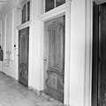 Gangdeuren - Delft - 20052556 - RCE.jpg 1,200 × 1,195; 203 KB
-
 Gevel - Delft - 20052505 - RCE.jpg 802 × 1,200; 233 KB
-
 Gevel binnenplaats - Delft - 20052551 - RCE.jpg 1,193 × 1,200; 382 KB
-
 Interieur gang - Delft - 20052507 - RCE.jpg 1,200 × 1,195; 203 KB
-
 Interieur gang - Delft - 20052555 - RCE.jpg 1,183 × 1,200; 194 KB
-
 Interieur plafond in gang - Delft - 20052508 - RCE.jpg 1,195 × 1,200; 259 KB
-
 Kapspant - Delft - 20052568 - RCE.jpg 1,200 × 1,192; 221 KB
-
 Keuken - Delft - 20052566 - RCE.jpg 1,192 × 1,200; 238 KB
-
 Plafond parterre - Delft - 20052565 - RCE.jpg 1,188 × 1,200; 216 KB
-
 Schouw in tussenkamer parterre - Delft - 20052563 - RCE.jpg 1,188 × 1,200; 198 KB
-
 Stucwerk in gang - Delft - 20052559 - RCE.jpg 1,200 × 1,197; 270 KB
-
 Trap - Delft - 20052567 - RCE.jpg 1,198 × 1,200; 160 KB
-
 Tussengoot - Delft - 20052553 - RCE.jpg 1,197 × 1,200; 327 KB
-
 Tussengoot - Delft - 20052554 - RCE.jpg 1,200 × 1,195; 389 KB
-
 Voorgevel - Delft - 20052506 - RCE.jpg 866 × 1,200; 273 KB
-
 WLM - R&@E - 11991 Oude Delft 73.jpg 768 × 1,024; 449 KB


