Category:Orford Ness
Jump to navigation
Jump to search
cuspate foreland shingle spit in Suffolk, England  | |||||
| Upload media | |||||
| Instance of | |||||
|---|---|---|---|---|---|
| Location | East Suffolk, Suffolk, East of England, England | ||||
| Owned by | |||||
| Operator | |||||
| Maintained by | |||||
| official website | |||||
 | |||||
Subcategories
This category has the following 3 subcategories, out of 3 total.
Media in category "Orford Ness"
The following 200 files are in this category, out of 200 total.
-
-
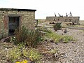
 'The Barracks', Orford Ness - geograph.org.uk - 939014.jpg 640 × 427; 107 KB
-
 170531 Orford 1 (35835128895).jpg 5,472 × 3,080; 8.38 MB
-
 A Relic of Past Experimentation - geograph.org.uk - 927001.jpg 480 × 640; 107 KB
-
 Abandoned Coils of Wire - geograph.org.uk - 926991.jpg 640 × 480; 92 KB
-
 Access denied - geograph.org.uk - 927247.jpg 640 × 480; 89 KB
-
 Access to the AWRE Site - geograph.org.uk - 927244.jpg 640 × 480; 88 KB
-
 Across to Orford Ness - geograph.org.uk - 3684716.jpg 2,048 × 1,536; 469 KB
-
 Admiralty Chart No 1089 Orfordness to Blakeney, Published 1941.jpg 11,057 × 18,355; 54.16 MB
-
 Admiralty Chart No 1406 Dover and Calais to Orfordness and Scheveningen, Published 1906.jpg 16,332 × 11,290; 57.9 MB
-
 Admiralty Chart No 1610 North Foreland to Orfordness, Published 1933 Large Corrections 1947.jpg 13,567 × 11,258; 33.89 MB
-
 Admiralty Chart No 1610 North Foreland to Orfordness, Published 1953.jpg 16,395 × 11,326; 43.18 MB
-
 Admiralty Chart No 1630 England - east coast Orfordness to Cromer RMG L1186, Published 1874.tiff 8,827 × 12,257; 309.54 MB
-
-

-
 Admiralty Chart No 2052 The Naze to Orford Ness, Published 1966.jpg 16,324 × 11,222; 11.95 MB
-
 Advisory Notice on Orford Ness - geograph.org.uk - 926983.jpg 480 × 640; 90 KB
-
 Appleton-Alb345b.1Cropped.jpg 2,892 × 2,001; 740 KB
-
 AWRE Police Tower, Orford Ness - geograph.org.uk - 934994.jpg 480 × 640; 70 KB
-
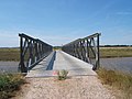
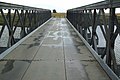
 Bailey Bridge crossing Stony Ditch - geograph.org.uk - 926829.jpg 640 × 474; 71 KB
-
-
-
 Black Beacon (24042339961).jpg 3,617 × 2,695; 2.13 MB
-
 Bomb Ballistics Building, Orford Ness - geograph.org.uk - 1966618.jpg 800 × 533; 160 KB
-
 Butley River from the air - geograph.org.uk - 2962712.jpg 480 × 640; 115 KB
-
 Chinese Wall Bridge, Orford Ness - geograph.org.uk - 1955771.jpg 640 × 427; 85 KB
-
 Coastguard Lookout - geograph.org.uk - 927023.jpg 640 × 480; 76 KB
-
 Coastguard station, Orford Ness - geograph.org.uk - 4238260.jpg 640 × 425; 150 KB
-
 Cold war detritus, Orford Ness - geograph.org.uk - 932646.jpg 640 × 480; 143 KB
-

-
 Dangerous Structure - geograph.org.uk - 2601008.jpg 800 × 531; 104 KB
-

-
 Desolation at Orford Ness - geograph.org.uk - 176347.jpg 640 × 480; 73 KB
-
 Discarded Perforated Steel Planking - geograph.org.uk - 926988.jpg 640 × 480; 138 KB
-
 Ferry, Orford Ness - geograph.org.uk - 535535.jpg 640 × 480; 64 KB
-
 First World War barracks, Orford Ness - geograph.org.uk - 938960.jpg 640 × 427; 106 KB
-
 Floating Landing Stage, Orford Ness - geograph.org.uk - 1956196.jpg 640 × 427; 97 KB
-
 Former Coastguard Lookout - geograph.org.uk - 927100.jpg 640 × 480; 92 KB
-

-
 Gate and perimeter fence, Orford Ness - geograph.org.uk - 938989.jpg 640 × 427; 77 KB
-
 Gateway at Orfordness - geograph.org.uk - 2600859.jpg 800 × 531; 107 KB
-
 Grazing Land at Orfordness - geograph.org.uk - 2601575.jpg 800 × 531; 110 KB
-
 Grazing marsh, Orford Ness - geograph.org.uk - 939151.jpg 640 × 427; 103 KB
-
 Harumphy.cobramist.jpg 2,565 × 864; 292 KB
-
 Interior of Laboratory 1 - geograph.org.uk - 935271.jpg 640 × 480; 132 KB
-
 Lab 1 - geograph.org.uk - 927263.jpg 640 × 480; 89 KB
-
 Lab 1 - geograph.org.uk - 927267.jpg 640 × 480; 91 KB
-
 Lab 1 - geograph.org.uk - 927278.jpg 640 × 480; 90 KB
-
 Laboratories at Orfordness - geograph.org.uk - 2601429.jpg 800 × 531; 126 KB
-
 Laboratory 1 - Orford Ness - geograph.org.uk - 4238263.jpg 471 × 640; 171 KB
-
 Laboratory One - geograph.org.uk - 2601348.jpg 800 × 531; 102 KB
-
 Lagoons and River Wall, Orford Ness - geograph.org.uk - 1967893.jpg 800 × 533; 166 KB
-
 Looking Across the Shingle Banks - geograph.org.uk - 927168.jpg 640 × 475; 99 KB
-
 Looking Across the Shingle Banks - geograph.org.uk - 927299.jpg 640 × 472; 84 KB
-

-

-
 Narrow gauge railway tracks, Orford Ness - geograph.org.uk - 932638.jpg 427 × 640; 132 KB
-

-
 Ness Landscape (23496865854).jpg 3,601 × 2,066; 1.89 MB
-
 Ness Landscape (23496872074).jpg 3,648 × 1,939; 2.37 MB
-
 No Ice Cream Today^ Orford Ness - geograph.org.uk - 178792.jpg 640 × 480; 66 KB
-

-
 Old airfield, Orford Ness - geograph.org.uk - 4238266.jpg 640 × 480; 192 KB
-
 Ordnance Survey One-Inch Sheet 150 Ipswich, Published 1946.jpg 11,004 × 12,810; 12.76 MB
-
 Ordnance Survey One-Inch Sheet 150 Ipswich, Published 1956.jpg 8,321 × 9,932; 8.12 MB
-
 Ordnance Survey One-Inch Sheet 150 Ipswich, Published 1969.jpg 8,278 × 9,900; 29.02 MB
-
 Ordnance Survey One-Inch Sheet 87 Ipswich, Published 1921.jpg 12,187 × 8,446; 38.8 MB
-
 Orford Beach - geograph.org.uk - 927092.jpg 480 × 640; 98 KB
-
 Orford Beach - geograph.org.uk - 927124.jpg 477 × 640; 57 KB
-
 Orford Beach - geograph.org.uk - 927129.jpg 480 × 640; 77 KB
-
 Orford Beach - geograph.org.uk - 927144.jpg 640 × 480; 61 KB
-
 Orford beach - geograph.org.uk - 934901.jpg 640 × 427; 120 KB
-
 Orford Ness (13953806495).jpg 5,087 × 3,387; 14.85 MB
-
 Orford Ness (4022743855).jpg 3,888 × 2,592; 1.14 MB
-
 Orford Ness (4022825207).jpg 3,888 × 2,592; 643 KB
-
 Orford Ness (4023547788).jpg 3,888 × 2,592; 1.09 MB
-
 Orford Ness - geograph.org.uk - 4195009.jpg 640 × 480; 39 KB
-
 Orford Ness - geograph.org.uk - 4251542.jpg 640 × 425; 109 KB
-
 Orford Ness - geograph.org.uk - 959928.jpg 640 × 480; 154 KB
-
 Orford Ness - geograph.org.uk - 959933.jpg 480 × 640; 84 KB
-
 Orford Ness - geograph.org.uk - 959938.jpg 640 × 480; 122 KB
-
 Orford Ness - Portland Sheep (14534764423).jpg 3,648 × 2,736; 2.69 MB
-
 Orford Ness 01.jpg 3,008 × 2,000; 681 KB
-
 Orford Ness 02.jpg 3,008 × 2,000; 842 KB
-
 Orford Ness 03.jpg 3,008 × 2,000; 726 KB
-
 Orford Ness 04.jpg 3,008 × 2,000; 838 KB
-
 Orford Ness 05.jpg 3,008 × 2,000; 846 KB
-
 Orford Ness 06.jpg 3,008 × 2,000; 822 KB
-
 Orford Ness 07.jpg 3,008 × 2,000; 798 KB
-
 Orford Ness 08.jpg 3,008 × 2,000; 886 KB
-
 Orford Ness 09.jpg 3,008 × 2,000; 816 KB
-
 Orford Ness 10.jpg 3,008 × 2,000; 833 KB
-
 Orford Ness 11.jpg 3,008 × 2,000; 824 KB
-
 Orford Ness 12.jpg 3,008 × 2,000; 810 KB
-
 Orford Ness 13.jpg 3,008 × 2,000; 812 KB
-
 Orford Ness 14.jpg 3,008 × 2,000; 735 KB
-
 Orford Ness 15.jpg 3,008 × 2,000; 768 KB
-
 Orford Ness 16.jpg 3,008 × 2,000; 807 KB
-
 Orford Ness 17.jpg 3,008 × 2,000; 825 KB
-
 Orford Ness 18.jpg 3,008 × 2,000; 835 KB
-
 Orford Ness 19.jpg 3,008 × 2,000; 724 KB
-
 Orford Ness 20.jpg 3,008 × 2,000; 839 KB
-
 Orford Ness 2016-08-27-2 (cropped, edited).jpg 4,491 × 2,255; 3.39 MB
-
 Orford Ness 2016-08-27-2.jpg 4,491 × 2,994; 3.92 MB
-
 Orford Ness 2016-08-27-3.jpg 5,129 × 3,419; 5.04 MB
-
 Orford Ness 2016-08-27-4.jpg 4,340 × 2,892; 3.47 MB
-
 Orford Ness and Lighthouse (27948724263).jpg 3,648 × 1,984; 4.2 MB
-
 Orford Ness footpaths - geograph.org.uk - 1457404.jpg 640 × 480; 294 KB
-
 Orford Ness from Orford Castle - geograph.org.uk - 3889292.jpg 800 × 600; 59 KB
-
 Orford Ness from Orford Quay - geograph.org.uk - 3891124.jpg 800 × 600; 51 KB
-
 Orford Ness from the air - geograph.org.uk - 2033665.jpg 640 × 480; 127 KB
-
 Orford Ness from the air - geograph.org.uk - 2033668.jpg 480 × 640; 114 KB
-
 Orford Ness from the air - geograph.org.uk - 2033671.jpg 480 × 640; 104 KB
-
 Orford Ness Map (UK).svg 492 × 549; 26 KB
-
 Orford Ness Nuclear Testing Site - geograph.org.uk - 2091041.jpg 800 × 531; 64 KB
-
 Orford Ness Nuclear Testing Site - geograph.org.uk - 2091047.jpg 800 × 482; 53 KB
-
 Orford Ness pagoda exterior.jpg 1,536 × 1,024; 256 KB
-
 Orford Ness pagoda interior.jpg 768 × 1,024; 192 KB
-
 Orford Ness Pagodas in Distance - geograph.org.uk - 1329348.jpg 640 × 480; 72 KB
-
 Orford Ness Panorama (28458761072).jpg 3,601 × 1,246; 4.08 MB
-
 Orford Ness transmitter station - geograph.org.uk - 581061.jpg 640 × 480; 51 KB
-
 Orford Ness, Suffolk (3031657650).jpg 2,272 × 1,704; 841 KB
-
 Orfordness Geology - geograph.org.uk - 2600972.jpg 800 × 531; 177 KB
-
 Orfordness grazing marsh - geograph.org.uk - 1329637.jpg 640 × 480; 120 KB
-
 Orfordness pagodas.spliced.jpg 1,289 × 431; 317 KB
-
 Orfordness Railway Remains - geograph.org.uk - 2601533.jpg 800 × 531; 170 KB
-
 Orfordness Shingle - geograph.org.uk - 2600885.jpg 800 × 531; 130 KB
-
 Orfordness Shingle - geograph.org.uk - 2600892.jpg 800 × 531; 121 KB
-
 Orfordness Shingle - geograph.org.uk - 2600915.jpg 800 × 531; 135 KB
-
 Orfordness Shingle - geograph.org.uk - 2600935.jpg 800 × 531; 135 KB
-
 Orfordness Shingle - geograph.org.uk - 2600937.jpg 800 × 531; 118 KB
-
 Orfordness Shingle - geograph.org.uk - 2600960.jpg 800 × 531; 139 KB
-
 Orfordness Shingle - geograph.org.uk - 2600998.jpg 800 × 531; 146 KB
-
 Orfordness Shingle - geograph.org.uk - 2601023.jpg 800 × 531; 119 KB
-
 Orfordness Shingle - geograph.org.uk - 2601434.jpg 800 × 531; 110 KB
-
 Orfordness Shingle - geograph.org.uk - 2601436.jpg 800 × 528; 112 KB
-
 Orfordness Shingle - geograph.org.uk - 2601446.jpg 800 × 531; 113 KB
-
 Orfordness Shingle - geograph.org.uk - 2601462.jpg 800 × 531; 165 KB
-
 Orfordness Shingle - geograph.org.uk - 2601464.jpg 800 × 531; 151 KB
-
 Orfordness Shingle - geograph.org.uk - 2601512.jpg 800 × 531; 94 KB
-
 Orfordness Shingle - geograph.org.uk - 2601525.jpg 800 × 531; 159 KB
-
 Orfordness transmitting station - Suffolk aerial image (11739241703).jpg 4,500 × 2,967; 4.02 MB
-
 Orfordness transmitting station.jpg 2,592 × 1,944; 2.52 MB
-
 Pagodas (28281406510).jpg 3,648 × 1,967; 3.71 MB
-
 Pagodas and Shingle (28459293362).jpg 3,633 × 1,864; 4.8 MB
-
 Pagodas from the Sea - geograph.org.uk - 2091051.jpg 800 × 531; 54 KB
-
 Pagodas from the Sea - geograph.org.uk - 2091059.jpg 800 × 531; 58 KB
-
 Plant life on Orford Ness - geograph.org.uk - 1457131.jpg 640 × 480; 427 KB
-
 Plant on Orford Ness - geograph.org.uk - 1457122.jpg 640 × 480; 579 KB
-
 Police Look Out Tower, Orford Ness - geograph.org.uk - 292811.jpg 480 × 640; 62 KB
-

-
 Random rusting remains, Orford Ness - geograph.org.uk - 932419.jpg 482 × 640; 125 KB
-

-
 Road giving access to Orford Ness - geograph.org.uk - 926824.jpg 640 × 475; 77 KB
-

-
 Sea defences near Orford Ness - geograph.org.uk - 762759.jpg 640 × 427; 70 KB
-
 Shingle bank on Orford Ness - geograph.org.uk - 926611.jpg 640 × 480; 87 KB
-
 Shingle Ridges on Orford Ness - geograph.org.uk - 927147.jpg 640 × 470; 76 KB
-
 Shingle ridges on Orfordness - geograph.org.uk - 1329671.jpg 640 × 480; 112 KB
-
 Shingle, Orford Ness - geograph.org.uk - 935159.jpg 640 × 427; 145 KB
-
 Steel cable on the Shingle - geograph.org.uk - 926831.jpg 480 × 640; 108 KB
-
 Stony Ditch - geograph.org.uk - 1329663.jpg 640 × 480; 105 KB
-
 Stony Ditch on Orford Ness - geograph.org.uk - 1472297.jpg 640 × 480; 345 KB
-
 Stony Ditch, Orford Ness - geograph.org.uk - 1957555.jpg 640 × 427; 95 KB
-
 Stonyditch Point, Orford Ness - geograph.org.uk - 1963297.jpg 640 × 427; 87 KB
-

-
 The edge of Orford Ness - geograph.org.uk - 3891117.jpg 800 × 600; 64 KB
-
 The former RAF officers' mess building on Orford Ness.jpg 5,760 × 3,840; 6 MB
-
 The Hard Target - geograph.org.uk - 927254.jpg 640 × 480; 93 KB
-
 The Hard Target - geograph.org.uk - 927255.jpg 640 × 480; 83 KB
-
 The Plate Store, Orford Ness - geograph.org.uk - 1966667.jpg 800 × 533; 159 KB
-
 The Police Tower - geograph.org.uk - 927139.jpg 480 × 640; 90 KB
-

-
 Track across the Shingle - geograph.org.uk - 926841.jpg 640 × 474; 77 KB
-
 Track on Orford Ness - geograph.org.uk - 535497.jpg 640 × 480; 80 KB
-
 Two types of masts - geograph.org.uk - 581045.jpg 480 × 640; 41 KB
-
 Vegetated Shingle - geograph.org.uk - 926850.jpg 640 × 480; 60 KB
-
 Vegetation on the Shingle Ridges - geograph.org.uk - 926979.jpg 640 × 474; 93 KB
-
 Vehicle Ferry, Orford Ness - geograph.org.uk - 535533.jpg 640 × 480; 87 KB
-
 View across Orfordness - geograph.org.uk - 1329692.jpg 640 × 480; 118 KB
-
-

-

-

-

-
 Watson-Watt Radar Tower on Orfordness - geograph.org.uk - 2619516.jpg 2,440 × 3,376; 6.37 MB
-
 Who's this in our field - geograph.org.uk - 581034.jpg 640 × 480; 86 KB
-
 WikiBallisticsBuilding.jpg 4,646 × 3,097; 4.44 MB
-
 WikiBarrackBlock.jpg 5,417 × 3,611; 3.89 MB
-
 Cobra Mist masts at Orford Ness - geograph.org.uk - 527715.jpg 640 × 480; 118 KB
-

-
 Orford Ness - geograph.org.uk - 40533.jpg 640 × 427; 54 KB
-

-

-
 Orford Ness, Lantern Marsh Shingle Ridge - geograph.org.uk - 272927.jpg 640 × 427; 143 KB
-
 Orfordness, pagoda - geograph.org.uk - 289956.jpg 640 × 480; 90 KB
-
 Stony Ditch, Orford Ness - geograph.org.uk - 527722.jpg 640 × 480; 57 KB
-
 The Airfield Marsh reedbed on Orford Ness - geograph.org.uk - 365595.jpg 640 × 480; 126 KB
-
 The Pagoda, Orfordness - geograph.org.uk - 287752.jpg 640 × 427; 71 KB
-
 The Road To Oblivion...Orford Ness - geograph.org.uk - 176381.jpg 640 × 480; 76 KB


.jpg)


.jpg)
.jpg)


.jpg)
.jpg)
.jpg)
.jpg)


.jpg)


.jpg)


.jpg)


.svg)


.jpg)


.jpg)
.jpg)


.jpg)
.jpg)
.jpg)