Category:Ordnance Survey 1st series
Jump to navigation
Jump to search
Subcategories
This category has the following 3 subcategories, out of 3 total.
O
Media in category "Ordnance Survey 1st series"
The following 18 files are in this category, out of 18 total.
-
 Bayswater station 1869 map.png 1,200 × 600; 2.06 MB
-
 Beaminster tunnel maps.png 850 × 337; 197 KB
-
 Blyth map c.1860.jpg 1,103 × 747; 755 KB
-
 Carr Hill Map 1862.gif 700 × 470; 26 KB
-
 Felling old OS1.gif 700 × 470; 26 KB
-
 Gloucester Road station 1869.png 2,000 × 740; 4.24 MB
-
 Highgate station 1870 - coloured.png 2,090 × 1,079; 1.66 MB
-
 Highgate station 1870.png 2,090 × 1,079; 280 KB
-
 John Street Hampstead 1866.jpg 1,413 × 1,307; 744 KB
-
 Llangurig railway extent 1866.jpg 355 × 221; 70 KB
-
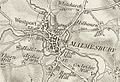 Malmesbury and Westport.jpg 619 × 425; 253 KB
-
 Old-crompton-map-1851.jpg 1,906 × 1,392; 1.82 MB
-
 OS Map windy nook 1862.gif 700 × 470; 23 KB
-
 Padiham map ca1844.jpg 1,101 × 1,078; 95 KB
-
 Pembroke Place Liverpool OS1E 1850.png 1,682 × 958; 925 KB
-
 Sale 1842 map.jpg 2,000 × 2,274; 6.26 MB
-
 Scratchbury old map.JPG 591 × 544; 125 KB
-
 Stretford.jpg 2,000 × 1,813; 3.43 MB


