Category:OpenStreetMap maps of Vancouver
Jump to navigation
Jump to search
Media in category "OpenStreetMap maps of Vancouver"
The following 13 files are in this category, out of 13 total.
-
 DTES-and-surroundings-map.png 1,233 × 887; 1.32 MB
-
 Hinge Park & Olympic Village Square 2.png 808 × 523; 134 KB
-
 Hinge Park & Olympic Village Square.png 1,344 × 786; 328 KB
-
 Hinge Park - Main Street Science World Station.png 1,161 × 615; 226 KB
-
 Hinge Park - Olympic Village Station.png 620 × 527; 157 KB
-
 Location map Canada Vancouver Downtown.png 1,116 × 828; 687 KB
-
 Location map Canada Vancouver Richmond.png 1,262 × 856; 812 KB
-
 Location map Canada Vancouver.png 1,265 × 852; 997 KB
-
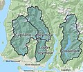 Metro Vancouver Watershed Boundaries.jpg 1,366 × 1,188; 303 KB
-
 Vancouver (British Columbia) - OpenStreetMap.png 1,092 × 794; 1,016 KB
-
 Vancouver (British Columbia) Downtown - OpenStreetMap.png 1,228 × 847; 1.16 MB
-
 Vancouver Lawn Tennis Club.png 1,178 × 752; 918 KB
-
 Vancouver OpenStreetMap.svg 1,390 × 985; 6.6 MB


_-_OpenStreetMap.png)
_Downtown_-_OpenStreetMap.png)

