Category:OpenStreetMap maps of Hertfordshire
Jump to navigation
Jump to search
Media in category "OpenStreetMap maps of Hertfordshire"
The following 7 files are in this category, out of 7 total.
-
 A602base.png 913 × 638; 356 KB
-
 A602development.png 907 × 639; 339 KB
-
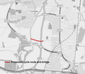 Cheshunt A10 cycle link.png 554 × 486; 123 KB
-
 Elstree and Borehamwood parish UK location map.svg 398 × 400; 1.73 MB
-
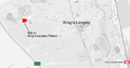 Kings Langley Palace map.png 1,306 × 685; 367 KB
-
 Nickey Line map.png 1,157 × 1,034; 577 KB
-
 Potters Bar map 1.png 700 × 500; 61 KB


