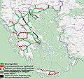
Category:OpenStreetMap maps of Greece
Jump to navigation
Jump to search
Countries of Europe: Albania · Andorra · Armenia‡ · Austria · Azerbaijan‡ · Belarus · Belgium · Bosnia and Herzegovina · Bulgaria · Croatia · Cyprus‡ · Czech Republic · Denmark · Estonia · Finland · France‡ · Georgia‡ · Germany · Greece · Hungary · Iceland · Republic of Ireland · Italy · Kazakhstan‡ · Latvia · Liechtenstein · Lithuania · Luxembourg · Malta · Moldova · Montenegro · Netherlands‡ · North Macedonia · Norway · Poland · Portugal‡ · Romania · Russia‡ · San Marino · Serbia · Slovakia · Slovenia · Spain‡ · Sweden · Switzerland · Turkey‡ · Ukraine · United Kingdom · Vatican City
Specific status: Bailiwick of Guernsey · Isle of Man · Jersey – Limited recognition: Kosovo
‡: partly located in Europe
Specific status: Bailiwick of Guernsey · Isle of Man · Jersey – Limited recognition: Kosovo
‡: partly located in Europe
The Maps in this category should be eventually sorted into subcategories following the administrative regions:

Subcategories
This category has the following 12 subcategories, out of 12 total.
A
C
- OpenStreetMap maps of Crete (6 F)
E
- OpenStreetMap maps of Epirus (3 F)
M
O
T
- OpenStreetMap maps of Thessaly (10 F)
Media in category "OpenStreetMap maps of Greece"
The following 75 files are in this category, out of 75 total.
-
 A1 Map 2018.jpg 878 × 808; 193 KB
-
 A1 Map.jpg 564 × 600; 94 KB
-
 A13 Map.jpg 1,028 × 726; 234 KB
-
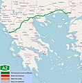 A2 Map 2018.jpg 728 × 737; 169 KB
-
 A2 Map.jpg 772 × 815; 166 KB
-
 A25 Highway Greece.png 1,044 × 858; 470 KB
-
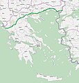
 A25 Map.jpg 772 × 815; 165 KB
-
 A27 Map.jpg 800 × 520; 181 KB
-
 A3 greece road map.jpg 727 × 747; 188 KB
-
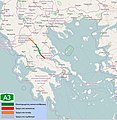 A3 Map 2018.jpg 727 × 747; 188 KB
-
 A4 Map.jpg 772 × 815; 164 KB
-
 A5 Map.jpg 865 × 768; 224 KB
-
 A52 Map 2024.png 1,703 × 1,116; 644 KB
-
 A642 Map.png 733 × 716; 654 KB
-
 A65 Map.png 685 × 629; 440 KB
-
 A7 Map.jpg 772 × 815; 164 KB
-
 A8 Map 2018.jpg 728 × 810; 175 KB
-
 A8 Map.jpg 782 × 754; 195 KB
-
 A90 Map 2018.jpg 728 × 810; 175 KB
-
 Aegean Motorway Map.png 878 × 808; 402 KB
-
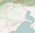 Dimos Avdiron Map.png 1,113 × 1,040; 990 KB
-
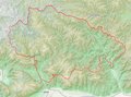
 Dimos Didymotichou Topo.png 1,356 × 856; 964 KB
-
 Dimos Iasmou Map.png 1,012 × 978; 989 KB
-
 Dimos Komotinis Topo.png 997 × 981; 1.17 MB
-
 Dimos Maronias-Sapon Map.png 1,242 × 898; 1.2 MB
-
 Dimos Mykis Map.png 1,275 × 942; 2.13 MB
-
 Dimos Nestou Map.png 724 × 934; 798 KB
-
 Dimos Pangeou Map.png 1,305 × 950; 1.2 MB
-
 Dimos Soufliou Topo.png 1,113 × 978; 1.53 MB
-
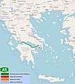
 E55 Map in Greece.png 878 × 808; 406 KB
-
 E65 Map in Greece.png 878 × 808; 403 KB
-
 E75 Map in Greece.png 878 × 808; 402 KB
-
 E79 Map in Greece.png 878 × 808; 406 KB
-
 E85 Map in Greece.png 878 × 808; 405 KB
-
 E86 Map in Greece.png 878 × 808; 404 KB
-
 E90 Map in Greece.png 878 × 808; 401 KB
-
 E92 Map in Greece.png 878 × 808; 404 KB
-
 E92 Map.png 1,066 × 242; 191 KB
-
 E94 Map in Greece.png 878 × 808; 405 KB
-
 E94 Map.png 865 × 201; 125 KB
-
 EO 44 Road Map (Ανατολικά-East).png 1,327 × 899; 649 KB
-
 EO 44 Road Map (Δυτικά-West).png 973 × 811; 236 KB
-
 Eo3 map.jpg 1,042 × 802; 288 KB
-
 EO30 Map.png 781 × 454; 255 KB
-
 Eo6 map.jpg 1,075 × 549; 272 KB
-
 EO77 Map.jpg 962 × 766; 202 KB
-
 Eo8a.jpg 1,035 × 850; 330 KB
-
 EO9c Map.png 1,021 × 480; 174 KB
-
 Greece A16 - Αντίγραφο.jpg 1,049 × 495; 213 KB
-
 Greece road map.jpg 891 × 838; 271 KB
-
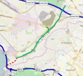
 Hiking Trail Metamormfosi-Gournosovo (OpenStreetMap).png 1,157 × 720; 510 KB
-
 Kasta tumulus and Lion of Amphipolis location map en.jpg 565 × 761; 56 KB
-
 Kasta tumulus and Lion of Amphipolis location map gr.jpg 565 × 761; 58 KB
-
 Kodza Déré River Railway 000 (OpenStreetMap).png 1,280 × 670; 553 KB
-
 Map of Doirani.png 2,069 × 1,641; 595 KB
-
 Map of Eleftheroupoli.png 2,071 × 1,919; 639 KB
-
 Map of Epanomi.png 2,071 × 1,919; 808 KB
-
 Map of Giannitsa.png 2,017 × 1,869; 866 KB
-
 Map of Goumenissa.svg 1,294 × 1,199; 419 KB
-
 Map of Litochoro.png 1,933 × 1,791; 678 KB
-
 Map of Naousa.svg 2,416 × 2,239; 2.05 MB
-
 Map of Neapoli.png 1,933 × 1,791; 358 KB
-
 Map of Palaio Faliro.svg 2,661 × 2,341; 19.53 MB
-
 Map of Polygyros.png 2,071 × 1,919; 699 KB
-
 Map of Polykastro.png 2,071 × 1,919; 663 KB
-
 Pindos Aromanian villages which signed letter asking autonomy 27 July 1917.jpg 1,271 × 900; 161 KB
-
 Rigeo-Eretria Railway (Ρήγαιο-Ερέτρια Λάρισας) - OpenStreetMap.jpg 567 × 447; 37 KB
-
 Screenshot of GeoLocator example for Greek Wikipedia Education Program.png 1,280 × 682; 262 KB
-
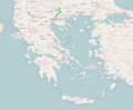
 Vardar OSM.png 402 × 446; 303 KB
-
 Α29 Motorway Map.jpg 716 × 542; 163 KB
-
 ΠΑΘΕ 2016.png 716 × 626; 90 KB
-
 Παράκαμψη Γιαννιτσών.jpeg 1,007 × 742; 120 KB
-
 Χάρτης μεταβυζαντινών ναών στην περιοχή Μεταξάδων EN 2.png 1,920 × 1,080; 1.34 MB
-
 Χάρτης μεταβυζαντινών ναών στην περιοχή Μεταξάδων GR 2.png 1,920 × 1,080; 1.35 MB
-
 Χάρτης μεταβυζαντινών ναών στην περιοχή Μεταξάδων GR.png 1,920 × 1,080; 1.34 MB


.png)
.png)


.png)


.png)


_-_OpenStreetMap.jpg)


