Category:Oosteinde 175, Delft
Jump to navigation
Jump to search
| Object location | | View all coordinates using: OpenStreetMap |
|---|
 | |||||
| Upload media | |||||
| Instance of |
| ||||
|---|---|---|---|---|---|
| Location | Delft, South Holland, Netherlands | ||||
| Street address |
| ||||
| Located on street | |||||
| Occupant | |||||
| Heritage designation |
| ||||
| Inception |
| ||||
| Significant event |
| ||||
 | |||||
|
This is a category about rijksmonument number 11963
|
| Address |
|
Media in category "Oosteinde 175, Delft"
The following 10 files are in this category, out of 10 total.
-
 Achtergevel vergadergebouw - Delft - 20052303 - RCE.jpg 968 × 1,200; 267 KB
-
 De Porceleijene Fles", gevel - Delft - 20052276 - RCE.jpg 1,200 × 874; 229 KB
-
 De Porceleijne Fles", overzicht - Delft - 20052275 - RCE.jpg 869 × 1,200; 184 KB
-

-

-
 Interieur vergadergebouw - Delft - 20052304 - RCE.jpg 1,200 × 955; 178 KB
-
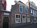
 Oosteinde 175 Delft.JPG 2,736 × 3,648; 2.4 MB
-
 RM11963 Delft - Oosteinde 175.jpg 3,264 × 2,448; 2.17 MB
-

-
 Voorgevel van voormalige fabriek - Delft - 20052305 - RCE.jpg 954 × 1,200; 214 KB


.jpg)


