Category:Ombersley
Jump to navigation
Jump to search
village in Worcestershire, UK Mar2006.jpg) | |||||
| Upload media | |||||
| Instance of | |||||
|---|---|---|---|---|---|
| Location | Wychavon, Worcestershire, West Midlands, England | ||||
| Population |
| ||||
| Area |
| ||||
 | |||||
Subcategories
This category has the following 11 subcategories, out of 11 total.
C
- Cresswells, Ombersley (4 F)
D
- The Dower House, Ombersley (1 F)
H
- Holt Fleet (6 F)
- Holt Fleet Bridge (17 F)
K
- The King's Arms, Ombersley (8 F)
O
W
- Ombersley War Memorial (8 F)
Media in category "Ombersley"
The following 200 files are in this category, out of 640 total.
(previous page) (next page)-
 'River King' on the River Severn - geograph.org.uk - 3750895.jpg 1,600 × 1,136; 740 KB
-
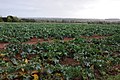 A field of cabbages - geograph.org.uk - 3725428.jpg 1,024 × 680; 240 KB
-
 A gate too far - geograph.org.uk - 5120072.jpg 1,600 × 1,187; 355 KB
-
 A4133 Approaching Hadley - geograph.org.uk - 4192603.jpg 640 × 430; 52 KB
-
 A4133 Approaching Hadley Junction - geograph.org.uk - 4192604.jpg 640 × 474; 56 KB
-
 A4133 approaching Ombersley - geograph.org.uk - 2473800.jpg 640 × 529; 57 KB
-
 A4133 Approaching Ombersley - geograph.org.uk - 4192606.jpg 640 × 492; 74 KB
-
 A4133 at Holt Fleet - geograph.org.uk - 3749684.jpg 1,600 × 1,186; 567 KB
-
 A4133 Descending Into Holt Fleet - geograph.org.uk - 4193750.jpg 640 × 471; 51 KB
-
 A4133 junctions south of Hadley - geograph.org.uk - 3482761.jpg 1,024 × 768; 95 KB
-
 A4133 Ombersley - geograph.org.uk - 6032279.jpg 640 × 480; 78 KB
-
 A4133 Ombersley Road Hadley Village Sign - geograph.org.uk - 5653676.jpg 640 × 480; 113 KB
-

-
 A4133 Ombersley Village Sign - geograph.org.uk - 4192605.jpg 640 × 468; 62 KB
-

-
 A449 at Hawford Mill - geograph.org.uk - 3150581.jpg 640 × 448; 95 KB
-
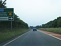
 A449 at Northampton - geograph.org.uk - 1927158.jpg 640 × 480; 165 KB
-

-
 A449 Doverdale Junction - geograph.org.uk - 5678696.jpg 640 × 480; 41 KB
-

-

-

-

-
 A449 Near Sytchampton - geograph.org.uk - 5678694.jpg 640 × 480; 39 KB
-
 A449 Near Turning For Hadley - geograph.org.uk - 5678605.jpg 640 × 480; 73 KB
-

-
 A449 northbound at Oldfield - geograph.org.uk - 4635236.jpg 640 × 482; 51 KB
-
 A449 northbound at Sinton - geograph.org.uk - 4632953.jpg 640 × 481; 54 KB
-

-
 A449 Northbound Near Oldfield - geograph.org.uk - 5678631.jpg 640 × 480; 56 KB
-

-

-
 A449 Ombersley bypass crossing A4133 - geograph.org.uk - 3482781.jpg 1,024 × 768; 98 KB
-
 A449 overbridge Ombersley - geograph.org.uk - 2743888.jpg 640 × 403; 60 KB
-
 A449 Passing Ombersley - geograph.org.uk - 5678617.jpg 640 × 480; 64 KB
-
 A449 southbound at Hawford - geograph.org.uk - 3555831.jpg 640 × 480; 62 KB
-
 A449 southbound at Sytchampton - geograph.org.uk - 3555820.jpg 640 × 481; 52 KB
-
 A449 southbound crossing the A4133 - geograph.org.uk - 3555827.jpg 640 × 481; 64 KB
-
 A449 southbound near Acton - geograph.org.uk - 3555816.jpg 640 × 481; 47 KB
-
 A449 southbound near Barnhall Farm - geograph.org.uk - 3555830.jpg 640 × 481; 70 KB
-
 A449 southbound near Northampton - geograph.org.uk - 3555821.jpg 640 × 480; 55 KB
-
 A449 Stourport 7 Miles - geograph.org.uk - 5678613.jpg 640 × 425; 73 KB
-
 A449 Turning For Chatley - geograph.org.uk - 5678588.jpg 640 × 480; 85 KB
-
 Across the fields to Hinks End, Cottage and Uphampton - geograph.org.uk - 6018868.jpg 1,600 × 1,200; 385 KB
-
 Across the fields towards Doverdale - geograph.org.uk - 1927267.jpg 640 × 480; 196 KB
-
 Across the Severn - geograph.org.uk - 850814.jpg 640 × 480; 103 KB
-

-
 Additional residence at Baytree House, Uphampton - geograph.org.uk - 6018157.jpg 1,600 × 1,200; 624 KB
-
 Allotments with pigeons, between Uphampton and Ombersley - geograph.org.uk - 6021125.jpg 1,600 × 1,200; 384 KB
-
 Allotments, Long Headland, Ombersley - geograph.org.uk - 6017971.jpg 1,600 × 1,200; 327 KB
-

-
 Another big wheat field - geograph.org.uk - 850957.jpg 640 × 480; 100 KB
-
 Approaching Dunhampton crossroads - geograph.org.uk - 2861822.jpg 640 × 459; 53 KB
-

-
 Arable crop - geograph.org.uk - 5693053.jpg 1,600 × 901; 694 KB
-
 Arable land at Sytchampton - geograph.org.uk - 3725445.jpg 1,024 × 680; 195 KB
-
 Arable land near Ombersley - geograph.org.uk - 3650656.jpg 1,024 × 680; 267 KB
-
 Autumn tree - geograph.org.uk - 5120173.jpg 1,200 × 1,600; 512 KB
-
 Barn conversion, Boreley - geograph.org.uk - 6175175.jpg 1,600 × 1,200; 754 KB
-
 Barn conversion, Uphampton - geograph.org.uk - 6018193.jpg 1,600 × 1,200; 386 KB
-

-
 Barn on Ombersley side of Uphampton - geograph.org.uk - 6017982.jpg 1,600 × 1,200; 309 KB
-
 Barnhall Farm, Ombersley, Worcestershire - geograph.org.uk - 5120065.jpg 1,600 × 1,200; 602 KB
-
 Barns for grain storage at Brookhampton Farm - geograph.org.uk - 6224545.jpg 1,600 × 1,200; 384 KB
-
 Battenton Farm on Owlhill Lane, Lineholt - geograph.org.uk - 6223802.jpg 1,600 × 1,200; 396 KB
-
 Baytree House, Uphampton - geograph.org.uk - 6018149.jpg 1,600 × 1,200; 511 KB
-
 Big field of nothing - geograph.org.uk - 850895.jpg 640 × 480; 93 KB
-
 Birds Cottages, Uphampton - geograph.org.uk - 6018019.jpg 1,600 × 1,200; 455 KB
-
 Birds Farm, Uphampton - geograph.org.uk - 6018008.jpg 1,600 × 1,200; 498 KB
-
 Bishopswood Road, Lineholt - geograph.org.uk - 6124010.jpg 1,600 × 901; 650 KB
-
 Black and white building at The Cross - geograph.org.uk - 3482768.jpg 1,024 × 767; 83 KB
-
 Blossom Farm, Chatley, Worcestershire - geograph.org.uk - 5120266.jpg 1,600 × 1,182; 364 KB
-
 Boat approaching Holt Fleet bridge over the River Severn - geograph.org.uk - 4533509.jpg 4,048 × 2,030; 2.92 MB
-
 Boat approaching Holt Lock on the River Severn - geograph.org.uk - 3749710.jpg 1,600 × 1,107; 733 KB
-
 Boat exiting Holt Lock on the River Severn - geograph.org.uk - 3749715.jpg 1,600 × 1,047; 499 KB
-
-
-
 Boreley Lane - geograph.org.uk - 5693048.jpg 1,600 × 901; 798 KB
-
 Boreley Lane crossroads - geograph.org.uk - 6123772.jpg 1,600 × 901; 683 KB
-
 Brant House near Mutton Hall - geograph.org.uk - 6175138.jpg 1,600 × 1,200; 551 KB
-
 Bridge over the River Salwarpe - geograph.org.uk - 2770735.jpg 1,024 × 674; 221 KB
-
 Bridge over the River Salwarpe, Worcestershire - geograph.org.uk - 3828710.jpg 1,024 × 706; 479 KB
-
 Bridleway to Chatley from Barnhall Farm - geograph.org.uk - 5120059.jpg 1,600 × 1,200; 552 KB
-
 Brockhampton Farm, Sytchampton - geograph.org.uk - 3725442.jpg 1,024 × 680; 153 KB
-
 Bungalow at Lythe Farm - geograph.org.uk - 3751911.jpg 1,600 × 1,226; 587 KB
-
 Bungalow near the River Severn close to Clack's Farm - geograph.org.uk - 6175196.jpg 1,600 × 1,200; 814 KB
-
 Business advertising in Holt Fleet - geograph.org.uk - 3482806.jpg 1,024 × 768; 100 KB
-
 Butchers, delicatessen and wine shop - geograph.org.uk - 2183867.jpg 640 × 480; 85 KB
-

-
 Car park at Mutton Hall Caravan Park - geograph.org.uk - 3749827.jpg 1,600 × 1,148; 760 KB
-
 Caravans at Mutton Hall Caravan Park - geograph.org.uk - 3749818.jpg 1,600 × 1,185; 641 KB
-
 Caravans near the east bank of the Severn - geograph.org.uk - 3158425.jpg 1,024 × 768; 124 KB
-
 Chalets by the River Severn from near Holt Fleet - geograph.org.uk - 6175136.jpg 1,600 × 1,200; 379 KB
-
 Chatley turn on the A449 trunk road - geograph.org.uk - 5120172.jpg 1,600 × 1,200; 481 KB
-
 Chestons Cottage, Uphampton - geograph.org.uk - 6018170.jpg 1,600 × 1,200; 341 KB
-
 Christmas tree sales - geograph.org.uk - 2195483.jpg 4,272 × 2,848; 4.45 MB
-
 Comhampton turn off at Acton Farm - geograph.org.uk - 2861817.jpg 640 × 461; 57 KB
-
 Copse off Haye Lane, Ombersley - geograph.org.uk - 5829635.jpg 1,600 × 1,191; 455 KB
-
 Corner Cottage and Baytree Cottage, Uphampton - geograph.org.uk - 6018141.jpg 1,600 × 1,200; 436 KB
-
 Corner Cottage, uphampton - geograph.org.uk - 1071806.jpg 640 × 480; 63 KB
-
 Cottage near Brook Farm - geograph.org.uk - 1927151.jpg 640 × 480; 232 KB
-
 Cottage, Church Lane, Ombersley - geograph.org.uk - 5356506.jpg 2,338 × 1,565; 445 KB
-
 Cottages along the River Severn - geograph.org.uk - 3749747.jpg 1,600 × 1,176; 723 KB
-
 Cottages at Hadley Farm - geograph.org.uk - 6058160.jpg 1,920 × 1,280; 1.41 MB
-
 Cottages on Church Lane - geograph.org.uk - 1139101.jpg 640 × 480; 78 KB
-
 Cottages, Ombersley - geograph.org.uk - 279287.jpg 640 × 480; 62 KB
-
 Country crossroads - geograph.org.uk - 850953.jpg 640 × 480; 120 KB
-
 Country lane to Sinton, Ombersley, Worcester - geograph.org.uk - 5120224.jpg 1,600 × 1,200; 461 KB
-
 Cross Cottage, Hadley - geograph.org.uk - 4566793.jpg 1,600 × 1,200; 510 KB
-
 Cross House at Hadley - geograph.org.uk - 2743882.jpg 640 × 498; 92 KB
-
 Cross House, Hadley - geograph.org.uk - 2473796.jpg 640 × 574; 68 KB
-
 Cross Keys (1), Ombersley, Worcs - geograph.org.uk - 4579264.jpg 1,024 × 683; 156 KB
-
 Cross Keys (2) - sign, Ombersley, Worcs - geograph.org.uk - 4579279.jpg 775 × 1,024; 172 KB
-
 Cross Keys - geograph.org.uk - 279296.jpg 640 × 480; 51 KB
-
 Cross Keys, Ombersley - geograph.org.uk - 2647201.jpg 3,488 × 2,616; 2.21 MB
-
 Crossing The River Severn Holt Fleet - geograph.org.uk - 4193752.jpg 640 × 454; 48 KB
-
 Cyclist at Comhampton junction - geograph.org.uk - 1927166.jpg 640 × 480; 189 KB
-
 Dark Lane - geograph.org.uk - 6123777.jpg 1,600 × 901; 738 KB
-
 Dean's Wood, Haye Lane, Hadley - geograph.org.uk - 5829648.jpg 1,600 × 1,200; 722 KB
-
 Derelict building near Wyneyards - geograph.org.uk - 1927174.jpg 640 × 480; 264 KB
-
 Dog Lane - geograph.org.uk - 2194523.jpg 4,272 × 2,848; 7.65 MB
-
 Doverdale Lane Entering Doverdale - geograph.org.uk - 5678747.jpg 640 × 480; 69 KB
-
 Doverdale Lane Near Doverdale (2) - geograph.org.uk - 5678742.jpg 640 × 480; 65 KB
-
 Doverdale Lane Near Doverdale - geograph.org.uk - 5678739.jpg 640 × 480; 48 KB
-

-
 Doverdale Lane Near Dunhampton - geograph.org.uk - 5678698.jpg 640 × 480; 42 KB
-
 Doverdale Lane, Doverdale - geograph.org.uk - 2532684.jpg 1,024 × 763; 229 KB
-
 Downshill Cottage, Comhampton - geograph.org.uk - 6223937.jpg 1,600 × 1,200; 672 KB
-
 East river bank of the River Severn - geograph.org.uk - 3751871.jpg 1,600 × 1,200; 665 KB
-
 Easy to miss footpath into Dean's Wood - geograph.org.uk - 5829640.jpg 1,600 × 1,200; 689 KB
-
 Edge of Dean's Wood, Hadley - geograph.org.uk - 5829654.jpg 1,600 × 1,200; 405 KB
-
 Electricity Pylon next to Doverdale Lane - geograph.org.uk - 4545962.jpg 1,600 × 1,158; 279 KB
-
 Electricity pylons near Ombersley - geograph.org.uk - 3650080.jpg 1,024 × 680; 155 KB
-
 End of Lane at Pope's Hole Farm - geograph.org.uk - 4566721.jpg 1,600 × 1,200; 665 KB
-
 End of the road - geograph.org.uk - 850862.jpg 640 × 480; 73 KB
-
 Entering Acton - geograph.org.uk - 1927186.jpg 640 × 480; 187 KB
-
 Entering Ombersley - geograph.org.uk - 6123740.jpg 1,600 × 901; 729 KB
-
 Entrance to Knights Grove, Hadley Heath - geograph.org.uk - 5120051.jpg 1,600 × 1,200; 685 KB
-
 Entrance to Ombersley Court - geograph.org.uk - 6031825.jpg 640 × 480; 114 KB
-
 Entrance to St Andrew's Church - geograph.org.uk - 1139028.jpg 640 × 480; 76 KB
-
 Extracting water from the Severn - geograph.org.uk - 3157802.jpg 1,024 × 768; 112 KB
-
 Farm buildings at Stonehill Farm, Dark Lane, Sytchampton - geograph.org.uk - 6224560.jpg 1,600 × 1,200; 448 KB
-
 Farm track by the River Severn - geograph.org.uk - 5698505.jpg 5,640 × 3,760; 6.86 MB
-
 Farm track on the Ombersley Estate - geograph.org.uk - 1139881.jpg 640 × 480; 124 KB
-
 Farmland and a footpath - geograph.org.uk - 3650674.jpg 1,024 × 680; 262 KB
-
 Farmland and an oak tree - geograph.org.uk - 3650649.jpg 1,024 × 680; 210 KB
-
 Farmland at Lineholt - geograph.org.uk - 3725451.jpg 1,024 × 680; 238 KB
-
 Farmland at Uphampton - geograph.org.uk - 3725408.jpg 1,024 × 680; 237 KB
-
 Felled tree on the Ombersley Estate - geograph.org.uk - 1139887.jpg 640 × 480; 90 KB
-

-
 Field by River Salwarpe - geograph.org.uk - 2770826.jpg 1,024 × 683; 202 KB
-
 Field entrance - geograph.org.uk - 3650643.jpg 1,024 × 680; 299 KB
-
 Field Entrance - geograph.org.uk - 5793683.jpg 640 × 427; 347 KB
-
 Field near Mount Pleasant Lane - geograph.org.uk - 2194561.jpg 4,272 × 2,848; 4.59 MB
-
 Field near Woodfield Cedars - geograph.org.uk - 1927154.jpg 640 × 480; 240 KB
-
 Field of rape east of Ombersley - geograph.org.uk - 3482777.jpg 1,024 × 768; 84 KB
-
 Field of sheep with Ombersley church spire - geograph.org.uk - 5120220.jpg 1,600 × 1,200; 376 KB
-
 Field of sprouts - geograph.org.uk - 6017966.jpg 1,600 × 1,200; 454 KB
-
 Field on the edge of Uphampton - geograph.org.uk - 6018206.jpg 1,600 × 1,200; 279 KB
-

-
 Fields at the bottom of Lineholt Lane - geograph.org.uk - 6224585.jpg 1,600 × 1,200; 375 KB
-
 Fields near Dog Lane - geograph.org.uk - 2194541.jpg 4,272 × 2,848; 4.82 MB
-
 Fields near Mayhouse Farm, Hadley Heath - geograph.org.uk - 4568212.jpg 1,600 × 1,200; 427 KB
-
 Fields near Pope's Hole Farm, Hadley - geograph.org.uk - 4566733.jpg 1,600 × 1,200; 357 KB
-
 Fields near Stonehill Farm, Sytchampton - geograph.org.uk - 6224578.jpg 1,600 × 1,200; 391 KB
-
 Fieldscape near Lineholt Common - geograph.org.uk - 1927178.jpg 640 × 480; 193 KB
-
 Fish Pond - 1 - geograph.org.uk - 1139430.jpg 640 × 480; 97 KB
-
 Fish pond, Ombersley - geograph.org.uk - 5657349.jpg 640 × 480; 44 KB
-
 Fish Pond, Ombersley park - geograph.org.uk - 1071790.jpg 640 × 480; 90 KB
-
 Fishing peg on the River Severn - geograph.org.uk - 5695693.jpg 5,700 × 3,800; 7.62 MB
-
 Fishing platform along the River Severn - geograph.org.uk - 3751890.jpg 1,600 × 1,200; 617 KB
-

-
 Flood plain of the River Severn - geograph.org.uk - 5699224.jpg 6,000 × 4,000; 5.93 MB
-
 Flooded field by the River Severn - geograph.org.uk - 5697735.jpg 6,000 × 4,000; 6.95 MB
-
 Footbridge along the Severn Way Footpath - geograph.org.uk - 3751880.jpg 1,600 × 1,279; 1 MB
-
 Footbridge near The Hollies, Boreley - geograph.org.uk - 6175790.jpg 1,600 × 1,200; 762 KB
-
 Footbridge over the River Salwarpe - geograph.org.uk - 5793739.jpg 640 × 427; 337 KB
-
 Footpath along the River Severn at Holt Fleet - geograph.org.uk - 3749688.jpg 1,200 × 1,600; 1.18 MB
-
 Footpath on the Ombersley Estate - geograph.org.uk - 1139415.jpg 640 × 480; 106 KB
-
 Footpath sign on minor road - geograph.org.uk - 4566650.jpg 1,600 × 1,200; 322 KB
-
 Footpath through the crops - geograph.org.uk - 1927264.jpg 640 × 480; 249 KB
-
 Footpath to Acton Fields - geograph.org.uk - 2194626.jpg 4,272 × 2,848; 6.4 MB
-
 Footpath to Chatley - geograph.org.uk - 3650664.jpg 1,024 × 680; 230 KB
-
 Footpath to Turn Mill - geograph.org.uk - 6082125.jpg 1,600 × 901; 675 KB
-
 Footpath with no access, Hadley - geograph.org.uk - 4566762.jpg 1,600 × 1,200; 633 KB
-
 Footpaths cross Bishops Wood Lane, Lineholt - geograph.org.uk - 6223805.jpg 1,600 × 1,200; 598 KB
-
 Fork in the lane - geograph.org.uk - 1927183.jpg 640 × 480; 205 KB
-
 Formerly a farm building, Uphampton - geograph.org.uk - 6018199.jpg 1,600 × 1,200; 337 KB
-

-
 Fruitiers arms caravan park, Uphampton - geograph.org.uk - 6021117.jpg 1,600 × 1,200; 295 KB
-
 Garage in Ombersley - geograph.org.uk - 3731537.jpg 1,024 × 680; 157 KB
-
 Gate along the Severn Way Footpath - geograph.org.uk - 3749739.jpg 1,600 × 1,200; 549 KB
-
 Gate along the Severn Way Footpath - geograph.org.uk - 3749764.jpg 1,600 × 1,200; 1.1 MB
-
 Gate along the Severn Way Footpath - geograph.org.uk - 3749825.jpg 1,600 × 1,354; 1.25 MB
-
 Gate along the Severn Way Footpath - geograph.org.uk - 3749833.jpg 1,600 × 1,200; 768 KB
-
 Gate on the Wychavon Way - geograph.org.uk - 1593454.jpg 640 × 485; 125 KB
-
 Gate to footpath to Ombersley from Haye Lane - geograph.org.uk - 5829669.jpg 1,600 × 1,191; 588 KB
-
 Gates, Ombersley - geograph.org.uk - 2604089.jpg 640 × 379; 194 KB
-
 Grafton House, Worcester Road - geograph.org.uk - 2784357.jpg 640 × 468; 58 KB
-
 Grassland, Dunhampton - geograph.org.uk - 1927164.jpg 640 × 480; 196 KB


,_Ombersley,_Worcs_-_geograph.org.uk_-_4579264.jpg)
_-_sign,_Ombersley,_Worcs_-_geograph.org.uk_-_4579279.jpg)


_-_geograph.org.uk_-_5678742.jpg)


