Category:Olney, Buckinghamshire
Jump to navigation
Jump to search
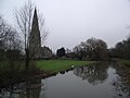
English: Olney is an attractive and historic market town and civil parish in the Borough of Milton Keynes, England, with a population of around 6,000 people. It is also part of the ceremonial county of Buckinghamshire. It lies on the River Great Ouse, very close to the borders with Bedfordshire and Northamptonshire and equidistant from Northampton, Bedford and Milton Keynes with easy access to the M1 at Junction 14 (approximately seven miles) and with fast train links to London from Milton Keynes Central or Bedford (each approximately twelve miles distant). It is a popular tourist destination perhaps best known for the Olney Pancake Race ("olni").
Nederlands: Olney is een plaats in het bestuurlijke gebied Milton Keynes, in het Engelse graafschap Buckinghamshire. De plaats telt 6.032 inwoners.
Norsk bokmål: Olney er en liten by i Buckinghamshire, England. Den ligger i distriktet Milton Keynes, ved elven Great Ouse.
Polski: Olney - miasto w Wielkiej Brytanii, w Anglii, w regionie South East England, w hrabstwie Buckinghamshire. W 2001 r. miasto to zamieszkiwało 6 032 osób.
Română: Olney este unul dintre oraşele constituente ale oraşului şi autorităţii unitare Milton Keynes, în comitatul Buckinghamshire, regiunea South East, Anglia.
town and parish in the Borough of Milton Keynes, Buckinghamshire, England  | |||||
| Upload media | |||||
| Instance of | |||||
|---|---|---|---|---|---|
| Location | City of Milton Keynes, Buckinghamshire, South East England, England | ||||
| Located in or next to body of water | |||||
| Different from | |||||
| official website | |||||
 | |||||
Subcategories
This category has the following 8 subcategories, out of 8 total.
B
- The Bull Inn, Olney (3 F)
C
- Olney Church Hall (2 F)
- Cowper and Newton Museum (3 F)
O
- Olney Cenotaph (1 F)
- Olney Village Sign (4 F)
T
- The Two Brewers, Olney (5 F)
V
- The Vicarage, Olney (3 F)
Media in category "Olney, Buckinghamshire"
The following 200 files are in this category, out of 201 total.
(previous page) (next page)-
 A Literary Pilgrim in England - COWPER'S HOUSE AT OLNEY.png 1,407 × 1,605; 761 KB
-
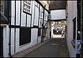
 Alley in Olney - geograph.org.uk - 5680362.jpg 3,264 × 2,448; 2.55 MB
-
-
 Altar (52094289125).jpg 5,218 × 5,218; 14.2 MB
-
 Architectural Detail - Olney - Buckinghamshire - England (28271713545).jpg 3,648 × 2,736; 5.01 MB
-
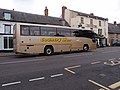
 Bedford bus 41 - geograph.org.uk - 3966970.jpg 800 × 600; 113 KB
-
 Bert's bench (52094285905).jpg 7,091 × 3,989; 20.3 MB
-
 Bert's view (52094285605).jpg 8,688 × 4,887; 22.21 MB
-
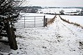
 Beside Pastures Farm - geograph.org.uk - 6130662.jpg 768 × 1,024; 249 KB
-
 Bridge Street, Olney - geograph.org.uk - 2998879.jpg 800 × 600; 106 KB
-
 Bridleway down towards Dicken's Spinney - geograph.org.uk - 3301737.jpg 1,600 × 1,068; 432 KB
-
 Bridleway to Hungary Hall - geograph.org.uk - 452913.jpg 640 × 428; 111 KB
-
 Brock's Garage - geograph.org.uk - 1176496.jpg 640 × 480; 55 KB
-
 Bus shelter plaque - geograph.org.uk - 1177652.jpg 640 × 480; 64 KB
-
 Carlton House on High Street, Olney - geograph.org.uk - 5434671.jpg 1,992 × 1,460; 889 KB
-
 Cattle Ford at Olney - geograph.org.uk - 3020138.jpg 3,264 × 2,448; 3.55 MB
-
 Chancel (52094287510).jpg 6,990 × 3,932; 17.29 MB
-
 Charging point,Olney - geograph.org.uk - 3966962.jpg 800 × 600; 106 KB
-
 Children's playground by the new housing - geograph.org.uk - 3085045.jpg 1,600 × 1,067; 601 KB
-
 Church Street, Olney - geograph.org.uk - 5429706.jpg 2,048 × 1,536; 1.43 MB
-
 Coronation (52093800243).jpg 7,461 × 4,197; 19.13 MB
-
 Coronation Bus Shelter - geograph.org.uk - 1177643.jpg 640 × 480; 100 KB
-
 Country Lion coach - geograph.org.uk - 3966934.jpg 800 × 600; 98 KB
-
 Cricket pavilion at Olney - geograph.org.uk - 1177552.jpg 640 × 480; 79 KB
-

-
 Disused farm building - geograph.org.uk - 3085049.jpg 1,600 × 1,066; 586 KB
-
 Duck pond by the Wellingborough road - geograph.org.uk - 3085040.jpg 1,600 × 1,066; 644 KB
-

-
 East Street development opportunity - geograph.org.uk - 1540169.jpg 640 × 480; 100 KB
-
 East Street from Silver End, Olney - geograph.org.uk - 278535.jpg 640 × 480; 119 KB
-
 Emberton (52093784991).jpg 7,447 × 4,189; 15.95 MB
-
 Ewe and Lambs, near Olney - geograph.org.uk - 454304.jpg 640 × 428; 115 KB
-
 Factory conversion on the corner of Midland Road - geograph.org.uk - 5434683.jpg 2,048 × 1,536; 947 KB
-
 Factory conversion on the corner of Midland Road - geograph.org.uk - 6195778.jpg 1,920 × 1,280; 1.24 MB
-
 Farmland north of Olney - geograph.org.uk - 452930.jpg 640 × 428; 101 KB
-
 Feoffee Estate Houses,Olney - geograph.org.uk - 1176843.jpg 640 × 480; 65 KB
-
 Feoffee Estate, Olney - geograph.org.uk - 1176846.jpg 640 × 480; 99 KB
-
 Fields by the A509, Olney - geograph.org.uk - 5434878.jpg 2,048 × 1,536; 2.26 MB
-
 Filgrave (52093800473).jpg 4,092 × 4,092; 10.96 MB
-

-
 Footbridge on the Ouse flood meadow - geograph.org.uk - 1540116.jpg 640 × 480; 93 KB
-
 Footbridge over the Ouse - geograph.org.uk - 1530631.jpg 640 × 480; 109 KB
-
 Footpath down to the river - geograph.org.uk - 3085080.jpg 1,600 × 1,069; 530 KB
-
 Footpath to Austen Avenue - geograph.org.uk - 3085027.jpg 1,200 × 1,600; 655 KB
-
 Footpath to Hungary Hall - geograph.org.uk - 452905.jpg 640 × 428; 94 KB
-
 Footpath to Olney Hyde - geograph.org.uk - 4722694.jpg 1,600 × 1,066; 626 KB
-
 Footpath Waymarks, near Olney - geograph.org.uk - 454287.jpg 428 × 640; 71 KB
-
 Ford Garage in Olney High Street - geograph.org.uk - 1175196.jpg 640 × 480; 71 KB
-
 Former Boot and Shoe factory, Olney - geograph.org.uk - 288591.jpg 640 × 480; 101 KB
-
 Fuel Pumps at the Sabaru garage - geograph.org.uk - 1175208.jpg 640 × 480; 80 KB
-
 Gate on the bridleway to Hungry Hall - geograph.org.uk - 3301744.jpg 1,600 × 1,066; 377 KB
-
 Gate within a gate on the path to Lavendon - geograph.org.uk - 3085051.jpg 1,600 × 1,068; 785 KB
-
 Gayhurst (52092761162).jpg 5,793 × 3,259; 11.85 MB
-
 Golden tree on the track towards Old Pond Close - geograph.org.uk - 4722756.jpg 1,066 × 1,600; 534 KB
-
 Graveyard of St. Peter and Paul Church - Olney - Buckinghamshire - England (28193529111).jpg 2,736 × 3,648; 5.34 MB
-
 Grazing sheep and sheep-fold - Olney - geograph.org.uk - 195512.jpg 640 × 480; 77 KB
-
 Great Ouse meadows - Olney - geograph.org.uk - 195510.jpg 480 × 640; 143 KB
-
 Great Ouse River - Olney - geograph.org.uk - 195504.jpg 640 × 480; 86 KB
-
 Green Burial Ground - geograph.org.uk - 710571.jpg 640 × 480; 79 KB
-
 Green lane by Pastures Farm - geograph.org.uk - 4722707.jpg 1,600 × 1,066; 597 KB
-
 Happy Days Toy Shop, High Street, Olney - geograph.org.uk - 4423005.jpg 1,800 × 3,200; 909 KB
-

-
 Heavy traffic on the A509 - geograph.org.uk - 3966907.jpg 800 × 600; 126 KB
-
 Hedgerow by the brook - geograph.org.uk - 3227328.jpg 1,200 × 1,600; 638 KB
-
 High Street pavement, Olney - geograph.org.uk - 1176513.jpg 640 × 480; 80 KB
-
 High Street shops - geograph.org.uk - 814633.jpg 640 × 481; 73 KB
-
 High Street, Olney - geograph.org.uk - 2415016.jpg 798 × 532; 504 KB
-
 High Street, Olney - geograph.org.uk - 3969842.jpg 3,072 × 1,728; 1.35 MB
-
 High Street, Olney - geograph.org.uk - 5434661.jpg 2,014 × 1,488; 901 KB
-
 High Street, Olney - geograph.org.uk - 5434667.jpg 2,048 × 1,536; 1.52 MB
-
 High Street, Olney - geograph.org.uk - 5434672.jpg 2,048 × 1,536; 918 KB
-
 High Street, Olney - geograph.org.uk - 814602.jpg 640 × 480; 71 KB
-
 Hilary Brock Ltd, High Street, Olney - geograph.org.uk - 5820505.jpg 4,032 × 2,886; 3.06 MB
-
 Houses on Bridge Street, Olney - geograph.org.uk - 5429705.jpg 2,048 × 1,536; 1.53 MB
-
 Houses on High Street South - geograph.org.uk - 1176489.jpg 640 × 480; 64 KB
-
 Houses on Wagstaff Way, Olney - geograph.org.uk - 5680615.jpg 3,264 × 2,448; 3.16 MB
-
 Hovis Flour Tanker - geograph.org.uk - 3966942.jpg 800 × 600; 109 KB
-
 James's steeple (52093783371).jpg 8,688 × 4,887; 25.14 MB
-
 John Newton's grave - geograph.org.uk - 4985569.jpg 2,816 × 2,112; 2.58 MB
-
 Kitchener Close - geograph.org.uk - 3846691.jpg 640 × 480; 75 KB
-
 Knobs (52092758662).jpg 7,084 × 3,985; 15.51 MB
-
 Lodge Plugs, Olney - geograph.org.uk - 1175038.jpg 480 × 640; 72 KB
-
 Long Lane Bridleway - geograph.org.uk - 3301733.jpg 1,600 × 1,067; 418 KB
-
 Longland Farm - geograph.org.uk - 66657.jpg 640 × 480; 123 KB
-
 Looking over the stubble field toward Olney Hyde - geograph.org.uk - 3227356.jpg 1,600 × 1,068; 520 KB
-
 Looking to Bridge Street - geograph.org.uk - 5207575.jpg 640 × 360; 40 KB
-
 Market Day, Olney - geograph.org.uk - 31340.jpg 640 × 593; 265 KB
-
 Market Place, Olney - geograph.org.uk - 5429708.jpg 2,048 × 1,536; 1.5 MB
-
 Market Place, Olney - geograph.org.uk - 5434659.jpg 2,048 × 1,536; 1.56 MB
-
 Men at work - geograph.org.uk - 3966926.jpg 600 × 800; 119 KB
-
 Milk Lorry - geograph.org.uk - 3966912.jpg 800 × 600; 114 KB
-
 Milton Keynes Boundary Path - geograph.org.uk - 4722743.jpg 1,600 × 1,066; 452 KB
-
 Minor roadworks in Olney - geograph.org.uk - 1175056.jpg 640 × 480; 94 KB
-

-
 New Leaf florists, Olney - geograph.org.uk - 1174976.jpg 640 × 480; 89 KB
-
 Old factory flats - geograph.org.uk - 3085036.jpg 1,200 × 1,600; 446 KB
-
 Cowper Memorial Church, Olney - geograph.org.uk - 1415289.jpg 640 × 480; 72 KB
-
 Olney (52094022144).jpg 5,575 × 3,136; 9.94 MB
-
 Olney - geograph.org.uk - 454215.jpg 640 × 428; 98 KB
-
 Olney Baptist Church - geograph.org.uk - 814654.jpg 640 × 480; 93 KB
-
 Olney Beacon Platinum Jubilee 2.jpg 2,736 × 3,648; 1.29 MB
-
 Olney Beacon Platinum Jubilee 3.jpg 3,648 × 2,736; 1.61 MB
-
 Olney Beacon Platinum Jubilee 4.jpg 3,648 × 2,736; 1.88 MB
-
 Olney Beacon Platinum Jubilee First Flame.jpg 3,648 × 2,736; 1.26 MB
-
 Olney Buckinghamshire 1.jpg 2,583 × 1,668; 821 KB
-
 Olney churchyard - geograph.org.uk - 2205810.jpg 1,024 × 694; 227 KB
-
 Olney fire station - geograph.org.uk - 623443.jpg 640 × 427; 190 KB
-
 Olney High Street - geograph.org.uk - 195506.jpg 640 × 534; 92 KB
-
 Olney High Street, West Side - geograph.org.uk - 395932.jpg 640 × 480; 119 KB
-
 Olney Hyde - geograph.org.uk - 66662.jpg 640 × 480; 121 KB
-
 Olney old fire station - geograph.org.uk - 1957285.jpg 640 × 427; 241 KB
-
 Olney Pancake Race - geograph.org.uk - 2304546.jpg 800 × 562; 497 KB
-
 Olney Pancake Race 2009.jpg 3,888 × 2,592; 4.54 MB
-
 Olney Rugby Club House - geograph.org.uk - 1177539.jpg 640 × 480; 62 KB
-
 Olney shrub sign - geograph.org.uk - 3085057.jpg 1,600 × 1,069; 536 KB
-
 Olney Town Football Club - geograph.org.uk - 1176853.jpg 640 × 480; 66 KB
-
 Olney Town Football Club - geograph.org.uk - 2692977.jpg 3,648 × 2,736; 2.1 MB
-
 Olney Town v Potton United (8114459929).jpg 1,917 × 1,390; 1.92 MB
-
 Olney Town v Potton United (8114460961).jpg 2,048 × 1,536; 2.31 MB
-
 Olney Village Sign - geograph.org.uk - 4423895.jpg 3,672 × 4,896; 6.2 MB
-
 Olney, East Street (geograph 6305631).jpg 800 × 600; 760 KB
-
 Olney.jpg 400 × 266; 98 KB
-
 Ouse bridge near Olney - geograph.org.uk - 1540139.jpg 640 × 480; 87 KB
-
 Ouse Valley Way makes its way out of Olney - geograph.org.uk - 3219864.jpg 1,200 × 1,600; 564 KB
-
 Outbuilding at the old vicarage - geograph.org.uk - 3085075.jpg 1,600 × 1,066; 621 KB
-
 Pastures Farm on the B5388 - geograph.org.uk - 4722708.jpg 1,600 × 1,066; 443 KB
-
 Path down to the Great Ouse - geograph.org.uk - 3219857.jpg 1,600 × 1,066; 595 KB
-
 Path to Bridge Street - geograph.org.uk - 5207583.jpg 640 × 360; 53 KB
-
 Path toward Weston Road - geograph.org.uk - 3301739.jpg 1,600 × 1,068; 416 KB
-

-
 Preparing for Pancake day - geograph.org.uk - 1174994.jpg 640 × 480; 98 KB
-
 Public Convenience, Olney - geograph.org.uk - 1174930.jpg 480 × 640; 63 KB
-
 Redline bus in Olney - geograph.org.uk - 3966948.jpg 800 × 600; 112 KB
-

-
 Scotts lorry in Olney - geograph.org.uk - 3966953.jpg 800 × 600; 122 KB
-
 Sensible sign, the riverside,Olney - geograph.org.uk - 1223661.jpg 640 × 480; 109 KB
-
 Sheep Pastures at Olney Park Farm - geograph.org.uk - 361859.jpg 640 × 480; 143 KB
-
 Sillswood, Olney - geograph.org.uk - 454252.jpg 640 × 428; 89 KB
-
 Smith Skips - geograph.org.uk - 3966974.jpg 800 × 600; 116 KB
-
 Soul's Garage workshop - geograph.org.uk - 3085073.jpg 1,600 × 1,069; 485 KB
-
 Sports field at Olney - geograph.org.uk - 1223687.jpg 640 × 480; 103 KB
-
 St Peter and St Paul Church - geograph.org.uk - 3846682.jpg 640 × 480; 147 KB
-
 St Peter and St Paul church and Mill Stream - geograph.org.uk - 5273670.jpg 2,000 × 1,500; 320 KB
-
 St Peter ^ St Paul, Olney - East end - geograph.org.uk - 3265936.jpg 721 × 1,000; 323 KB
-
 St Peter ^ St Paul, Olney - Easter sepulchre - geograph.org.uk - 3265960.jpg 1,000 × 711; 263 KB
-
 St Peter ^ St Paul, Olney - Font - geograph.org.uk - 3265956.jpg 702 × 1,000; 227 KB
-
 St Peter ^ St Paul, Olney - geograph.org.uk - 3265935.jpg 740 × 1,000; 238 KB
-
 St Peter ^ St Paul, Olney - Sanctuary - geograph.org.uk - 3265958.jpg 1,000 × 702; 305 KB
-
 St. Laurence (52094039489).jpg 6,558 × 3,689; 15.7 MB
-
 St. Peter (52094288065).jpg 8,564 × 4,817; 22.19 MB
-
 Stantonbury (52093789371).jpg 7,655 × 4,306; 21.93 MB
-
 Steam engine at Cowper Tannery, Olney - geograph.org.uk - 770661.jpg 420 × 640; 81 KB
-
 Steps at the bend in the river - geograph.org.uk - 1223648.jpg 640 × 480; 69 KB
-
 Stile on the path into town - geograph.org.uk - 3085048.jpg 1,200 × 1,600; 816 KB
-
 Stile on the path to the spinney - geograph.org.uk - 3301742.jpg 1,600 × 1,067; 349 KB
-
 Street Scene - Olney - Buckinghamshire - England (28193515001).jpg 3,648 × 2,736; 5.3 MB
-
 Street Scene Olney - geograph.org.uk - 2732532.jpg 3,648 × 2,736; 2.07 MB
-
 Subaru Dealership, Olney - geograph.org.uk - 1175215.jpg 640 × 480; 66 KB
-
 Teapots Cafe, Olney - geograph.org.uk - 2414935.jpg 798 × 532; 539 KB
-
 Telephone Exchange, Olney - geograph.org.uk - 1639397.jpg 640 × 480; 69 KB
-
 Terraced houses on Wellingborough Road, Olney - geograph.org.uk - 5434822.jpg 2,002 × 1,474; 1.12 MB
-
 The Castle - geograph.org.uk - 1177607.jpg 640 × 480; 76 KB
-
 The Cherry Tree, Olney (geograph 7572260).jpg 1,024 × 676; 129 KB
-
 The Entrance to Olney Park Farm - geograph.org.uk - 361853.jpg 640 × 480; 161 KB
-
 The Garden Allotments at Olney - geograph.org.uk - 288588.jpg 640 × 480; 120 KB
-
 The Great Ouse at Olney, Buckinghamshire.jpg 1,382 × 1,843; 436 KB
-
 The High street, Olney - geograph.org.uk - 2304536.jpg 800 × 562; 571 KB
-
 The High Street, Olney - geograph.org.uk - 2304789.jpg 800 × 562; 526 KB
-
 The lane to Olney Hyde - geograph.org.uk - 3227351.jpg 1,600 × 1,067; 524 KB
-
 The Main Road - geograph.org.uk - 2288129.jpg 800 × 563; 136 KB
-
 The Market Place in Olney - geograph.org.uk - 395926.jpg 640 × 480; 104 KB
-
 The Old Lace Factory - geograph.org.uk - 1175048.jpg 480 × 640; 86 KB
-
 The Old Mill at Olney - geograph.org.uk - 285962.jpg 640 × 480; 96 KB
-
 The Olney Centre - geograph.org.uk - 3085062.jpg 1,200 × 1,600; 698 KB
-
 The Olney Deli and Tea Room - geograph.org.uk - 1175008.jpg 640 × 480; 86 KB
-
 The Olney Wine Bar, Olney - geograph.org.uk - 2414944.jpg 798 × 532; 533 KB
-
 The Pancake Race Notice Board, Olney - geograph.org.uk - 2317931.jpg 798 × 532; 540 KB
-
 The Queen Hotel, Olney - geograph.org.uk - 2998848.jpg 800 × 600; 114 KB
-
 The Queen Hotel, Olney - geograph.org.uk - 2998855.jpg 600 × 800; 92 KB
-
 The River Great Ouse and Olney Mill - geograph.org.uk - 5273666.jpg 2,000 × 1,500; 334 KB
-
 The River Great Ouse at Olney - geograph.org.uk - 1535280.jpg 640 × 449; 151 KB
-
 The River Great Ouse, Olney - geograph.org.uk - 2998887.jpg 800 × 600; 171 KB
-
 The Runners, Olney Pancake Race - geograph.org.uk - 2319702.jpg 798 × 532; 537 KB
-
 The Swan Inn and Bistro, Olney (geograph 7272850).jpg 3,799 × 2,741; 2.31 MB
-
 The Swan Inn and the A509 - geograph.org.uk - 5273676.jpg 2,000 × 1,500; 253 KB
-
 The Vets, Olney - geograph.org.uk - 2304583.jpg 800 × 562; 501 KB
-
 Towards Olney Park Farm - geograph.org.uk - 6130661.jpg 768 × 1,024; 226 KB
-
 Track to Olney Hyde - geograph.org.uk - 3227350.jpg 1,600 × 1,067; 462 KB
-
 Tyringham (52093801823).jpg 6,642 × 3,736; 12.49 MB
-
 UK Olney (Pancake Sign).jpg 1,681 × 1,434; 432 KB
-
 UK Olney (Sign2).jpg 775 × 587; 79 KB
-
 Uni-cyclist, Olney Pancake Race - geograph.org.uk - 2414950.jpg 798 × 532; 486 KB
-
 View from Milton Keynes Boundary Walk - geograph.org.uk - 66668.jpg 640 × 480; 123 KB
-

-
 War Memorial, Olney - geograph.org.uk - 4423909.jpg 3,672 × 4,896; 5.79 MB
-
 William Cowper's garden - geograph.org.uk - 814714.jpg 640 × 480; 172 KB
-
 William Cowper's summer house - geograph.org.uk - 814645.jpg 640 × 480; 170 KB
-
 Witches brew, Olney - geograph.org.uk - 1174960.jpg 640 × 480; 25 KB
-
 Young woodland by the Pastures Farm pond - geograph.org.uk - 4722749.jpg 1,600 × 1,066; 553 KB
-
 Cowpers Oak Lodge - geograph.org.uk - 517184.jpg 640 × 480; 110 KB


.jpg)
.jpg)

.jpg)
.jpg)


.jpg)


.jpg)


.jpg)


.jpg)


.jpg)

.jpg)


.jpg)


.jpg)


.jpg)


.jpg)
.jpg)

.jpg)


.jpg)
.jpg)
.jpg)


.jpg)


.jpg)


.jpg)


.jpg)
.jpg)
.jpg)


