Category:Old maps of the ancient kingdoms of Judah and Israel
Jump to navigation
Jump to search
English: This category is intended for old maps of the divided kingdoms of ancient Israel and Judah, that means in the times after the supposed "United Monarchy" under David and Salomon (for those, see Category:Old maps of the United Monarchy). Please only group maps into this category when they specifically name the two divided kingdoms - otherwise, better place the maps under Category:Old maps of ancient Israel. Please sort all maps with a key of the year that they were drawn, in order for them to be sorted chronologically.
Old maps with a pure historical/biblical perspective should not be categorized under modern or medieval maps of Palestine/Israel, unless they are supposed to also show the contemporary surroundings. For old maps of modern Israel/Palestine (i.e. Ottoman times and 1900s onwards), see there.
Media in category "Old maps of the ancient kingdoms of Judah and Israel"
The following 15 files are in this category, out of 15 total.
-
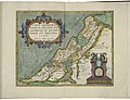 Map of Israel by Abraham Ortelius.jpeg 3,054 × 2,348; 2.24 MB
-
 Giacomo Cantelli and Domenico De Rossi. TERRA SANCTA. 1677-1688.jpg 856 × 677; 242 KB
-

-

-
 Palestine (Putzger).png 2,803 × 3,600; 25.64 MB
-
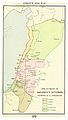
 The divided kingdom.jpg 1,095 × 1,776; 162 KB
-

-
 MACCOUN(1899) p101 ABOUT 930 B.C. - THE DIVISION OF SOLOMON'S KINGDOM.jpg 2,034 × 3,598; 2.79 MB
-
 MACCOUN(1899) p105 ELIJAH AND ELISHA.jpg 2,050 × 3,598; 2.07 MB
-
 MACCOUN(1899) p115 ABOUT 797 B.C. - THE ASSYRIAN CONQUEST OF SYRIA.jpg 2,030 × 3,594; 2.54 MB
-
 MACCOUN(1899) p117 ABOUT 750 B.C. - THE SUPREMACY OF ISRAEL UNDER JEROBOAM II..jpg 2,034 × 3,606; 2.31 MB
-
 MACCOUN(1899) p119 37 ABOUT 734 B.C. - ASSYRIAN CONQUEST OF ISRAEL.jpg 2,030 × 3,582; 2.52 MB
-
 MACCOUN(1899) p121 722 B.C. FALL OF ISRAEL - TAKEN CAPATIVE BY SARGON.jpg 2,014 × 3,598; 2.18 MB
-

-
 Outlines of European history (1914) (14796379073).jpg 1,086 × 1,750; 313 KB


.jpg)
.png)

_(14586728179).jpg)
_p101_ABOUT_930_B.C._-_THE_DIVISION_OF_SOLOMON%27S_KINGDOM.jpg)
_p105_ELIJAH_AND_ELISHA.jpg)
_p115_ABOUT_797_B.C._-_THE_ASSYRIAN_CONQUEST_OF_SYRIA.jpg)
_p117_ABOUT_750_B.C._-_THE_SUPREMACY_OF_ISRAEL_UNDER_JEROBOAM_II..jpg)
_p119_37_ABOUT_734_B.C._-_ASSYRIAN_CONQUEST_OF_ISRAEL.jpg)
_p121_722_B.C._FALL_OF_ISRAEL_-_TAKEN_CAPATIVE_BY_SARGON.jpg)
_(14757708746).jpg)
_(14796379073).jpg)