Category:Old maps of the Strait of Kerch
Jump to navigation
Jump to search
Subcategories
This category has only the following subcategory.
Media in category "Old maps of the Strait of Kerch"
The following 22 files are in this category, out of 22 total.
-
 Battista Agnese. Black Sea. HM 25. PORTOLAN ATLAS Italy, ca. 1540.D.jpg 904 × 837; 284 KB
-
 Tabula Asiae II (Caucasus, Ukraine) southwest.jpg 800 × 600; 106 KB
-
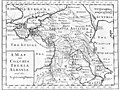 Map of Colchis, Iberia, Albania, and the neighbouring countries ca 1770.jpg 1,016 × 760; 194 KB
-

-
 Карта к статье «Керчь» № 2. Военная энциклопедия Сытина (Санкт-Петербург, 1911-1915).jpg 2,910 × 2,058; 542 KB
-
 519 of 'The Illustrated History of the War against Russia. Plates' (11045726023).jpg 1,871 × 2,763; 1.15 MB
-

-
 Map of the Sea of Azov. George Dodd. Pictorial history of the Russian war 1854-5-6.jpg 6,382 × 6,066; 1.79 MB
-

-
 Fullarton, A. & Co. Caucausus & Crimea. 1872 (P).jpg 743 × 453; 96 KB
-
 Image taken from page 713 of The Comprehensive History of England (16403084930).jpg 1,476 × 1,428; 275 KB
-
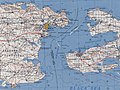
 Tuzla 1902 map.jpg 1,756 × 1,524; 652 KB
-
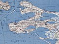
 Taman. 1900-1902.jpg 1,194 × 748; 807 KB
-

-

-

-

-
-
-
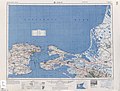 USSR map NL 37-7 Kerch'.jpg 5,743 × 4,366; 8.41 MB
-
 Admiralty Chart No 2205 Kertch Strait, Published 1874, New Edition 1920.jpg 16,339 × 10,897; 63.49 MB
-
 Admiralty Chart No 2235 Fort Anakria to Kerch-Yenikale Strait, Published 1854, New Edition 1919.jpg 16,257 × 11,149; 47.6 MB

_southwest.jpg)

._%D0%92%D0%BE%D0%B5%D0%BD%D0%BD%D0%B0%D1%8F_%D1%8D%D0%BD%D1%86%D0%B8%D0%BA%D0%BB%D0%BE%D0%BF%D0%B5%D0%B4%D0%B8%D1%8F_%D0%A1%D1%8B%D1%82%D0%B8%D0%BD%D0%B0_(%D0%A1%D0%B0%D0%BD%D0%BA%D1%82-%D0%9F%D0%B5%D1%82%D0%B5%D1%80%D0%B1%D1%83%D1%80%D0%B3,_1911-1915).jpg)
.jpg)
.jpg)


.jpg)
.jpg)
.jpg)


.jpg)
._%D0%92%D0%BE%D0%B5%D0%BD%D0%BD%D0%B0%D1%8F_%D1%8D%D0%BD%D1%86%D0%B8%D0%BA%D0%BB%D0%BE%D0%BF%D0%B5%D0%B4%D0%B8%D1%8F_%D0%A1%D1%8B%D1%82%D0%B8%D0%BD%D0%B0_(%D0%A1%D0%B0%D0%BD%D0%BA%D1%82-%D0%9F%D0%B5%D1%82%D0%B5%D1%80%D0%B1%D1%83%D1%80%D0%B3,_1911-1915).jpg)
.jpg)
.jpg)
.jpg)
.jpg)


