Category:Old maps of the Merovingian territory
Jump to navigation
Jump to search
Media in category "Old maps of the Merovingian territory"
The following 20 files are in this category, out of 20 total.
-
 Die Reiche der Franken in Gallien unter den Merovingern (Spruner, 1854).jpg 6,627 × 5,176; 6.63 MB
-
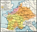
 Droysens-20.jpg 8,825 × 5,750; 3.92 MB
-
 Droysens-20a.jpg 6,385 × 5,423; 3.9 MB
-
 Droysens-20b.jpg 2,082 × 1,828; 3.15 MB
-
 Droysens-20c.jpg 2,104 × 1,820; 3.36 MB
-
 Droysens-20d.jpg 2,103 × 1,819; 3.45 MB
-
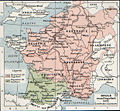
 Francia at the death of Pepin of Heristal, 714.jpg 1,254 × 1,149; 1 MB
-
 Frankenreich unter den Merowingern.jpg 3,287 × 2,874; 2 MB
-
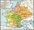
 Frankish Kingdom under the Merovingians.jpg 4,358 × 2,874; 2.84 MB
-
 Frankish kingdoms in 628.jpg 1,239 × 1,149; 355 KB
-
 Gaule et pays voisins en 714, Auguste Longnon 1907.jpg 2,085 × 1,668; 1.49 MB
-
 Growth of Frankish Power, 481-814 Edit.jpeg 1,085 × 694; 226 KB
-
 Growth of Frankish Power, 481-814.jpg 1,085 × 694; 196 KB
-
 Growth of the Frankish kingdoms (Putzger).jpg 1,614 × 1,583; 982 KB
-
 Politically divided Gaul, 481.jpg 1,242 × 1,144; 335 KB
-
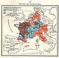
 Teilungen des Frankenreich unter den Merowingern.jpg 1,111 × 2,782; 878 KB
-
 The Frankish dominions in Merovingian times (486-768).jpg 3,890 × 3,010; 3.48 MB
-
-
 The Frankish kingdom under the Merovingians up to the time of Charlemagne 486-768.jpg 6,760 × 5,600; 6.09 MB
-
 Verovering van Gallie.jpg 1,242 × 1,144; 1.05 MB
.jpg)


.jpg)

.jpg)
.jpg)

