Category:Old maps of cities in Spain
Jump to navigation
Jump to search

Subcategories
This category has the following 23 subcategories, out of 23 total.
*
.
A
- Old maps of Albacete (3 F)
- Old maps of Alcalá de Henares (11 F)
- Old maps of Alicante (19 F)
B
C
- Old maps of Cartagena, Spain (30 F)
L
M
- Old maps of Melilla (17 F)
S
- Old maps of Salamanca (18 F)
T
- Old maps of Teruel (7 F)
V
- Old maps of Villena (14 F)
Z
- Old maps of Zaragoza (10 F)
Media in category "Old maps of cities in Spain"
The following 11 files are in this category, out of 11 total.
-
 Cuenca -España- Ciudad; de 1850.jpg 1,101 × 1,054; 713 KB
-
 Mar de Ontigola domingo de aguirre.jpg 1,284 × 899; 360 KB
-
 Plano de Badajoz 1873.jpeg 1,437 × 1,231; 222 KB
-
 Plano Santiago. 1595. Archivo General de Simancas. MPD, 34, 21.JPG 873 × 736; 246 KB
-
 Plano-de-Medina-sigloXVI.gif 1,587 × 1,644; 80 KB
-
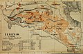
 Spain and Portugal- handbook for travellers (1901) (14589929298).jpg 1,406 × 2,040; 971 KB
-
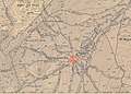
 Spain and Portugal- handbook for travellers (1901) (14589991618).jpg 1,968 × 1,190; 957 KB
-
 Spain and Portugal- handbook for travellers (1901) (14773409691).jpg 1,984 × 1,370; 1.13 MB
-
 Spain and Portugal- handbook for travellers (1901) (14774226524).jpg 2,048 × 1,376; 1.14 MB
-
 Spain and Portugal- handbook for travellers (1901) (14774241304).jpg 1,960 × 1,296; 907 KB
-
 Valenzuela. Mapa topográfico -1888-.jpg 1,527 × 1,089; 1,019 KB


_(14589929298).jpg)
_(14589991618).jpg)
_(14773409691).jpg)
_(14774226524).jpg)
_(14774241304).jpg)
