Category:Old maps of Vienna
Jump to navigation
Jump to search
Burgenland · Carinthia · Lower Austria · Salzburg · Styria · Tyrol · Upper Austria · Vienna · Vorarlberg
This category is for old maps showing all or a large part of Vienna. See subcategories for smaller areas.
- "Old maps" means maps made over seventy (70) years ago.
| Where to categorize or find maps of Vienna made in the last 70 years: |
|---|
| Category:Maps of Vienna or its subcategories |
Subcategories
This category has the following 15 subcategories, out of 15 total.
- 17th-century maps of Vienna (26 F)
- 20th-century maps of Vienna (43 F)
!
- Old maps of Leopoldstadt (30 F)
- Old maps of Landstraße (Vienna) (11 F)
- Old maps of Wieden (Vienna) (8 F)
- Old maps of Margareten (11 F)
- Old maps of Mariahilf (10 F)
- Old maps of Neubau (Vienna) (8 F)
- Old maps of Josefstadt (6 F)
- Old maps of Alsergrund (15 F)
- Old maps of Brigittenau (8 F)
A
- Albertinischer Plan (2 F)
Pages in category "Old maps of Vienna"
This category contains only the following page.
Media in category "Old maps of Vienna"
The following 12 files are in this category, out of 12 total.
-

-
 64 of 'Geschichte der Wiener-Stadt u. Vorstädte' (11240455513).jpg 1,158 × 1,372; 318 KB
-
-
 36 of 'Geschichte der Wiener-Stadt u. Vorstädte' (11240200906).jpg 1,536 × 1,120; 678 KB
-
 68 of 'Geschichte der Wiener-Stadt u. Vorstädte' (11240672043).jpg 1,631 × 1,055; 510 KB
-

-
 68 of 'Geschichte der Wiener-Stadt u. Vorstädte' (11240493363).jpg 1,532 × 1,151; 694 KB
-
 73 of 'Geschichte der Wiener-Stadt u. Vorstädte' (11240359316).jpg 1,550 × 1,243; 749 KB
-
 Baden und Neulengbach. NYPL1226531.tiff 5,251 × 4,472; 67.22 MB
-
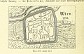
 Brockhaus and Efron Encyclopedic Dictionary b83 474-0.jpg 3,312 × 2,832; 2.52 MB
-
 Bécs Habsburg-térkép 01.jpg 640 × 480; 103 KB
-
 Josephinische Landesaufnahme Wien 1768 Auszug Nordwestbahnstraße.jpg 469 × 447; 222 KB
.jpg)
.jpg)
.jpg)
.jpg)
.jpg)
.jpg)
.jpg)
.jpg)


