Category:Old maps of Tunis
Jump to navigation
Jump to search
Subcategories
This category has only the following subcategory.
M
Media in category "Old maps of Tunis"
The following 59 files are in this category, out of 59 total.
-
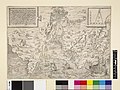 Print, map (BM 1847,1009.1.+ 1).jpg 2,500 × 1,875; 913 KB
-
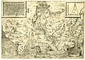 Print, map (BM 1847,1009.1.+).jpg 2,500 × 1,761; 1.3 MB
-
 Ca. 1560 view of Tunis by Agostino Veneziano.jpg 3,365 × 2,594; 1.56 MB
-
 UBBasel Map 1565 Kartenslg AA 117 Tunisis.tiff 13,056 × 8,952, 2 pages; 334.41 MB
-

-
 Djerba Tunisia (1600).jpg 800 × 600; 152 KB
-
 Map of Tunis (1628).jpg 768 × 1,024; 212 KB
-
 1659 map of Tunes.jpg 1,339 × 870; 296 KB
-
 Plan de Tunis - tiré par le S(ieu)r de Darcy - btv1b53242295d (1 of 2).jpg 8,960 × 6,174; 5.38 MB
-
 Tuni - Peeters Jacob - 1686.jpg 1,500 × 586; 381 KB
-
 The bay of Tunis - Seller John The English Pilot - 1771.jpg 1,500 × 818; 578 KB
-
-
 TUNIS 1893, PLAN DE VILLE.jpg 4,653 × 4,547; 11.27 MB
-
 1893 French map of Tunis.tif 7,170 × 6,760; 16.6 MB
-

-
 Cook's practical guide to Algeria and Tunisia (1908) (14770952944).jpg 1,278 × 2,592; 451 KB
-
 Cook's practical guide to Algeria and Tunisia (1908) (14770954214).jpg 1,314 × 2,120; 417 KB
-
 1943 German military map - Tunesien - Sheet Tunis.jpg 20,873 × 16,545; 64.06 MB
-
 Map of Tunis and its vicinity - 1954.jpg 2,500 × 2,298; 959 KB
-

-
 Admiralty Chart No 1184 Baie de Tunis, Published 1953.jpg 12,272 × 8,376; 25.42 MB
-
 Admiralty Chart No 1184 Bay and Lake of Tunis, Published 1888.jpg 8,303 × 6,103; 4.65 MB
-
 AFR V2 D213 Tunis.jpg 1,736 × 2,102; 552 KB
-

-
-
 Carte Hachette Joanne-1887-plan de Tunis.jpg 4,200 × 5,286; 7.42 MB
-
 Carte Hachette Joanne-1887-Tunis & alentours.jpg 2,694 × 4,134; 3.25 MB
-
 ETH-BIB-Tunis Stadtplan (Medina)-Dia 247-16106.tif 3,770 × 2,605; 9.45 MB
-
 ETH-BIB-Tunis, Karte der nördl. Medina-Dia 247-Z-00078.tif 2,943 × 3,430; 29.03 MB
-
 ETH-BIB-Tunis, Stadtplan, aus Guidebleu-Dia 247-02363.tif 2,999 × 3,458; 9.97 MB
-
 Evènements du 9 avril 1938.jpg 1,072 × 845; 264 KB
-
 France & Colonies-1894-Tunis.jpg 3,465 × 3,432; 2.93 MB
-
 Medina Tunis.jpg 1,563 × 1,082; 511 KB
-
 Plan de Tunis - Atlas universel, pl. 127 - gravé par R. Hausermann - btv1b84954845.jpg 4,944 × 3,728; 2.84 MB
-
 Plan de Tunis - btv1b531797063.jpg 9,112 × 7,136; 7.46 MB
-
 Plan du Nouveau Fort (Nova Arx) de Tunis 1574 (cropped).jpg 897 × 919; 292 KB
-
 Plan du Nouveau Fort (Nova Arx) de Tunis 1574.jpg 903 × 1,191; 354 KB
-
 Plan Tunis 1888.jpg 1,821 × 2,556; 629 KB
-
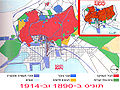 Plan tunis 1890 1914-he.jpg 1,500 × 1,124; 1.29 MB
-
 Plan tunis 1890 1914.jpg 1,626 × 1,134; 215 KB
-
 Plan Tunis 1903.jpg 1,000 × 1,251; 269 KB
-
 Plan Tunis 1916.jpg 2,142 × 1,713; 555 KB
-
 Plan Tunis 1928.jpg 800 × 810; 88 KB
-
 Plan Tunis 1937.jpg 1,713 × 2,376; 866 KB
-
 Plan Tunis et ses environs - 1888.jpg 1,146 × 1,602; 123 KB
-
 Plan Tunis et ses environs - 1903.jpg 1,000 × 1,308; 242 KB
-
 Plan Tunis et ses environs - 1916.jpg 1,725 × 2,148; 502 KB
-
 Plan Tunis et ses environs - 1937.jpg 1,146 × 1,516; 377 KB
-
 Sketch-Map of Southern Tunis… - DPLA - 6302b5e7c28219fd790488f440ccfd85.jpg 973 × 1,000; 266 KB
-

-

-

-
 Tunis - par J. Vanney - btv1b53213404d.jpg 9,160 × 11,438; 17.05 MB
-
 Tunis 1942 US Army Map.jpg 4,770 × 5,964; 6.72 MB
-
 Tunis map plan 1881.jpg 649 × 504; 100 KB
-
 Tunis remparts portes.jpg 1,425 × 2,000; 375 KB
-
 Tunis, 1573 RCIN 721070.jpg 2,250 × 1,701; 1.82 MB
-
 Tunis, 1573.jpg 2,464 × 1,872; 1,000 KB
-
 Tunisi percorso TGM.jpg 1,098 × 646; 192 KB
.jpg)
.jpg)


.jpg)
.jpg)

r_de_Darcy_-_btv1b53242295d_(1_of_2).jpg)

.jpg)

.jpg)
_(14770952944).jpg)
_(14770954214).jpg)


.jpg)


_de_Tunis_1574_(cropped).jpg)
_de_Tunis_1574.jpg)


_(14576741770).jpg)
_(14576975987).jpg)
_(14763439155).jpg)


