Category:Old maps of Tiel
Jump to navigation
Jump to search
Media in category "Old maps of Tiel"
The following 9 files are in this category, out of 9 total.
-

-
 Atlas de Wit 1698-pl007-Tiel-KB PPN 145205088.jpg 2,000 × 1,634; 1.88 MB
-
 Depiction of the events occurring in the Netherlands in 1672.jpg 1,476 × 1,157; 1.04 MB
-
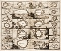 Lambert-van-den-Bos-Lieuwe-van-Aitzema-Historien-onses-tyds MGG 0406.tif 4,146 × 3,485; 41.38 MB
-
 Plattegrond der stad naar Jac. van Deventer - Tiel - 20208704 - RCE.jpg 1,200 × 894; 211 KB
-
 Plattegrond en profiel der stad naar Merian - Tiel - 20208707 - RCE.jpg 1,200 × 892; 267 KB
-
 Plattegrond naar Blaeu - Tiel - 20208705 - RCE.jpg 1,200 × 896; 399 KB
-

-
 Tiel, Gemeenteatlas van Nederland.jpg 1,567 × 2,102; 3.66 MB


,_door_Adriaan_Anthoniszoon_in_het_Algemeen_Rijksarchief_-_Tiel_-_20208710_-_RCE.jpg)
