Category:Old maps of Taichung
Jump to navigation
Jump to search
中文(臺灣):臺中市的古地圖
Media in category "Old maps of Taichung"
The following 17 files are in this category, out of 17 total.
-
 1684 台灣地理圖.jpg 1,466 × 1,161; 1.18 MB
-
 01淡水廳全圖.jpg 3,664 × 2,918; 3.21 MB
-
 05淡水廳分圖四.jpg 3,529 × 2,947; 2.83 MB
-
 08淡水廳沿海礁砂形勢圖一.jpg 3,542 × 2,940; 2.86 MB
-
 Lyu Chuan Map.jpg 2,136 × 2,472; 6.11 MB
-
 Map of Hokuton-shō.jpg 1,411 × 928; 399 KB
-
 Taichung City Map by US Army.jpg 5,048 × 6,723; 7.9 MB
-
 TaihokuImperialUni Forest1.jpg 4,108 × 3,622; 1.46 MB
-
 大南庄蔗苗養成所圃場圖.jpg 2,393 × 3,619; 1,021 KB
-
 大甲街地圖.jpg 2,349 × 1,957; 2.55 MB
-
 大甲郡管內圖.jpg 1,140 × 1,419; 884 KB
-
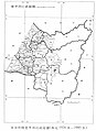 日據時期台中州圖.jpg 744 × 1,020; 82 KB
-
 東勢郡管內圖.jpg 4,455 × 3,144; 6.59 MB
-
 次高太魯閣國立公園.jpg 1,847 × 1,365; 1.42 MB
-
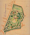 臺中市水源地運動場.jpg 1,723 × 2,021; 926 KB
-
 臺中市街略圖.jpg 1,386 × 1,610; 1.18 MB
-
 臺中市通稱町名.jpg 3,642 × 3,652; 6.51 MB


