Category:Old maps of Senlis (Oise)
Jump to navigation
Jump to search
Media in category "Old maps of Senlis (Oise)"
The following 8 files are in this category, out of 8 total.
-

-
 340 of 'Senlis et ses environs' (11235303784).jpg 1,967 × 3,027; 1.09 MB
-
 341 of 'Senlis et ses environs' (11234218756).jpg 1,857 × 2,854; 943 KB
-
 Atlas topographique des environs de Paris - 05. Senlis - David Rumsey.jpg 11,875 × 7,792; 32.67 MB
-

-

-
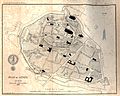 Senlis (Oise), plan de la ville en 1772.jpg 1,934 × 1,547; 895 KB
-
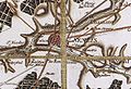 Senlis-Carte de Cassini1.jpg 627 × 426; 263 KB

.jpg)
.jpg)


,_plan_de_la_ville_en_1772.jpg)
