Category:Old maps of Rica de Plata
Jump to navigation
Jump to search
Subcategories
This category has only the following subcategory.
B
Media in category "Old maps of Rica de Plata"
The following 18 files are in this category, out of 18 total.
-

-

-

-

-
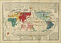
 Bankoku Sozu.jpg 1,204 × 2,873; 2.18 MB
-

-
 Dury Atlas Maps 1 and 2 The World.jpg 5,100 × 2,719; 3.13 MB
-
 Kunyu Wanguo Quantu (坤輿萬國全圖).jpg 11,726 × 5,266; 16.75 MB
-
 L'Amerique divisée Par Grands Etats Par le Sr Janvier Géographe A Paris (MAPS 31).jpg 7,254 × 4,980; 6.95 MB
-

-

-
-
 North Pacific Ocean - btv1b531563526 (2 of 2).jpg 9,066 × 12,738; 7.98 MB
-
 Ortelius - Maris Pacifici 1589.jpg 4,001 × 2,771; 3.81 MB
-
 Phantom islands in 1855 Spruner Map of Australia and Polynesia.jpg 408 × 266; 17 KB
-
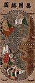
 World map from Japan, Bankoku sozu, 1671.jpg 4,595 × 3,314; 1.65 MB
-
 Nouvel atlas portatif 1806 (138991322).jpg 6,023 × 5,152; 26.03 MB
-
 坤輿萬國全圖(右).jpg 6,000 × 5,415; 6.79 MB

.jpg)


.jpg)
.jpg)

.jpg)
.jpg)
.jpg)


.jpg)
