Category:Old maps of Northeast India
Jump to navigation
Jump to search
Subcategories
This category has the following 6 subcategories, out of 6 total.
N
- Northeast Frontier Agency (2 F)
O
- Old maps of Assam (37 F)
- Old maps of Manipur (10 F)
- Old maps of Meghalaya (2 F)
S
T
- Old maps of Tripura (15 F)
Media in category "Old maps of Northeast India"
The following 13 files are in this category, out of 13 total.
-
 Northeast-India-in-1814-Thomson-map.jpg 971 × 1,319; 881 KB
-
 1907-east-bengal-assam3.jpg 1,200 × 994; 405 KB
-
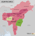 AssamProvince1936 Map.png 2,000 × 2,060; 519 KB
-

-
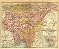
 Bengal gazetteer 1907-9.jpg 2,000 × 1,612; 854 KB
-
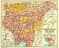 Bengal gazetteer 1907.jpg 1,000 × 806; 749 KB
-
-
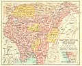
 Easter Bengal and Assam with Bhutan.jpg 1,000 × 806; 294 KB
-
-
 Joppen1907BritishBengalBritishBurmaA.jpg 877 × 1,200; 238 KB
-
 Manipur-map-Johnstone.png 973 × 717; 569 KB
-
 Northeast India - DPLA - a07b3ba822beabece29d6a25d1e09d99.jpg 3,256 × 2,546; 2.23 MB
-
 Northeast-India-in-1855-Colton-map.jpg 897 × 999; 605 KB


_(14784338845).jpg)


