Category:Old maps of Martha's Vineyard
Jump to navigation
Jump to search
Subcategories
This category has only the following subcategory.
1
Media in category "Old maps of Martha's Vineyard"
The following 31 files are in this category, out of 31 total.
-
 Chart of Nantucket Island and the eastern half of Martha's Vineyard. LOC 78692798.jpg 12,738 × 8,947; 12.49 MB
-
 Chart of Nantucket Island and the eastern half of Martha's Vineyard. LOC 78692798.tif 12,738 × 8,947; 326.06 MB
-
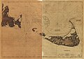 Chart of Nantucket Island and the eastern half of Martha's Vineyard. LOC 78692799.jpg 12,889 × 9,119; 12.83 MB
-
 Chart of Nantucket Island and the eastern half of Martha's Vineyard. LOC 78692799.tif 12,889 × 9,119; 336.27 MB
-
 Nantucket Island and the west end of Martha's Vineyard RMG K0715.jpg 1,280 × 908; 805 KB
-
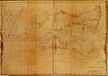
 Buzzards Bay and shoals of Nantucket. LOC gm72003569.jpg 12,178 × 6,686; 7.91 MB
-
 Buzzards Bay and shoals of Nantucket. LOC gm72003569.tif 12,178 × 6,686; 232.95 MB
-
 Coast of New England from Chatham Harbor to Narragansett Bay. LOC 77693979.jpg 12,824 × 9,072; 13.09 MB
-
 Cape Poge bearing S 50°E, distant 2 miles (3046596694).jpg 2,000 × 1,511; 2.43 MB
-
-
 Admiralty Chart No 2456 Muskeget Channel (Massachusetts), Published 1857.jpg 8,062 × 10,732; 8.05 MB
-
-

-
 From Muskeget Channel to Buzzards Bay and entrance to Vineyard Sound, Mass. (3120841360).jpg 1,408 × 2,000; 2.35 MB
-
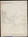
 Admiralty Chart No 2890 Nantucket Shoal to Block Island, Published1862.jpg 13,086 × 8,678; 14.67 MB
-
 Plan for laying out the village of Oak Bluffs, Marthas Vineyard (3720094479).jpg 1,024 × 689; 577 KB
-
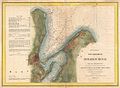
 Map Of Site - NARA - 85967583.jpg 8,352 × 5,884; 3.34 MB
-
 Cape cod 1871.jpg 8,896 × 6,019; 8.84 MB
-
 Plan of Oak Bluffs, Marthas Vineyard (3720094735).jpg 1,024 × 684; 555 KB
-

-

-
 1888 Old Colony Railroad Marthas Vineyard map.png 2,296 × 3,500; 17.88 MB
-
 From Muskeget Channel to Buzzards Bay and entrance to Vineyard Sound, Mass. (3120016189).jpg 1,465 × 2,000; 2.65 MB
-
 Eldridge's Map of Martha's Vineyard.jpg 3,000 × 2,251; 1.29 MB
-
 Eastern Martha's Vineyard, 1894 (cropped).jpg 1,535 × 1,833; 898 KB
-
 Eastern Martha's Vineyard, 1894.jpg 1,700 × 2,800; 1.3 MB
-

-
 Eldridges map of Marthas Vineyard (4587187280).jpg 2,000 × 1,194; 2.01 MB
-
 Map of Cape Cod and vicinity (2675096300).jpg 1,867 × 2,000; 3.24 MB
-
 Martha's Vineyard and Nantucket Islands (66823).jpg 3,354 × 2,151; 2.76 MB
-
 Admiralty Chart No 2456 Nantucket Sound and Western Approaches, Published 1896, New Edition 1946.jpg 16,280 × 11,066; 54.86 MB


.jpg)
,_Martha%27s_Vineyard,_Massachusetts_-_Geographicus_-_HolmesHole-uscs-1847.jpg)
,_Published_1857.jpg)

,_Massachusetts_-_Geographicus_-_MuskegetChannel2-uscs-1859.jpg)
.jpg)

.jpg)


.jpg)


.jpg)

.jpg)


.jpg)
.jpg)
.jpg)
