Category:Old maps of Lüneburg
Jump to navigation
Jump to search
Subcategories
This category has only the following subcategory.
M
Media in category "Old maps of Lüneburg"
The following 26 files are in this category, out of 26 total.
-

-
 1890 - Norddeutsche Staaten.jpg 3,170 × 1,825; 5.73 MB
-

-
 Braunschweig Lüneburg (Merian) 225.jpg 1,918 × 1,612; 613 KB
-

-
 Grundriss der Immenau 9099.jpg 8,304 × 2,947; 4.06 MB
-
 Grundriss von Lüneburg 1856.jpg 4,247 × 5,831; 9.89 MB
-
 Immenau von der Stamersbrücke bis zur Aalkiste 9100.jpg 10,621 × 3,000; 4.87 MB
-
 Kartefürstentumlüneburg1708.jpg 300 × 241; 35 KB
-
 Kirchhof und neues Gebäude 9087.jpg 4,327 × 2,899; 1.98 MB
-
 Kloster Lüne 1800.jpg 524 × 688; 94 KB
-
 Landkarte Ducatus Brunsvicensis fereq(ue) Lunaeburgensis.jpg 3,617 × 2,989; 2.48 MB
-
 Lüneburg 1 (Merian).jpg 1,392 × 992; 371 KB
-
 Lüneburg 2 (Merian).jpg 1,824 × 852; 364 KB
-
 Lüneburg Carte 1730.jpg 4,273 × 4,352; 9.59 MB
-
 Lüneburg Heiliggeisthospital 1798.jpg 4,250 × 2,922; 4.74 MB
-
 Lüneburg Hospital St Benedikt 1771.jpg 2,805 × 3,215; 4.74 MB
-
 Lüneburg Michaeliskirche Grundriss.jpg 725 × 934; 311 KB
-
 Lüneburg Plan 1889 Am Sande.jpg 1,243 × 767; 630 KB
-
 Lüneburg Plan 1889 genordet.jpg 5,911 × 4,339; 10.44 MB
-
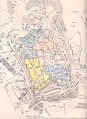
 Lüneburg Plan 1889.jpg 4,339 × 5,911; 12.93 MB
-
 Lüneburg Ratswasserkunst.jpg 2,834 × 3,760; 6.39 MB
-
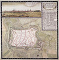
 Lüneburg Stadtgrundriss mit Befestigung 1793.jpg 4,268 × 2,766; 6.41 MB
-
 Lüneburgum um 1740 (Sammlung Moll).jpg 4,510 × 4,029; 18.41 MB
-
 Lüneburgum um 1740.jpg 2,194 × 1,920; 1.62 MB
-
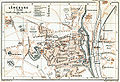 Map luneburg 1910.jpg 1,173 × 800; 621 KB
_regionum_delineatio_-_Auctore_Ioanne_Mellingero%22_(22069949680).jpg)


_225.jpg)


_Lunaeburgensis.jpg)
.jpg)
.jpg)


.jpg)

