Category:Old maps of Harz
Jump to navigation
Jump to search
Media in category "Old maps of Harz"
The following 11 files are in this category, out of 11 total.
-
-

-
 Comitatus Hohnstein nec non Dynastiarum Lohra et Klettenberg.jpg 7,696 × 6,580; 13.23 MB
-
 Das Harz- Und Thüringer-Waldgebirge im Jahre 1824.pdf 6,943 × 5,275, 2 pages; 13.39 MB
-
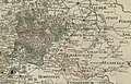
 Fürstentum Halberstadt-Abtei Quedlinburg.jpg 2,940 × 1,912; 3.83 MB
-
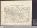
 Harz map 1860.png 1,545 × 1,025; 203 KB
-
 Harz-Gebirge.jpg 3,539 × 2,930; 3.57 MB
-
 Mansfeld geological map2 300dpi.jpg 13,299 × 7,699; 4.23 MB
-
 Reichsstadt Goslar Territorium, F. A. Schrämbl, 1797.png 1,915 × 875; 2.91 MB
-
 Reichsstadt Goslar Territorium, J.B. Homann 1710-1740.jpg 1,690 × 1,268; 975 KB
-
 Topographisch-militairische Charte von Teutschland - Section 069.png 3,466 × 2,711; 21.62 MB
.jpg)


