Category:Old maps of Germany from the Norman B. Leventhal Map Center
Jump to navigation
Jump to search
Countries of Europe: Belgium · Cyprus‡ · Denmark · France‡ · Germany · Greece · Hungary · Republic of Ireland · Italy · Lithuania · Netherlands‡ · Poland · Portugal‡ · Romania · Russia‡ · Spain‡ · Switzerland · Turkey‡ · United Kingdom
‡: partly located in Europe
‡: partly located in Europe
Media in category "Old maps of Germany from the Norman B. Leventhal Map Center"
The following 9 files are in this category, out of 9 total.
-
 1935 pictorial map of Germany.tif 6,018 × 4,468; 76.95 MB
-
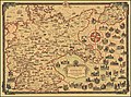 A Pictorial Map of Germany By Ernest Dudley Chase.jpg 10,014 × 7,459; 20.81 MB
-
 A pictorial map of Germany.tif 5,898 × 4,516; 76.23 MB
-

-

-

-
 Plan de Cologne by Hòtel Disch.jpg 651 × 479; 313 KB
-
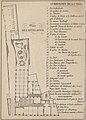 Plan de Hotel Disch (and map key for Cologne).jpg 473 × 658; 329 KB
-
 Rhein Panorama von Cöln nach Düsseldorf und Mainz (35179324375).jpg 714 × 2,000; 1.33 MB

.jpg)
.jpg)
.jpg)

.jpg)
.jpg)