Category:Old maps of Chiayi County
Jump to navigation
Jump to search
中文(臺灣):嘉義縣的古地圖
Media in category "Old maps of Chiayi County"
The following 12 files are in this category, out of 12 total.
-
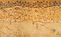
 AMH-5413-NA Chart showing the Wancan region on Formosa.jpg 2,400 × 1,850; 619 KB
-
 Taiwan di li tu.jpg 1,636 × 995; 565 KB
-
 Zhuluo Qing map 1696.png 775 × 622; 135 KB
-
 Hotei Railway Map 1926.png 1,064 × 398; 669 KB
-
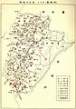 Location map of schools in Tainan 1927.jpg 840 × 1,200; 209 KB
-
 Map of Kanan Irrigation System.jpg 3,332 × 2,768; 2.06 MB
-
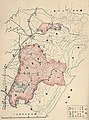 Map of wildlife protection area in Tainan 1940.jpg 891 × 1,200; 224 KB
-
 Rokkyakusyou Map.jpg 2,212 × 2,362; 423 KB
-
 Tainanshu Kannaizu.jpg 2,260 × 2,794; 676 KB
-
 大林庄管內圖.jpg 2,949 × 2,895; 3.52 MB
-
 新高阿里山國立公園.jpg 2,046 × 1,538; 1.81 MB
-
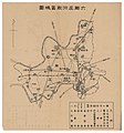
 荷苞嶼水系.jpg 3,207 × 1,368; 2.15 MB


