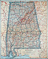
Category:Old maps of Alabama
Jump to navigation
Jump to search
States of the United States: Alabama · Alaska · Arizona · Arkansas · California · Colorado · Connecticut · Delaware · Florida · Georgia · Hawaii · Idaho · Illinois · Indiana · Iowa · Kansas · Kentucky · Louisiana · Maine · Maryland · Massachusetts · Michigan · Minnesota · Mississippi · Missouri · Montana · Nebraska · Nevada · New Hampshire · New Jersey · New Mexico · New York · North Carolina · North Dakota · Ohio · Oklahoma · Oregon · Pennsylvania · Rhode Island · South Carolina · South Dakota · Tennessee · Texas · Utah · Vermont · Virginia · Washington · West Virginia · Wisconsin · Wyoming – District of Columbia: Washington, D.C.
Guam · Northern Mariana Islands · Puerto Rico
Guam · Northern Mariana Islands · Puerto Rico
Subcategories
This category has the following 7 subcategories, out of 7 total.
C
O
Media in category "Old maps of Alabama"
The following 200 files are in this category, out of 255 total.
(previous page) (next page)-
 (Collected reprints, 1902-1928 (19-)) (20717677006).jpg 1,238 × 1,874; 843 KB
-
 (Map of northwest Alabama and northeast Mississippi). LOC 2006635328.tif 6,917 × 4,559; 90.22 MB
-

-
 (Plat of land along the Rio de la Movila near its juncture with Bayou Chataugé). LOC 2013585046.tif 7,923 × 5,565; 126.15 MB
-
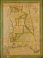
 1833 Map of Alabama counties.jpeg 3,542 × 4,653; 1.58 MB
-
 1838 Map of Alabama counties.jpeg 3,430 × 4,427; 1.47 MB
-
 1840 LaTourrette Tuscaloosa.jpeg 1,606 × 1,594; 498 KB
-
 1840 Map of Florence, Alabama.jpeg 1,611 × 1,689; 416 KB
-
 1840 Map of Montgomery County, Alabama.jpeg 1,798 × 2,548; 957 KB
-
 1840 Map of Tuscumbia, Alabama.jpeg 1,617 × 1,312; 469 KB
-
 1840 Map of Wetumpka, Alabama.jpeg 1,681 × 1,258; 379 KB
-
 1848 Map of Alabama counties.jpeg 2,267 × 2,876; 1.06 MB
-
 1856 U.S. Coast Survey Map of Mobile Bay, Alabama - Geographicus - MobileBay-uscs-1856.jpg 3,753 × 5,000; 3.18 MB
-
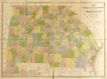
 1859 Map of Alabama counties.jpeg 3,982 × 4,858; 2.44 MB
-
 1864 Mitchell Map of Georgia and Alabama - Geographicus - GAAL-mitchell-1860.jpg 3,500 × 2,859; 3.97 MB
-
 1865 Johnson Map of Georgia and Alabama - Geographicus - GeorgiaAlabama-johnson-1865.jpg 4,000 × 2,868; 3.96 MB
-
 1886 Lewis Map of Mobile Bay, Alabama - Geographicus - MobileBay-lewis-1880s.jpg 3,000 × 3,788; 1.72 MB
-
 1893 Map of Alabama counties.jpg 3,450 × 4,485; 4.64 MB
-
 1901 map of Montgomery County, Alabama.jpeg 5,181 × 5,989; 1.21 MB
-
 1911 Map of Alabama Congressional districts.jpeg 3,249 × 4,500; 2.13 MB
-
 1918 map of Montgomery County, Alabama.jpeg 3,259 × 3,797; 929 KB
-
 1920 Map of Alabama Congressional districts.jpeg 2,140 × 3,295; 1.13 MB
-

-

-
-
-

-

-

-
-

-

-
-
 A plan of Mobile Bar, LOC 73697604.jpg 4,142 × 3,163; 1.71 MB
-
 A plan of Mobile Bar, LOC 73697604.tif 4,142 × 3,163; 37.48 MB
-

-

-

-
 Alabama 1-50,000. Fort Rucker military installation map LOC 2011592116.jpg 8,146 × 10,823; 16.45 MB
-
 Alabama 1-50,000. Fort Rucker military installation map LOC 2011592116.tif 8,146 × 10,823; 252.24 MB
-
-
 Alabama LOC 2006629778.jpg 3,515 × 4,484; 1.95 MB
-
 Alabama LOC 2006629778.tif 3,515 × 4,484; 45.09 MB
-
 Alabama Railroad Commissioners Map of Alabama 1888.jpg 4,032 × 6,512; 6.23 MB
-
 Alabama; county subdivisions, census county divisions and places. 1970. LOC gm72003042.jpg 6,465 × 10,489; 5.88 MB
-
 Alabama; county subdivisions, census county divisions and places. 1970. LOC gm72003042.tif 6,465 × 10,489; 194.01 MB
-

-
 Arbuckle Bros. Coffee Company (3093823448).jpg 799 × 481; 349 KB
-
 Battle of Tehoo(pca). LOC 2012588006.jpg 3,159 × 2,473; 818 KB
-
 Battle of Tehoo(pca). LOC 2012588006.tif 3,159 × 2,473; 22.35 MB
-
 Bird's eye view looking northwest, city of Anniston, Calhoun County, Alabama. LOC 75693072.jpg 10,704 × 7,376; 18.97 MB
-
 Bird's eye view looking northwest, city of Anniston, Calhoun County, Alabama. LOC 75693072.tif 10,704 × 7,376; 225.89 MB
-
 Birmingham Alabama map 1903.jpg 2,864 × 1,904; 1.07 MB
-
 Black belt water resource study area, Alabama LOC 92682559.jpg 4,349 × 3,270; 1.5 MB
-
 Black belt water resource study area, Alabama LOC 92682559.tif 4,349 × 3,270; 40.69 MB
-
 Britannica Alabama.jpg 1,806 × 2,595; 2.38 MB
-

-
 Carte d'une partie du cours de la riviere de la Mobille et de celle des Chicachas. LOC 2015588082.tif 16,219 × 3,399; 157.72 MB
-

-
 Chart showing the entrance of Rear Admiral Farragut into Mobile Bay. 5th of August 1864 LOC 99447257.tif 8,085 × 11,015; 254.79 MB
-
 Collier's 1921 Alabama.jpg 1,814 × 2,234; 1.18 MB
-

-
-

-
 EB9 Alabama - sketch map.jpg 1,235 × 1,551; 307 KB
-

-
 Entrance to Mobile Bay LOC 80691507.jpg 6,279 × 9,234; 9.09 MB
-
 Entrance to Mobile Bay LOC 80691507.tif 6,279 × 9,234; 165.88 MB
-

-

-

-
-

-
-
 Five Mile Creek. LOC gm69003397.jpg 8,365 × 5,015; 5.17 MB
-
 Five Mile Creek. LOC gm69003397.tif 8,365 × 5,015; 120.02 MB
-
 Flooded areas, Big Wills Creek, vicinity of Gadsden, Alabama. LOC gm71001581.jpg 6,691 × 4,869; 4.77 MB
-
 Flooded areas, Big Wills Creek, vicinity of Gadsden, Alabama. LOC gm71001581.tif 6,691 × 4,869; 93.21 MB
-

-
-

-

-
 General soil map, state of Alabama LOC 90684182.jpg 5,164 × 3,335; 1.61 MB
-
 General soil map, state of Alabama LOC 90684182.tif 5,164 × 3,335; 49.27 MB
-
 General soil map, State of Alabama LOC 90684183.jpg 5,692 × 7,161; 7.01 MB
-
 General soil map, State of Alabama LOC 90684183.tif 5,692 × 7,161; 116.62 MB
-
 Halls Mill Creek. LOC gm69002800.jpg 8,313 × 4,976; 4.63 MB
-
 Halls Mill Creek. LOC gm69002800.tif 8,313 × 4,976; 118.35 MB
-

-

-

-

-
 Horseshoe Bend National Military Park, Alabama LOC 2005633459.jpg 5,046 × 7,023; 5.23 MB
-
 Horseshoe Bend National Military Park, Alabama LOC 2005633459.tif 5,046 × 7,023; 101.39 MB
-
 Horseshoe Bend National Military Park, Alabama LOC 95681125.jpg 5,073 × 7,084; 5.89 MB
-
 Horseshoe Bend National Military Park, Alabama LOC 95681125.tif 5,073 × 7,084; 102.82 MB
-
 Horseshoe Bend National Military Park, Alabama LOC 96681417.jpg 5,062 × 7,057; 6.05 MB
-
 Horseshoe Bend National Military Park, Alabama LOC 96681417.tif 5,062 × 7,057; 102.2 MB
-

-
 J. H. Colton's School Atlas, 1860 - DPLA - 9afa4d40de861bb7b2a7e024bba61c0e (page 17).jpg 4,093 × 4,953; 2.26 MB
-

-
-
 Lakes Walter F. George & George W. Andrews LOC 2005630418.jpg 13,917 × 8,388; 14.69 MB
-
 Lakes Walter F. George & George W. Andrews LOC 2005630418.tif 13,917 × 8,388; 333.98 MB
-
-

-
 Lh000836r.gif 288 × 150; 10 KB
-
 Lh000842.gif 370 × 150; 15 KB
-
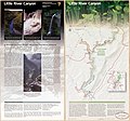
 Little River Canyon National Preserve LOC 2003623009.jpg 5,155 × 4,665; 2.91 MB
-
 Little River Canyon National Preserve LOC 2003623009.tif 5,155 × 4,665; 68.8 MB
-
 Little River Canyon National Preserve, Alabama LOC 2003623001.jpg 5,091 × 4,741; 3.31 MB
-
 Little River Canyon National Preserve, Alabama LOC 2003623001.tif 5,091 × 4,741; 69.06 MB
-
 Little River Canyon National Preserve, Alabama LOC 2004628401.jpg 5,017 × 4,703; 3.51 MB
-
 Little River Canyon National Preserve, Alabama LOC 2004628401.tif 5,017 × 4,703; 67.51 MB
-
 Little River Canyon National Preserve, Alabama LOC 2005631238.jpg 5,028 × 4,714; 3.55 MB
-
 Little River Canyon National Preserve, Alabama LOC 2005631238.tif 5,028 × 4,714; 67.81 MB
-
 Little River Canyon National Preserve, Alabama LOC 2007627669.jpg 5,042 × 4,714; 3.6 MB
-
 Little River Canyon National Preserve, Alabama LOC 2007627669.tif 5,042 × 4,714; 68 MB
-
 Little River Canyon National Preserve, Alabama LOC 2010594814.jpg 5,045 × 4,706; 3.36 MB
-
 Little River Canyon National Preserve, Alabama LOC 2010594814.tif 5,045 × 4,706; 67.93 MB
-
 Little River Canyon National Preserve, Alabama LOC 2013587314.jpg 5,048 × 4,724; 3.72 MB
-
 Little River Canyon National Preserve, Alabama LOC 2013587314.tif 5,048 × 4,724; 68.23 MB
-

-

-

-

-

-

-
 Map of Alabama LOC 2012590211.jpg 6,597 × 8,921; 7.4 MB
-
 Map of Alabama LOC 2012590211.tif 6,597 × 8,921; 168.38 MB
-
 Map of Alabama showing soil and water conservation district organization. LOC gm69002242.tif 3,644 × 5,590; 58.28 MB
-
 Map of Colbert County, Alabama LOC 2011590022.tif 12,859 × 7,689; 282.88 MB
-
 Map of Georgia and Alabama WDL9597.png 1,374 × 1,024; 2.47 MB
-

-
 Map of Mobile Bay LOC 2007629220.jpg 5,091 × 6,372; 2.79 MB
-
 Map of Mobile Bay LOC 2007629220.tif 5,091 × 6,372; 92.81 MB
-

-
-
-
-
 Map of South Carolina, Georgia, Alabama, and Tennessee. LOC gvhs01.vhs00053.jpg 2,088 × 1,720; 576 KB
-
 Map of South Carolina, Georgia, Alabama, and Tennessee. LOC gvhs01.vhs00053.tif 2,088 × 1,720; 10.28 MB
-
 Map of the Country South and West of Mobile - NARA - 70652875.jpg 19,454 × 11,119; 23.09 MB
-
 Map of the defences of the city of Mobile. (1862-64) LOC 99447254.tif 4,646 × 3,370; 44.8 MB
-

-
 Map showing entrance to Mobile Bay and course taken by Union fleet. LOC gvhs01.vhs00200.tif 1,740 × 2,220; 11.05 MB
-

-

-
-

-

-
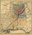
 Map showing the line of the Savannah & Memphis Railroad and its connections. LOC 98688798.jpg 9,918 × 6,792; 14.12 MB
-
 Map showing the line of the Savannah & Memphis Railroad and its connections. LOC 98688798.tif 9,918 × 6,792; 192.73 MB
-

-

-
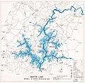 Martin Lake, Maxwell & Gunter recreation map. LOC 77693070.jpg 6,882 × 6,720; 4.62 MB
-
 Martin Lake, Maxwell & Gunter recreation map. LOC 77693070.tif 6,882 × 6,720; 132.31 MB
-
 Military map no. 54, prepared as basis for additional surveys LOC 99447245.jpg 6,921 × 4,891; 5.09 MB
-
 Military map no. 54, prepared as basis for additional surveys LOC 99447245.tif 6,921 × 4,891; 96.85 MB
-
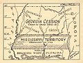 Mississippi Territory map.jpg 624 × 479; 89 KB
-
 National forests in Alabama - pocket visitor guide LOC 96685911.jpg 10,221 × 6,870; 6.69 MB
-
 National forests in Alabama - pocket visitor guide LOC 96685911.tif 10,221 × 6,870; 200.9 MB
-
 National forests in Alabama LOC 89697203.tif 10,272 × 6,927; 203.57 MB
-
 Native American Towns in Alabama 1818.jpeg 2,005 × 2,551; 585 KB
-

-

-
 Northeastern Gulf of Mexico, January 1997 LOC 97681342.jpg 8,065 × 8,486; 9.73 MB
-
 Northeastern Gulf of Mexico, January 1997 LOC 97681342.tif 8,065 × 8,486; 195.81 MB
-
 Northern Alabama and Georgia LOC 2004626025.jpg 6,532 × 7,745; 10.07 MB
-
 Northern Alabama and Georgia LOC 2004626025.tif 6,532 × 7,745; 144.74 MB
-
 Northern Alabama and Georgia LOC 2004626029.jpg 6,604 × 8,335; 11.13 MB
-
 Northern Alabama and Georgia LOC 2008628287.jpg 9,110 × 10,799; 16.14 MB
-
 Northern Alabama and Georgia LOC 2008628287.tif 9,110 × 10,799; 281.46 MB
-
 Northern Mississippi and Alabama (5960829275).jpg 2,000 × 1,336; 2.78 MB
-

-

-

-

-
 NSRW Mobile - Mobile Bay.jpg 605 × 695; 240 KB
-

-
 Preliminary chart of the sea coast of part of Alabama and Mississippi (NYPL b19561224-5247811).tiff 10,328 × 7,760, 2 pages; 229.57 MB
-

-
-
 Plan & view of the city of Mobile LOC 2012593360.jpg 10,767 × 8,088; 14.18 MB
-
 Plan & view of the city of Mobile LOC 2012593360.tif 10,767 × 8,088; 249.15 MB
-

-

-
-
 Plan of bend and breast works of Tohopeka, the battle of the 27th March 1814. LOC 2007629222.tif 5,045 × 4,093; 59.08 MB
-
 Plan of the battle of August 5, 1864. (Mobile Bay) LOC 99447253.jpg 1,923 × 1,458; 407 KB
-
 Plan of the battle of August 5, 1864. (Mobile Bay) LOC 99447253.tif 1,923 × 1,458; 8.02 MB
-
 Plan of the fortification at Mobile Point LOC 2012588004.jpg 2,599 × 4,144; 1.14 MB
-
 Plan of the fortification at Mobile Point LOC 2012588004.tif 2,599 × 4,144; 30.81 MB
-

-

-

-

-
-

-

)_(20717677006).jpg)
._LOC_2013585046.jpg)


.jpg)
.jpg)
%27_(11108999184).jpg)
.jpg)
%27_(11159325943).jpg)
%27_(11159968515).jpg)
_(20192648520).jpg)
_(20194013289).jpg)


_(14783602605).jpg)


_(19355708012).jpg)
.jpg)
._LOC_2012588006.jpg)


_(14781820614).jpg)


.jpg)


._LOC_2007626786.jpg)


.jpg)


.jpg)


.jpg)


_propos%C3%A9e,_marqu%C3%A9_en_jeaune_(i.e._jaune)._LOC_2009581264.jpg)

_LOC_99447253.jpg)


.jpg)