Category:Old county maps of Northumberland
Jump to navigation
Jump to search
Ceremonial counties of England: Bedfordshire · Berkshire · Buckinghamshire · Cambridgeshire · Cheshire · Cornwall · Derbyshire · Devon · Dorset · Durham · East Riding of Yorkshire · Essex · Gloucestershire · Hampshire · Herefordshire · Hertfordshire · Kent · Lancashire · Leicestershire · Lincolnshire · Norfolk · Northamptonshire · Northumberland · Nottinghamshire · Oxfordshire · Rutland · Shropshire · Somerset · Staffordshire · Suffolk · Surrey · Warwickshire · Wiltshire · Worcestershire
City-counties:
Former historic counties: Cumberland · Huntingdonshire · Middlesex · North Riding of Yorkshire · Sussex · West Riding of Yorkshire · Westmorland · Yorkshire
Other former counties:
City-counties:
Former historic counties: Cumberland · Huntingdonshire · Middlesex · North Riding of Yorkshire · Sussex · West Riding of Yorkshire · Westmorland · Yorkshire
Other former counties:
Media in category "Old county maps of Northumberland"
The following 13 files are in this category, out of 13 total.
-
-
 Northumberland - Lord Burghley's Atlas (1579), ff.71v-72 - BL Royal MS 18 D III.jpg 1,504 × 1,171; 991 KB
-
 Atlas Van der Hagen-KW1049B11 037-COMITATUS NORTHUMBRIA NORTHUMBERLAND..jpeg 5,500 × 4,604; 3.62 MB
-
 Comitatus Northumbria vernacule Northumber Land (8643504908).jpg 800 × 662; 125 KB
-
 "Comitatus Northumbria, vernacule Northumberland" (22246828772).jpg 3,574 × 3,041; 2.09 MB
-

-
 Maps of England circa 1670, Northumberland 28 of 40 (13432506245).jpg 4,948 × 6,274; 4.03 MB
-
 Comitatus Northumbria vernacule Northumberland - CBT 6595991.jpg 5,635 × 4,623; 7.05 MB
-
 Aikin(1800) p040 - Northumberland.jpg 1,166 × 1,932; 458 KB
-
 Gray1824.northumberland.jpg 793 × 942; 144 KB
-
 Pigot and Co (1842) p2.300 - Map of Northumberland.jpg 1,310 × 2,158; 820 KB
-
 CAPPER(1813) p807 - Northumberland.jpg 1,359 × 2,326; 800 KB
-
 CAPPER(1829) p677 - Northumberland.jpg 1,394 × 2,471; 861 KB
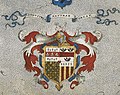
,_ff.71v-72_-_BL_Royal_MS_18_D_III_-_coat_of_arms_of_Thomas_Seckford.jpg)
,_ff.71v-72_-_BL_Royal_MS_18_D_III.jpg)

.jpg)
.jpg)
.5.(55).jpg)
.jpg)

_p040_-_Northumberland.jpg)

_p2.300_-_Map_of_Northumberland.jpg)
_p807_-_Northumberland.jpg)
_p677_-_Northumberland.jpg)