Category:Old city of Winterthur
Jump to navigation
Jump to search
| Object location | | View all coordinates using: OpenStreetMap |
|---|
quarter of Winterthur city   | |||||
| Upload media | |||||
| Instance of |
| ||||
|---|---|---|---|---|---|
| Part of |
| ||||
| Location |
| ||||
| Heritage designation | |||||
| Area |
| ||||
| Elevation above sea level |
| ||||
 | |||||
Subcategories
This category has the following 11 subcategories, out of 11 total.
E
- Ehemaliges Waaghaus (5 F)
F
- Fischmädchen-Brunnen (7 F)
H
- Haus zum Adler (5 F)
- Haus zur Geduld (7 F)
- Haus zur Sonne (Winterthur) (3 F)
J
- Justitiabrunnen (Winterthur) (11 F)
L
- Lindengutpark (3 F)
N
- Neumarkt (Winterthur) (12 F)
R
- Rathaus Winterthur (26 F)
S
W
Media in category "Old city of Winterthur"
The following 84 files are in this category, out of 84 total.
-
 (Altstadt)Häuser an der Stadthausstrasse in Winterthur.jpg 3,200 × 2,135; 5.11 MB
-
 750 Jahre Winterthur - Steinberggasse.jpg 4,000 × 3,000; 6.86 MB
-
 Albani Music Club.jpg 2,868 × 4,302; 4.62 MB
-
 Altstadt Winterthur vorweihnachtlich (2021).jpg 4,200 × 2,800; 8.94 MB
-
 Altstadt, mittelalterliche-neuzeitliche Stadt Winterthur.jpg 2,667 × 4,000; 2.4 MB
-
 Blick auf die Winterthurer Altstadt.jpg 3,600 × 2,402; 7.6 MB
-
 Dachgarten - panoramio.jpg 800 × 600; 115 KB
-
 Dimensione.jpg 4,302 × 2,868; 5.55 MB
-
 Geschäftshaus zum Lenzengraben.jpg 3,648 × 2,736; 4.21 MB
-
 Haus zu den drei Blumen.jpg 3,008 × 5,344; 3.77 MB
-
 Haus zum Hinteren Waldhorn.jpg 1,955 × 3,472; 2.18 MB
-
 Haus zum Steinadler - panoramio.jpg 800 × 776; 273 KB
-
 Hotel Loge Winterthur.jpg 2,848 × 4,272; 3.72 MB
-
 Kamm und Schere - panoramio.jpg 600 × 800; 155 KB
-
 Kleinstes Haus in Winterthur, Neustadtgasse 18a (2022).jpg 4,200 × 3,150; 9.79 MB
-
 Kleinstes Haus in Winterthur.jpg 4,000 × 3,000; 9.3 MB
-
 Kleinstes Haus von Winterthur.jpg 2,761 × 4,140; 5.24 MB
-
 Marktgasse ('Schluuch') in Winterthur 2014-02-24 14-57-04.JPG 4,928 × 3,264; 5.85 MB
-
 Marktgasse, Winterthur.jpg 4,831 × 3,588; 3.67 MB
-
 Neuhof Winterthur Schulgasse 3.jpg 1,563 × 2,979; 3.38 MB
-
 Neustadtgasse anno 1957.JPG 2,134 × 1,480; 565 KB
-
 Neustadtgasse in Winterthur-IMG 1672.jpg 2,560 × 1,708; 3.33 MB
-
 ObBogenVituduriI.jpg 1,542 × 1,981; 2.37 MB
-
 Oberer Graben 46 and 44.jpg 5,472 × 3,648; 4.48 MB
-
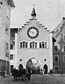
 Obertor (14) in Winterthur.jpg 3,244 × 4,055; 7.81 MB
-
 Obertor 14, Winterthur.jpg 2,974 × 4,349; 3.41 MB
-
 Obertor 16, 14, 12 in Winterthur.jpg 2,402 × 3,600; 5 MB
-
 Obertor 16, Winterthur.jpg 3,245 × 5,141; 3.74 MB
-
 Obertor 44, Winterthur.jpg 2,476 × 4,574; 2.29 MB
-
 Obertor in der Altstadt Winterthur.jpg 4,000 × 2,500; 7.02 MB
-
 Obertor Winterthur im Winter 21.jpg 3,888 × 5,184; 10.42 MB
-
 Obertor, Winterthur.jpg 2,670 × 3,979; 2.24 MB
-
 Parkhotel Winterthur, Ansicht General-Guisan-Strasse.jpg 4,000 × 2,667; 8.72 MB
-
 Picswiss ZH-13-15.jpg 300 × 451; 43 KB
-
 Picswiss ZH-13-17.jpg 300 × 452; 40 KB
-
 Riegelhaus - panoramio.jpg 800 × 600; 217 KB
-
 Riegelhaus und Brunnen - panoramio.jpg 800 × 600; 182 KB
-
 Rundum schwanger - panoramio.jpg 800 × 600; 181 KB
-
 Stadthausstrasse Winterthur IMG 2485.jpg 2,002 × 3,000; 5.38 MB
-
 Steinberggasse 54.jpg 4,795 × 2,943; 3.05 MB
-
 Steinberggasse.jpg 5,401 × 3,406; 4.78 MB
-
 Stolperstein für Bertha Weidler (Winterthur).jpg 2,245 × 2,131; 1.32 MB
-
 Stolperstein für Lina Levitus (Winterthur).jpg 817 × 817; 228 KB
-
 Stolperstein für Therese Levitus (Winterthur).jpg 801 × 801; 262 KB
-
 Strasse "Obertor" in Winterthur (2022).jpg 4,200 × 3,150; 9.43 MB
-
 Taverne zum Kreuz Winterthur.jpg 3,251 × 3,735; 6.37 MB
-
 Technikumstrasse anno 1957.JPG 2,119 × 1,454; 594 KB
-
 Technikumstrasse.jpg 3,931 × 3,246; 3.24 MB
-
 UntBogenVituduriI.jpg 1,278 × 1,733; 1.73 MB
-
 Winter in Winterthur - Stadthausstrasse.jpg 4,000 × 3,000; 8.17 MB
-

-
-
 Winterthur - fountain.jpg 3,558 × 4,272; 4.37 MB
-
 Winterthur - Marktgasse.jpg 4,188 × 3,648; 3.51 MB
-
 Winterthur - Neumarkt.jpg 5,097 × 3,458; 3.35 MB
-
 Winterthur - Oberer Graben 2014-02-24 14-14-13.jpg 4,928 × 3,264; 4.44 MB
-
 Winterthur - Obertor.jpg 4,652 × 3,648; 3.73 MB
-
 Winterthur - panoramio (1).jpg 4,272 × 2,848; 2.92 MB
-
 Winterthur - panoramio (8).jpg 2,848 × 4,272; 8.91 MB
-
 Winterthur - Steinberggasse IMG 4252.JPG 3,888 × 2,592; 3.82 MB
-
 Winterthur - Unterer Graben mit Bank Linth.jpg 4,200 × 3,150; 7.8 MB
-
 Winterthur 1964 Altstadt.JPG 1,384 × 1,752; 490 KB
-
 Winterthur 2021.jpg 4,872 × 3,048; 4.15 MB
-
 Winterthur dolny szpital.jpg 6,000 × 4,000; 7.73 MB
-
 Winterthur dom klubowy ewangelicki.jpg 6,000 × 4,000; 6.96 MB
-
 Winterthur Dom pod Wisnia.jpg 6,000 × 4,000; 8.04 MB
-
 Winterthur Holderplatz 4 - panoramio.jpg 3,266 × 2,420; 3.01 MB
-
 Winterthur kamienica Berna.jpg 4,000 × 6,000; 7.46 MB
-
 Winterthur kamienica Steinbergg 16.jpg 4,000 × 6,000; 7.15 MB
-
 Winterthur kamienica Steinbergg 25.jpg 4,000 × 6,000; 6.87 MB
-
 Winterthur kamienice Kirchpl.jpg 6,000 × 4,000; 7.65 MB
-
 Winterthur Marktgasse (31901879722).jpg 4,590 × 3,040; 7.35 MB
-
 Winterthur Obergasse.jpg 6,000 × 4,000; 7.18 MB
-
 Winterthur Spitalgasse.jpg 6,000 × 4,000; 7.99 MB
-
 Winterthur szyld.jpg 4,000 × 6,000; 5.87 MB
-
 Winterthur Untertor.jpg 6,000 × 4,000; 7 MB
-
 Winterthur vom Heiligberg 1957.JPG 2,107 × 1,430; 638 KB
-
 Winterthur vom Heiligberg weit.JPG 2,083 × 1,435; 637 KB
-
 Winterthur vom Heiligberg.JPG 2,121 × 1,444; 637 KB
-
 Winterthur, Switzerland - panoramio (4).jpg 4,896 × 3,264; 2.24 MB
-
 Winterthurer Bibliotheken 026380 O Untertor von Westen Eulachwuhr 1866.tif 3,771 × 2,975; 32.13 MB
-
 Winterthurer Bibliotheken 060759 O Stadthausstrasse 20 erste Turnhalle der Schweiz 1854.tif 3,081 × 1,959; 17.29 MB
-

-
 Zur Sonnenuhr am Garnmarkt Winterthur.jpg 4,200 × 2,803; 5.9 MB
H%C3%A4user_an_der_Stadthausstrasse_in_Winterthur.jpg)


.jpg)


.jpg)


_in_Winterthur_2014-02-24_14-57-04.JPG)


_in_Winterthur.jpg)


.jpg)
.jpg)
.jpg)
.jpg)


.jpg)
.jpg)


.jpg)


.jpg)
