Category:Old cartoon maps of Europe
Jump to navigation
Jump to search
Media in category "Old cartoon maps of Europe"
The following 15 files are in this category, out of 15 total.
-

-
 Carte des états désunis d'Europe - Kungliga Biblioteket - 10348540.tif 10,307 × 7,703, 2 pages; 454.33 MB
-
 Carte drôlatique d'Europe pour 1870.jpg 5,287 × 4,231; 5.28 MB
-
 Cartoon map of world war 1.jpg 300 × 208; 17 KB
-
 Fred. W. Rose The Avenger An Allegorical War Map for 1877 1877 Cornell CUL PJM 1080 01.jpg 9,002 × 7,137; 12.83 MB
-
 John Bull and his Friends 1900.jpg 8,439 × 5,943; 15.22 MB
-
 Latest war map of Europe - as seen through French eyes LOC 2010587001.jpg 5,300 × 3,958; 3.23 MB
-
 Latest war map of Europe - as seen through French eyes LOC 2010587001.tif 5,300 × 3,958; 60.02 MB
-
 Pictorial map of World War I in Russian.jpg 7,308 × 5,505; 14.99 MB
-
 Politische Charte von Europa, 1848.jpg 4,340 × 3,153; 3.81 MB
-
 Rusofob pic8.jpg 600 × 442; 48 KB
-
 Satirical Europe in 1870.jpg 1,119 × 715; 265 KB
-
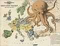
 Satirical Map of Europe, 1887.jpg 1,479 × 921; 369 KB
-
 Satirical map of Europe, 1914.jpg 1,525 × 1,117; 332 KB
-
 Serio-comic war map for 1877.jpg 8,440 × 6,448; 13.21 MB
.jpg)


