Category:Old Maslenica Bridge
Jump to navigation
Jump to search
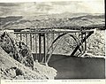
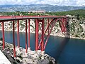
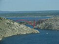
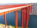
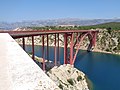
History: Opened 1961 (original), 2005 (rebuilt). Closed 1991-2005 (destroyed).
| Object location | | View all coordinates using: OpenStreetMap |
|---|
built in 1961, destroyed in 1991, rebuilt in 2005  Pohled na obnovený most | |||||
| Upload media | |||||
| Instance of | |||||
|---|---|---|---|---|---|
| Named after | |||||
| Made from material | |||||
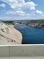
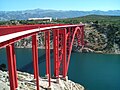
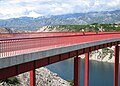
| Location | Zadar County, Croatia | ||||
| Crosses | |||||
| Carries | |||||
| Inception |
| ||||
| Date of official opening |
| ||||
| Length |
| ||||
| Different from | |||||
 | |||||
Subcategories
This category has only the following subcategory.
V
Media in category "Old Maslenica Bridge"
The following 14 files are in this category, out of 14 total.
-
 Koledar Metalne 1963 2.jpg 4,768 × 3,762; 7.89 MB
-
 Maslenica Bridge (D 8), Croatia.JPG 1,944 × 2,592; 1.07 MB
-
 Maslenica Bridge.jpg 2,736 × 3,648; 2.96 MB
-
 Maslenicki most 02.jpg 2,048 × 1,536; 1.02 MB
-
 Most Maslenica preko morskega zaliva pri Zadru.jpg 815 × 1,265; 166 KB
-
 Old and New Maslenica Bridges.JPG 3,124 × 2,250; 1.56 MB
-
 Old Maslenica Bridge 1.JPG 3,264 × 2,448; 4.62 MB
-
 Old Maslenica Bridge.JPG 1,600 × 1,200; 1.06 MB
-
 Pont de Maslenica (route D8).jpg 5,325 × 3,558; 2.43 MB
-
 Stari Maslenički most (Alte Maslenica-Brücke), Zadar (Kroatien) - 0016.jpg 4,000 × 2,667; 4.49 MB
-
 Stari maslenički most 001.jpg 2,048 × 1,536; 802 KB
-
 Stari maslenički most i novsko ždrilo.jpg 900 × 1,200; 223 KB
-
 Stari Maslenički most ploča.JPG 2,739 × 1,415; 708 KB
-
 Stari maslenički most.jpg 5,152 × 3,864; 7.91 MB

,_Croatia.JPG)


.jpg)
,_Zadar_(Kroatien)_-_0016.jpg)


