Category:Old Hutton and Holmescales
Jump to navigation
Jump to search

civil parish in South Lakeland, Cumbria, England  | |||||
| Upload media | |||||
| Instance of | |||||
|---|---|---|---|---|---|
| Location | South Lakeland, Cumbria, North West England, England | ||||
 | |||||
Subcategories
This category has the following 4 subcategories, out of 4 total.
Media in category "Old Hutton and Holmescales"
The following 169 files are in this category, out of 169 total.
-
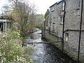
 A path leading to Saint Sunday's Beck - geograph.org.uk - 3127032.jpg 800 × 600; 341 KB
-
 Approaching Hood Ridding Farm - geograph.org.uk - 4531107.jpg 5,184 × 3,456; 5.66 MB
-
 Armistead wind farm - geograph.org.uk - 3322922.jpg 640 × 382; 103 KB
-
 B6254 about to pass under the M6 - geograph.org.uk - 2830862.jpg 640 × 495; 40 KB
-
 B6254 heading for Old Hutton - geograph.org.uk - 2830874.jpg 640 × 462; 79 KB
-
 B6254 in Old Hutton - geograph.org.uk - 4531295.jpg 5,184 × 3,456; 6.42 MB
-
 B6254 to Middleshaw - geograph.org.uk - 3928199.jpg 640 × 480; 102 KB
-
 Barkhouse Beck and Urchin Rigg - geograph.org.uk - 2335232.jpg 640 × 480; 94 KB
-
 Barkhouse Beck, Holmescales - geograph.org.uk - 3928143.jpg 640 × 480; 93 KB
-
 Barn near Beckside - geograph.org.uk - 2384105.jpg 640 × 480; 107 KB
-
 Beckside - geograph.org.uk - 6215482.jpg 6,000 × 4,000; 1.84 MB
-
 Before the party, Old Hutton - geograph.org.uk - 2384043.jpg 640 × 480; 121 KB
-

-
 Bendrigg Lodge - geograph.org.uk - 2346932.jpg 4,000 × 3,000; 4.69 MB
-
 Bendrigg Lodge Outdoor Centre - geograph.org.uk - 2346935.jpg 4,000 × 3,000; 3.75 MB
-
 Bleasegale Hill (214m) - geograph.org.uk - 2386982.jpg 800 × 600; 92 KB
-
 Bleasegale Hill - geograph.org.uk - 4581236.jpg 640 × 480; 44 KB
-
 Bleasegale Hill mast - geograph.org.uk - 1405590.jpg 640 × 425; 89 KB
-
 Bleasegale Hill Mast - geograph.org.uk - 3212667.jpg 3,562 × 2,250; 1.57 MB
-

-
 Bleasehall Wood - geograph.org.uk - 4531649.jpg 4,915 × 3,091; 6.7 MB
-
 Bleasgale Hill - geograph.org.uk - 6215510.jpg 3,950 × 5,011; 1.92 MB
-
 Brand new bridge, Saint Sunday's Beck - geograph.org.uk - 2384231.jpg 640 × 480; 177 KB
-
 Bridge over the B6254 - geograph.org.uk - 4531127.jpg 5,184 × 3,456; 6.05 MB
-
 Brunthwaite - geograph.org.uk - 956523.jpg 640 × 480; 90 KB
-
 Buttercup Field near Eskrigg End - geograph.org.uk - 4533698.jpg 5,184 × 3,456; 6.93 MB
-
 Country towards Gillsmere Sike - geograph.org.uk - 4534601.jpg 5,184 × 3,456; 7.16 MB
-
 Crosslands Farm - geograph.org.uk - 4531099.jpg 5,184 × 3,456; 5.88 MB
-
 Crosslands Farm - geograph.org.uk - 6215600.jpg 6,000 × 4,000; 1.61 MB
-
 Crosslands Tarn - geograph.org.uk - 2386962.jpg 800 × 600; 90 KB
-
 Crosslands Tarn - geograph.org.uk - 2830821.jpg 3,072 × 2,304; 1.33 MB
-
 Crosslands Tarn - geograph.org.uk - 3126956.jpg 800 × 600; 238 KB
-
 Crossroads, Hutton Gate - geograph.org.uk - 1589197.jpg 640 × 480; 62 KB
-
 Cul-de-Sac Bridleway - geograph.org.uk - 4581231.jpg 640 × 480; 133 KB
-
 Curious cows above Greenmoor Bank - geograph.org.uk - 2385908.jpg 640 × 480; 75 KB
-
 Dam and outflow from Killington Lake - geograph.org.uk - 2254392.jpg 640 × 480; 98 KB
-
 Damp woodland, Fellside Wood - geograph.org.uk - 956535.jpg 640 × 480; 179 KB
-

-
 Date stone, Crosslands Farm - geograph.org.uk - 2386107.jpg 581 × 640; 186 KB
-
 East Ridding - geograph.org.uk - 4531115.jpg 5,184 × 3,456; 6.39 MB
-
 Electricity Sub Station - geograph.org.uk - 142094.jpg 640 × 480; 98 KB
-
 Entering Old Hutton - geograph.org.uk - 3126975.jpg 800 × 600; 300 KB
-
 Eskrigg End - geograph.org.uk - 4533686.jpg 5,184 × 3,456; 5.3 MB
-
 Eskrigg Tarn from M6 southbound - geograph.org.uk - 2421768.jpg 640 × 480; 70 KB
-
 Farmland near Middleshaw - geograph.org.uk - 3590639.jpg 640 × 480; 339 KB
-
 Farmland near Old Hutton - geograph.org.uk - 3590623.jpg 640 × 480; 394 KB
-
 Farmland west of Middleshaw - geograph.org.uk - 3590700.jpg 640 × 527; 383 KB
-
 Felled area, Black Esset Plantation - geograph.org.uk - 956514.jpg 640 × 480; 112 KB
-
 Fields near Fall Beck - geograph.org.uk - 2410206.jpg 640 × 480; 85 KB
-
 Fields near Low Bleaze - geograph.org.uk - 2384137.jpg 800 × 600; 131 KB
-
 Fields North of Hood Ridding Farm - geograph.org.uk - 4531119.jpg 5,184 × 3,456; 7.36 MB
-
 Footbridge near Strickley - geograph.org.uk - 4266691.jpg 640 × 480; 135 KB
-
 Footpath between Low Bleaze and Bleasehall Wood - geograph.org.uk - 4531638.jpg 5,184 × 3,456; 6.79 MB
-
 Footpath in Bleasehall Wood - geograph.org.uk - 5351430.jpg 720 × 540; 221 KB
-
 Footpath near Great Eskrigg End - geograph.org.uk - 2385939.jpg 640 × 480; 201 KB
-
 Footpath near M6 - geograph.org.uk - 2254404.jpg 640 × 480; 74 KB
-
 Footpath to Beckside from Old Hutton - geograph.org.uk - 2384052.jpg 640 × 480; 108 KB
-
 Footpath to Hood Ridding Farm - geograph.org.uk - 4531280.jpg 5,184 × 3,456; 5.59 MB
-
 Footpath to Town Head - geograph.org.uk - 2254410.jpg 640 × 480; 58 KB
-
 Footpath to Town House - geograph.org.uk - 4533708.jpg 5,108 × 2,981; 6.11 MB
-
 Good looking pasture near Hood Riding Farm - geograph.org.uk - 2830797.jpg 3,072 × 2,304; 1.05 MB
-
 Grazing land near Crosslands Farm - geograph.org.uk - 3322919.jpg 640 × 352; 88 KB
-
 Great Brunthwaite - geograph.org.uk - 6215506.jpg 6,000 × 3,296; 1.9 MB
-
 Haweswater Aqueduct - geograph.org.uk - 6215576.jpg 6,000 × 3,666; 1.97 MB
-
 Hide Wood, Holmescales - geograph.org.uk - 956539.jpg 640 × 480; 106 KB
-
 Highgate Lane - geograph.org.uk - 2384222.jpg 640 × 480; 82 KB
-
 Hill Farm from M6 northbound - geograph.org.uk - 2410173.jpg 640 × 356; 60 KB
-
 Holmescales - geograph.org.uk - 3928129.jpg 640 × 480; 86 KB
-
 Holmescales - geograph.org.uk - 6215701.jpg 5,630 × 3,081; 1.54 MB
-
 Homescales - geograph.org.uk - 6215691.jpg 6,000 × 3,057; 1.91 MB
-
 Hood Ridding Farm - geograph.org.uk - 6215586.jpg 5,906 × 3,060; 1.87 MB
-
 Hutton Gate - geograph.org.uk - 956529.jpg 640 × 480; 135 KB
-
 Hutton Manor - geograph.org.uk - 6215578.jpg 5,999 × 3,510; 1.58 MB
-
 Killington Lake - geograph.org.uk - 3747350.jpg 3,264 × 2,448; 3.63 MB
-
 Killington Lake Services - geograph.org.uk - 2634504.jpg 3,872 × 2,592; 3.93 MB
-
 Killington Lake services - geograph.org.uk - 3453415.jpg 640 × 480; 67 KB
-
 Killington Reservoir from Killington Services - geograph.org.uk - 4108417.jpg 1,024 × 682; 126 KB
-
 Lambs nibbling the hedge at Old Hutton - geograph.org.uk - 2385946.jpg 640 × 480; 176 KB
-
 Lane at Crosslands Farm - geograph.org.uk - 4531103.jpg 5,184 × 3,456; 5.96 MB
-
 Lane near Essett Hill - geograph.org.uk - 4534590.jpg 5,184 × 3,456; 7.45 MB
-
 Lane to Ewebank - geograph.org.uk - 4533705.jpg 5,184 × 3,456; 6.02 MB
-
 Little Eskrigg End Farm - geograph.org.uk - 2385932.jpg 640 × 480; 81 KB
-
 Low Bendrigg - geograph.org.uk - 6215502.jpg 6,000 × 4,000; 2.02 MB
-
 Low Bleaze and Lowblease Hill - geograph.org.uk - 2384144.jpg 640 × 480; 70 KB
-
 M6 Brunthwaite - geograph.org.uk - 1589190.jpg 640 × 480; 46 KB
-
 M6 east of Old Hutton - geograph.org.uk - 3034294.jpg 640 × 480; 70 KB
-
 M6 Motorway - geograph.org.uk - 6215508.jpg 6,000 × 4,000; 1.48 MB
-
 M6 Motorway - geograph.org.uk - 6215580.jpg 5,069 × 2,687; 2.03 MB
-
 M6 motorway - geograph.org.uk - 6274282.jpg 1,280 × 850; 586 KB
-
 M6 Motorway, South of Killington - geograph.org.uk - 2944339.jpg 640 × 480; 375 KB
-
 M6 north of Reservoir Road Bridge - geograph.org.uk - 3034291.jpg 640 × 480; 87 KB
-
 M6 northbound - geograph.org.uk - 3504221.jpg 640 × 480; 55 KB
-
 M6 Northbound - geograph.org.uk - 3944304.jpg 640 × 480; 199 KB
-
 M6 northbound near Town House - geograph.org.uk - 3504213.jpg 640 × 481; 55 KB
-
 M6 Road bridge near old Hutton - geograph.org.uk - 1941818.jpg 640 × 480; 54 KB
-
 M6 west of Bleasegale Hill - geograph.org.uk - 3504190.jpg 640 × 480; 50 KB
-
 M6, Brunthwaite - geograph.org.uk - 956519.jpg 640 × 480; 70 KB
-
 Mast at Bleasegale Hill - geograph.org.uk - 1394205.jpg 640 × 425; 73 KB
-

-
 Minor road by turning for Activity Lodge - geograph.org.uk - 2830930.jpg 1,024 × 796; 296 KB
-
 Minor road passing Holmescales Farm - geograph.org.uk - 2830920.jpg 640 × 465; 55 KB
-
 New Hutton, Saint Sunday's Beck - geograph.org.uk - 2957562.jpg 1,024 × 768; 185 KB
-
 No Vehicular Access to Eskrigg End - geograph.org.uk - 4534581.jpg 5,184 × 3,456; 6 MB
-
 Northbound M6 near Killington - geograph.org.uk - 3944323.jpg 640 × 480; 250 KB
-
 Northbound M6, Old Hutton - geograph.org.uk - 3944317.jpg 640 × 480; 263 KB
-
 Oak Wood - geograph.org.uk - 6215503.jpg 6,000 × 4,000; 1.81 MB
-
-

-
 Old Hutton - geograph.org.uk - 4531287.jpg 5,184 × 3,456; 6.48 MB
-
 Old Hutton sub-station - geograph.org.uk - 6274920.jpg 1,280 × 720; 467 KB
-
 Old Hutton, parish church - geograph.org.uk - 2957596.jpg 1,024 × 768; 150 KB
-
 Old Hutton, sheep grazing - geograph.org.uk - 2957656.jpg 1,024 × 768; 140 KB
-
 Old hydro structure, Beckside^ - geograph.org.uk - 2384089.jpg 640 × 480; 201 KB
-
 Overgrown leat, Peasey Beck waterfall - geograph.org.uk - 2384070.jpg 480 × 640; 235 KB
-
 Overlooking Killington Lake - geograph.org.uk - 2634513.jpg 3,872 × 2,592; 4.03 MB
-
 Pasture near Highgate Lane - geograph.org.uk - 2384180.jpg 640 × 480; 107 KB
-
 Pasture near Hood Ridding Farm - geograph.org.uk - 2385961.jpg 640 × 480; 80 KB
-

-
-
 Peasey beck, Hutton Bridge - geograph.org.uk - 3928320.jpg 640 × 480; 126 KB
-
 Peasey beck, Hutton Bridge - geograph.org.uk - 3928328.jpg 640 × 480; 154 KB
-
 Polythene strips by Popplemire Lane - geograph.org.uk - 2384130.jpg 640 × 480; 93 KB
-
 Public Footpath leading to Blaystone Bridge - geograph.org.uk - 4531306.jpg 5,184 × 3,456; 6.08 MB
-
 Reservoir Road - geograph.org.uk - 2954246.jpg 640 × 480; 75 KB
-

-
 Road Bridge over M6 near Old Hutton - geograph.org.uk - 4032599.jpg 640 × 480; 223 KB
-
 Road to Bridge End, Old Hutton - geograph.org.uk - 3928099.jpg 640 × 480; 110 KB
-
 Rough pasture below Lowblease Hill - geograph.org.uk - 5351435.jpg 720 × 540; 77 KB
-
 Saint Sunday's Beck - geograph.org.uk - 3928194.jpg 640 × 480; 120 KB
-
 Sheep above Killington Reservoir - geograph.org.uk - 2954190.jpg 800 × 600; 135 KB
-
 Sheep and lambs relaxing, Old Hutton - geograph.org.uk - 2385948.jpg 640 × 480; 129 KB
-
 Sheep on Summerhouse Hill - geograph.org.uk - 2955924.jpg 800 × 600; 131 KB
-
 Sheep pasture above Killington Reservoir - geograph.org.uk - 2954647.jpg 800 × 600; 135 KB
-
 Sheep pasture near Low Bendrigg - geograph.org.uk - 2954260.jpg 640 × 480; 83 KB
-

-
 South Lakeland , Countryside Scenery - geograph.org.uk - 5019876.jpg 6,000 × 4,000; 7.89 MB
-
 South Lakeland , Countryside Scenery - geograph.org.uk - 5019878.jpg 6,000 × 4,000; 7.7 MB
-
 South Lakeland , Countryside Scenery - geograph.org.uk - 5019884.jpg 5,598 × 3,732; 5.47 MB
-
 South Lakeland , Countryside Scenery - geograph.org.uk - 5019886.jpg 6,000 × 4,000; 6.72 MB
-
 South Lakeland , Countryside Scenery ^ Pylons - geograph.org.uk - 5019862.jpg 6,000 × 4,000; 5.11 MB
-
 South Lakeland , The M6 Motorway - geograph.org.uk - 5019853.jpg 6,000 × 4,000; 5.27 MB
-
 South Lakeland , The M6 Motorway - geograph.org.uk - 5019858.jpg 6,000 × 4,000; 5.39 MB
-
 South Lakeland , The M6 Motorway - geograph.org.uk - 5019891.jpg 6,000 × 4,000; 4.96 MB
-
-
 Southbound M6 near Old Hutton - geograph.org.uk - 4032596.jpg 640 × 480; 241 KB
-
 Southbound M6 near Town House - geograph.org.uk - 4032590.jpg 640 × 480; 208 KB
-
 St John the Baptist, Old Hutton - geograph.org.uk - 3127023.jpg 800 × 600; 245 KB
-
 St. John the Baptist Church, Old Hutton - geograph.org.uk - 4531300.jpg 4,720 × 3,410; 4.87 MB
-

-
 Sunnyside, Old Hutton - geograph.org.uk - 3928092.jpg 640 × 480; 88 KB
-
 Syphon Well - geograph.org.uk - 4266696.jpg 640 × 480; 103 KB
-
 Syphon well near Bleasehall Wood - geograph.org.uk - 5351434.jpg 720 × 540; 96 KB
-
 Telecoms Mast, Breasegale Hill - geograph.org.uk - 2830740.jpg 2,304 × 3,072; 1.51 MB
-
-
 The dam for Killington Reservoir - geograph.org.uk - 5288882.jpg 4,335 × 2,885; 7.88 MB
-

-

-
 The terrace of Killington Lake Services - geograph.org.uk - 2634525.jpg 3,872 × 2,592; 4.72 MB
-
 The track to Eskrigg End - geograph.org.uk - 2385921.jpg 640 × 480; 154 KB
-
 The track to Hood Ridding Farm - geograph.org.uk - 2385955.jpg 640 × 480; 94 KB
-
 Town House - geograph.org.uk - 6215574.jpg 4,000 × 5,104; 1.92 MB
-
 Town House and horse - geograph.org.uk - 2385914.jpg 640 × 480; 126 KB
-
 View North West from Low Bleaze - geograph.org.uk - 4531620.jpg 5,184 × 3,456; 7.08 MB
-
 Viewpoint at Killington Lake Services - geograph.org.uk - 5403991.jpg 640 × 480; 301 KB
-
 Wall and Bluebells - geograph.org.uk - 170855.jpg 480 × 640; 102 KB
-
 Wall near Holmescales - geograph.org.uk - 2335225.jpg 640 × 480; 81 KB
-

-
 Brunthwaite - geograph.org.uk - 142096.jpg 640 × 480; 83 KB
-
 Trees - geograph.org.uk - 115852.jpg 640 × 480; 155 KB


_-_geograph.org.uk_-_2386982.jpg)


