Category:October 2006 in Cumbria
Jump to navigation
Jump to search
Deutsch: Bilder, die im Oktober 2006 in Cumbria aufgenommen worden sind. Bitte beachten Sie, dass dies weder das Datum des Uploads noch das Datum des Scannens eines Fotos ist.
English: Images/pictures taken in Cumbria during October 2006. Note this is not the date of the upload, nor the date a photo was scanned.
Español: Fotografías o imágenes tomadas en Cumbria durante octubre 2006. No es la fecha de subida ni escaneo, sino la fecha en que las fotografías o imágenes se crearon.
Esperanto: Bildoj faritaj en Cumbria en oktobro 2006. Tio ne estas la dato, kiam la bildoj estis alŝutitaj aŭ skanitaj.
Français : Photographies ou images prises en Cumbria durant octobre 2006. Ce n'est pas la date du téléchargement ou du scan.
Galego: Fotografías ou imaxes tomadas en Cumbria durante outubro 2006. Non é a data de subida nin escaneamento, senón a data na que se crearon as fotografías ou imaxes.
Italiano: Fotografie o immagini scattate a Cumbria nel ottobre 2006. Nota bene: la data non si riferisce né a quella di upload né a quella in cui la foto è stata digitalizzata.
Norsk bokmål: Bilder tatt i Cumbria i løpet av oktober 2006. Merk at dette ikke er datoen for opplasting, eller når et bilde har blitt skannet.
Norsk nynorsk: Bilete teke i Cumbria i løpet av oktober 2006. Merk at dette ikkje er datoen for opplasting, eller når eit bilete har vorte skanna.
Русский: Изображения, сделанные в Cumbria в течение октябрь 2006 (не дата загрузки изображения).
Українська: Зображення, зроблені в Cumbria протягом жовтень 2006. Зауважте, що це не дата завантаження чи дата сканування фотографії.
| October 2005 | ← | October 2006 | → | October 2007 | |||||||
| Jan | Feb | Mar | Apr | May | Jun | Jul | Aug | Sep | Oct | Nov | Dec |
| 69 | 78 | 49 | 40 | 44 | 41 | 48 | 26 | 39 | 40 | 43 | 16 |
|---|---|---|---|---|---|---|---|---|---|---|---|
Media in category "October 2006 in Cumbria"
The following 40 files are in this category, out of 40 total.
-
 Walney Bridge and Channel - geograph.org.uk - 485013.jpg 640 × 399; 67 KB
-
 Autumn on Rydal Water - geograph.org.uk - 266937.jpg 640 × 480; 128 KB
-
 A591, Grasmere to Keswick - geograph.org.uk - 403143.jpg 640 × 405; 55 KB
-
 Brand new - geograph.org.uk - 269479.jpg 640 × 480; 214 KB
-
 Bridge over Croglin Water. - geograph.org.uk - 261782.jpg 480 × 640; 135 KB
-
 Calf Crag from Greenup Edge - geograph.org.uk - 270469.jpg 640 × 480; 103 KB
-
 Crummock Water and Grasmoor - geograph.org.uk - 1557755.jpg 640 × 480; 56 KB
-
 Deadman Gill Bridge - geograph.org.uk - 269459.jpg 640 × 480; 234 KB
-
 Dry Stone Dykes - geograph.org.uk - 261731.jpg 640 × 480; 88 KB
-
 Fence, Crag Hill - geograph.org.uk - 262848.jpg 480 × 640; 138 KB
-
 Footbridge over Maize Beck - geograph.org.uk - 289702.jpg 640 × 480; 82 KB
-
 Glenridding Pier - geograph.org.uk - 259939.jpg 640 × 478; 89 KB
-
 Hillock Whins Scar, South Walney - geograph.org.uk - 256921.jpg 640 × 480; 139 KB
-
 Langwathby Post Office and Stores - geograph.org.uk - 259494.jpg 640 × 480; 101 KB
-
 Looking towards Hilpsford Point - geograph.org.uk - 271150.jpg 640 × 480; 118 KB
-
 Old Wall Straighthead Gill - geograph.org.uk - 260875.jpg 640 × 480; 121 KB
-
 Orton - geograph.org.uk - 270511.jpg 640 × 480; 62 KB
-
 Ponies grazing - geograph.org.uk - 254383.jpg 640 × 478; 79 KB
-
 Pooley Bridge, Barton - geograph.org.uk - 279442.jpg 640 × 480; 137 KB
-
 Red Deer stag above Greenup Edge - geograph.org.uk - 270468.jpg 640 × 480; 56 KB
-
 River Eden near Kirkandrews - geograph.org.uk - 269432.jpg 640 × 480; 134 KB
-
 Scroggs Bridge - geograph.org.uk - 257545.jpg 640 × 480; 107 KB
-
 Seathwaite from seathwaite fell - geograph.org.uk - 311695.jpg 640 × 480; 63 KB
-
 Sheepfold at the side of Deadman Gill - geograph.org.uk - 269457.jpg 640 × 480; 237 KB
-
 Speed restriction sign - geograph.org.uk - 260950.jpg 640 × 479; 119 KB
-
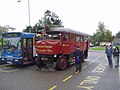 Stagecoach in Cumbria bus 30455 and the Lake District Steam Bus Co bus "Martha".jpg 2,048 × 1,536; 724 KB
-
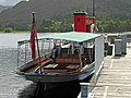
 Taking a break from swashbuckling (geograph 2820379).jpg 640 × 480; 289 KB
-

-
 The southern end of Burrells village - geograph.org.uk - 1021945.jpg 640 × 480; 42 KB
-
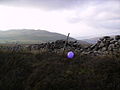 Wall and Balloon - geograph.org.uk - 262841.jpg 640 × 480; 71 KB
-
 Wall near Little Meg, Little Salkeld - geograph.org.uk - 280360.jpg 640 × 480; 161 KB
-
 Wythburn valley from Greenup Edge - geograph.org.uk - 270471.jpg 640 × 480; 106 KB
-
 Cattle near Knock Cross - geograph.org.uk - 258804.jpg 640 × 480; 80 KB
-
 Long Rein Point, South Walney - geograph.org.uk - 267118.jpg 640 × 480; 79 KB
-

-
 River Liza, Ennerdale - geograph.org.uk - 270093.jpg 640 × 480; 152 KB
-
 The B6277 - geograph.org.uk - 273428.jpg 640 × 480; 144 KB
-
 Tip of Ridding Head Scar - geograph.org.uk - 267139.jpg 640 × 480; 76 KB
-
 Topograph on Nine Standards Rigg - geograph.org.uk - 261164.jpg 640 × 480; 106 KB
-
 View from Whincop Bridge - geograph.org.uk - 266149.jpg 640 × 480; 241 KB


.jpg)


