Category:Oare, Kent
Jump to navigation
Jump to search
village and civil parish in Kent, UK  | |||||
| Upload media | |||||
| Instance of | |||||
|---|---|---|---|---|---|
| Location | Swale, Kent, South East England, England | ||||
 | |||||
Subcategories
This category has the following 6 subcategories, out of 6 total.
Media in category "Oare, Kent"
The following 200 files are in this category, out of 469 total.
(previous page) (next page)-
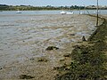
 'Calico Jack' heading into the Swale - geograph.org.uk - 4479159.jpg 1,024 × 784; 80 KB
-

-

-

-
 Mark Smith (musician).jpg 650 × 797; 462 KB
-
 A barge coming in from The Swale - geograph.org.uk - 1354007.jpg 640 × 461; 53 KB
-

-
 A barge yacht entering Oare Creek - geograph.org.uk - 3079884.jpg 1,024 × 753; 89 KB
-
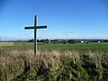 A cross in the fields - geograph.org.uk - 4230393.jpg 4,000 × 3,000; 4.2 MB
-

-
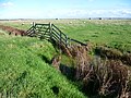
 A footbridge in the Ham Marshes - geograph.org.uk - 1268856.jpg 640 × 480; 123 KB
-

-
 A marshy field - geograph.org.uk - 3117314.jpg 640 × 430; 87 KB
-
 A scattering of trees - geograph.org.uk - 3042269.jpg 640 × 385; 57 KB
-

-
 Abandoned boat on Faversham Creek - geograph.org.uk - 4230498.jpg 4,000 × 3,000; 4.11 MB
-
 Abandoned boats on Faversham Creek - geograph.org.uk - 4230481.jpg 4,000 × 3,000; 3.88 MB
-
 Abandoned boats on Faversham Creek - geograph.org.uk - 4230486.jpg 4,000 × 3,000; 4.16 MB
-

-
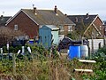 Allotments, Colegates Road, Oare - geograph.org.uk - 5634167.jpg 640 × 480; 106 KB
-
 Alongside the slipway to the old Harty Ferry - geograph.org.uk - 4593169.jpg 4,000 × 3,000; 4.03 MB
-
 Alongside the slipway to the old Harty Ferry - geograph.org.uk - 4593175.jpg 4,000 × 3,000; 4.37 MB
-
 Apple blossom in Bysing Wood - geograph.org.uk - 1261737.jpg 640 × 480; 172 KB
-
 At anchor in the Swale - geograph.org.uk - 3079532.jpg 1,024 × 744; 85 KB
-
 Barges anchored near Harty Ferry - geograph.org.uk - 4101568.jpg 640 × 480; 37 KB
-
 Base of a building, Oare Marshes - geograph.org.uk - 3097875.jpg 640 × 430; 71 KB
-
 Beached Boats on Faversham Creek - geograph.org.uk - 421145.jpg 640 × 480; 103 KB
-
 Behind the sea wall at Uplees Marshes - geograph.org.uk - 4230373.jpg 4,000 × 3,000; 3.96 MB
-
 Bird Hide, Oare Marshes NNR - geograph.org.uk - 3103169.jpg 640 × 430; 64 KB
-
 Boat in mud, Harty Ferry - geograph.org.uk - 3279129.jpg 4,288 × 3,216; 4.06 MB
-
 Boat on The Swale - geograph.org.uk - 3095291.jpg 640 × 430; 68 KB
-
 Boat on The Swale - geograph.org.uk - 3097843.jpg 640 × 430; 53 KB
-
 Boat wreckage on Oare Creek - geograph.org.uk - 5944452.jpg 640 × 449; 53 KB
-
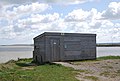
 Boathouse, Hollowshore - geograph.org.uk - 3108056.jpg 640 × 430; 61 KB
-
 Boats at Hollowshore - geograph.org.uk - 4228433.jpg 4,000 × 3,000; 4 MB
-
 Boats on Faversham Creek - geograph.org.uk - 399840.jpg 640 × 485; 66 KB
-
 Boats on the Swale near Harty Ferry - geograph.org.uk - 4101584.jpg 640 × 480; 36 KB
-
 Boats on The Swale, near Harty Ferry - geograph.org.uk - 4101574.jpg 640 × 479; 34 KB
-
 Brett House - geograph.org.uk - 1621727.jpg 640 × 427; 72 KB
-
 Byway across Uplees Marshes - geograph.org.uk - 3095324.jpg 640 × 430; 73 KB
-
 Byway leading towards Uplees - geograph.org.uk - 4490481.jpg 2,272 × 1,704; 762 KB
-
 Car Park, Oare Marshes NNR - geograph.org.uk - 3103050.jpg 640 × 430; 77 KB
-
 Cattle on the edge of Oare - geograph.org.uk - 3117297.jpg 640 × 430; 68 KB
-
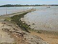
 Causeway at Harty Ferry - geograph.org.uk - 998447.jpg 640 × 480; 59 KB
-

-
 Causeway to disused jetty, Uplees - geograph.org.uk - 4490228.jpg 2,272 × 1,704; 1,023 KB
-
 Church of St Peter, Oare - geograph.org.uk - 3114120.jpg 640 × 430; 68 KB
-
 Church Road, Oare - geograph.org.uk - 3292132.jpg 979 × 734; 140 KB
-
 Church Road, Oare - geograph.org.uk - 3678078.jpg 3,488 × 2,616; 2.23 MB
-
 Church Road, Oare near Faversham - geograph.org.uk - 3718471.jpg 640 × 360; 78 KB
-
 Church Road, Oare near Faversham - geograph.org.uk - 3718484.jpg 640 × 360; 45 KB
-
 Church Road, Oare near Faversham - geograph.org.uk - 3718505.jpg 640 × 360; 53 KB
-
 Coastal embankment E of Luddenham Gut - at very high tide - geograph.org.uk - 6337468.jpg 5,184 × 2,920; 5.64 MB
-
 Coastal embankment E of Luddenham Gut - at very high tide - geograph.org.uk - 6337469.jpg 5,184 × 2,920; 5.17 MB
-
 Colegates Close, Oare - geograph.org.uk - 4490524.jpg 2,272 × 1,704; 748 KB
-
 Colegates Road, near Oare - geograph.org.uk - 4490532.jpg 2,272 × 1,704; 798 KB
-
 Colegates Road, near Oare - geograph.org.uk - 4490544.jpg 2,272 × 1,704; 944 KB
-
 Colegates Road, Oare - geograph.org.uk - 4490528.jpg 2,272 × 1,704; 828 KB
-
 Colegates Road, Oare - geograph.org.uk - 5634187.jpg 640 × 480; 104 KB
-
 Colgates Road, Oare - geograph.org.uk - 5634163.jpg 640 × 480; 100 KB
-

-
 Collection of farm buildings - geograph.org.uk - 3290798.jpg 979 × 734; 179 KB
-
 Concrete base on Oare Marsh - geograph.org.uk - 400111.jpg 640 × 480; 111 KB
-
 Country lanes near Faversham - geograph.org.uk - 3718526.jpg 640 × 360; 60 KB
-
 Court Lodge Farmhouse, Oare - geograph.org.uk - 3048024.jpg 640 × 480; 121 KB
-
 Creek and marshes - geograph.org.uk - 3097851.jpg 640 × 409; 51 KB
-
 Creek and marshes, The Swale - geograph.org.uk - 3097854.jpg 640 × 430; 60 KB
-
 Crossroads at Oare - geograph.org.uk - 5634190.jpg 640 × 480; 85 KB
-
 Dan's Dock - geograph.org.uk - 1268791.jpg 640 × 360; 75 KB
-
 Dans Dock, Uplees - geograph.org.uk - 4490476.jpg 2,272 × 1,704; 877 KB
-
 Derelict building - geograph.org.uk - 4148791.jpg 1,142 × 856; 200 KB
-
 Disused Dock, Uplees - geograph.org.uk - 4490240.jpg 2,272 × 1,704; 966 KB
-
 Disused dock, Uplees Marshes - geograph.org.uk - 3013326.jpg 640 × 427; 95 KB
-
 Disused Jetty - geograph.org.uk - 3095327.jpg 640 × 430; 73 KB
-
 Disused wharf, Uplees Marshes - geograph.org.uk - 3095319.jpg 640 × 430; 89 KB
-

-
 Ditch to the north of Oare Creek - geograph.org.uk - 2213361.jpg 640 × 480; 109 KB
-
 Ditch, Oare Marshes NNR - geograph.org.uk - 3105554.jpg 640 × 430; 69 KB
-
 Ditch, Oare Marshes NNR - geograph.org.uk - 3105561.jpg 640 × 430; 79 KB
-
 Ditch, Oare Marshes NNR - geograph.org.uk - 3105566.jpg 640 × 430; 63 KB
-
 Ditch, Teynham Marshes - geograph.org.uk - 3042259.jpg 640 × 430; 63 KB
-
 Drainage channel next to the Saxon Shore Way - geograph.org.uk - 4230493.jpg 4,000 × 3,000; 4.34 MB
-
 Drainage channel on Uplees Marshes - geograph.org.uk - 4230377.jpg 4,000 × 3,000; 4.4 MB
-
 Drainage ditch behind the seawall - geograph.org.uk - 3042254.jpg 640 × 396; 55 KB
-
 Drainage ditch below Norman's Hill - geograph.org.uk - 3108080.jpg 640 × 430; 69 KB
-
 Drainage ditch, Oare Marshes - geograph.org.uk - 3095352.jpg 640 × 382; 61 KB
-
 Drainage ditch, Oare NNR - geograph.org.uk - 3097816.jpg 640 × 430; 68 KB
-
 Drainage ditch, Oare NNR - geograph.org.uk - 3097879.jpg 640 × 430; 65 KB
-
 Drainage ditch, Teynham Levels - geograph.org.uk - 3040441.jpg 640 × 430; 71 KB
-
 Drainage ditch, Teynham Levels - geograph.org.uk - 3042267.jpg 640 × 430; 62 KB
-
 Drainage Ditch, Uplees Marshes - geograph.org.uk - 3095303.jpg 640 × 396; 74 KB
-
 Drainage on Uplees Marshes - geograph.org.uk - 4230375.jpg 4,000 × 3,000; 4.14 MB
-
 Dyke in Uplees Marsh - geograph.org.uk - 1268802.jpg 640 × 480; 115 KB
-
 Electricity pylon in Oare, Kent - July 2013.jpg 768 × 1,024; 166 KB
-
 Entering Oare from the northwest - geograph.org.uk - 4150003.jpg 1,109 × 831; 211 KB
-
 Evening sunlight on The Swale - geograph.org.uk - 1899577.jpg 1,280 × 960; 540 KB
-
 Evening sunlight on The Swale - geograph.org.uk - 6191718.jpg 4,000 × 3,000; 5.01 MB
-
 Faversham Creek - geograph.org.uk - 4344585.jpg 640 × 480; 64 KB
-
 Faversham Creek and Oare Creek - geograph.org.uk - 3108090.jpg 640 × 430; 55 KB
-
 Faversham viewed from Oare.jpg 4,780 × 3,422; 6.57 MB
-
 Fishermans Yard, Oare - geograph.org.uk - 1417143.jpg 640 × 467; 67 KB
-
 Fishing boat in The Swale - geograph.org.uk - 5705966.jpg 480 × 640; 55 KB
-

-
 Fishing smack in the Swale (1) - geograph.org.uk - 3080262.jpg 1,024 × 758; 60 KB
-
 Fishing smack in the Swale (2) - geograph.org.uk - 3080314.jpg 877 × 1,024; 87 KB
-
 Flood embankment - geograph.org.uk - 3113086.jpg 640 × 430; 84 KB
-
 Footbridge by Oare Creek - geograph.org.uk - 624483.jpg 640 × 480; 76 KB
-
 Footbridge, Saxon Shore Way - geograph.org.uk - 3105553.jpg 640 × 430; 83 KB
-

-
 Footpath at Oare - geograph.org.uk - 5705940.jpg 640 × 480; 103 KB
-
 Footpath from Uplees Road to Uplees Road - geograph.org.uk - 4230389.jpg 4,000 × 3,000; 3.95 MB
-
 Footpath on Colegates Road, Oare - geograph.org.uk - 1082684.jpg 640 × 481; 53 KB
-
 Footpath on Uplees Road, Oare - geograph.org.uk - 1082678.jpg 481 × 640; 67 KB
-
 Footpath to Uplees Road - geograph.org.uk - 4228409.jpg 4,000 × 3,000; 4 MB
-
 Footprints in the mud at Oare Creek - geograph.org.uk - 2767247.jpg 480 × 640; 49 KB
-

-
 Freshwater lagoon, Oare Marshes - geograph.org.uk - 1601817.jpg 640 × 480; 48 KB
-

-

-
 Frosty morning at Oare Creek - geograph.org.uk - 2767306.jpg 640 × 480; 95 KB
-
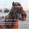 Frozen donkey, Uplees Farm near Faversham - geograph.org.uk - 5263442.jpg 2,543 × 2,543; 851 KB
-
 Frozen fields, dog walker - geograph.org.uk - 5263435.jpg 1,806 × 2,660; 727 KB
-
 Frozen pond, Uplees Rd, Faversham - geograph.org.uk - 5263455.jpg 5,472 × 3,648; 2.89 MB
-
 Frozen sheep, Uplees near Faversham - geograph.org.uk - 5263449.jpg 2,725 × 1,816; 894 KB
-
 Gate and footpath at Oare - geograph.org.uk - 3884249.jpg 480 × 640; 72 KB
-

-
 Gate on the Saxon Shore Way - geograph.org.uk - 3095241.jpg 640 × 430; 74 KB
-
 Golden Plover re-settling - geograph.org.uk - 1601785.jpg 640 × 492; 137 KB
-
 Gravel pits, Oare - geograph.org.uk - 399511.jpg 640 × 486; 79 KB
-

-
 Harty Ferry Cottages - geograph.org.uk - 3105549.jpg 640 × 430; 65 KB
-
 Harty Ferry Cottages - geograph.org.uk - 4490434.jpg 2,272 × 1,704; 716 KB
-
 Harty Ferry Cottages, Oare - geograph.org.uk - 3718495.jpg 640 × 360; 55 KB
-
 Harty Ferry Jetty - geograph.org.uk - 3103044.jpg 640 × 430; 65 KB
-
 Harty Ferry slipway (South) - geograph.org.uk - 2769192.jpg 640 × 480; 318 KB
-
 Harty Ferry Slipway - geograph.org.uk - 4490292.jpg 2,272 × 1,704; 796 KB
-
 Harty Ferry Slipway - geograph.org.uk - 4490297.jpg 2,272 × 1,704; 856 KB
-
 Harty Ferry Slipway - geograph.org.uk - 4490300.jpg 2,272 × 1,704; 793 KB
-
 Harty Ferry slipway, Oare Marshes - geograph.org.uk - 4479532.jpg 1,024 × 764; 134 KB
-
 Harty Ferry slipway, Oare Marshes, at low tide - geograph.org.uk - 4479598.jpg 1,024 × 750; 134 KB
-
 Hide by the Mouth of Faversham Creek - geograph.org.uk - 3320953.jpg 640 × 426; 47 KB
-
 High Tide disguising the slipway - geograph.org.uk - 1601794.jpg 480 × 640; 62 KB
-
 Highland bull at Oare - geograph.org.uk - 5705956.jpg 640 × 472; 72 KB
-
 Highland bull at Oare - geograph.org.uk - 5705961.jpg 640 × 457; 80 KB
-
 Highland cattle at Oare - geograph.org.uk - 3884229.jpg 640 × 480; 47 KB
-
 Highland cattle at Oare - geograph.org.uk - 5705969.jpg 640 × 431; 74 KB
-
 Houses at Oare - geograph.org.uk - 4230397.jpg 4,000 × 3,000; 3.89 MB
-
 Houses in Oare - geograph.org.uk - 3117306.jpg 640 × 430; 96 KB
-
 Houses on Church Rd - geograph.org.uk - 3117277.jpg 640 × 430; 61 KB
-
 Houses on the old coastline - geograph.org.uk - 3114118.jpg 640 × 430; 54 KB
-
 Houses on the old coastline - geograph.org.uk - 3117280.jpg 640 × 430; 53 KB
-
 Houses on The Street, Oare - geograph.org.uk - 4228421.jpg 4,000 × 3,000; 4.09 MB
-
 Housing on the edge of Oare - geograph.org.uk - 3114116.jpg 640 × 430; 58 KB
-
 In the mud, Oare Creek - geograph.org.uk - 3113061.jpg 640 × 430; 91 KB
-
 Incoming tide, Oare Creek - geograph.org.uk - 5944483.jpg 640 × 480; 54 KB
-
 Inside East Hide at Oare - geograph.org.uk - 3884238.jpg 480 × 640; 83 KB
-
 Junction of Bysing Wood Road - geograph.org.uk - 1450639.jpg 640 × 427; 87 KB
-

-
 Kissing gate, Oare - geograph.org.uk - 3117298.jpg 640 × 430; 81 KB
-
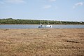
 Konig ponies in Oare Nature Reserve - geograph.org.uk - 1268731.jpg 640 × 480; 75 KB
-
 Konik ponies at Oare - geograph.org.uk - 5705974.jpg 640 × 479; 68 KB
-
 Konik ponies at Oare - geograph.org.uk - 5705977.jpg 640 × 458; 67 KB
-
 Konik ponies at Oare - geograph.org.uk - 5705980.jpg 480 × 640; 86 KB
-
 Lagoon, Oare Marshes NNR - geograph.org.uk - 3105539.jpg 640 × 430; 71 KB
-
 Lagoon, Oare Marshes NNR - geograph.org.uk - 3105541.jpg 640 × 430; 71 KB
-
 Lagoon, Oare Marshes NNR - geograph.org.uk - 3105544.jpg 640 × 430; 62 KB
-
 Lagoon, Oare Marshes NNR - geograph.org.uk - 3105547.jpg 640 × 430; 74 KB
-
 Lake, Oare Marshes - geograph.org.uk - 3103091.jpg 640 × 430; 78 KB
-
 Lake, Oare Marshes - geograph.org.uk - 3103157.jpg 640 × 430; 59 KB
-
 Lane leading from Oare towards Harty Ferry - geograph.org.uk - 4490443.jpg 2,272 × 1,704; 901 KB
-
 Large dyke beside sea wall - geograph.org.uk - 1268773.jpg 640 × 480; 66 KB
-

-

-
 Looking across Uplees Marshes - geograph.org.uk - 4228407.jpg 4,000 × 3,000; 4.15 MB
-
 Looking back up the slipway to Harty Ferry - geograph.org.uk - 1882840.jpg 1,280 × 960; 641 KB
-
 Looking back up the slipway to Harty Ferry - geograph.org.uk - 6191732.jpg 4,000 × 3,000; 4.52 MB
-
 Looking north from Oare Creek - geograph.org.uk - 3013335.jpg 640 × 427; 60 KB
-
 Looking north-northwest from Church Road - geograph.org.uk - 4150010.jpg 1,142 × 856; 197 KB
-
 Looking northwest along Uplees Road - geograph.org.uk - 4148741.jpg 1,207 × 905; 190 KB
-
 Low tide at the former Harty Ferry - geograph.org.uk - 1882833.jpg 1,280 × 960; 618 KB
-
 Low tide, The Swale - geograph.org.uk - 3103148.jpg 640 × 430; 54 KB
-
 Lowtide on Swale Strait - geograph.org.uk - 1268739.jpg 640 × 480; 70 KB
-
 Luddenham Marshes - geograph.org.uk - 4490214.jpg 2,272 × 1,704; 816 KB
-
 Marsh Toad in Dan's Dock - geograph.org.uk - 1268797.jpg 640 × 480; 122 KB
-
 Marshes by Oare Creek - geograph.org.uk - 3108059.jpg 640 × 430; 55 KB
-
 Marshes by Oare Creek - geograph.org.uk - 3108064.jpg 640 × 430; 63 KB
-
 Marshes by The Swale - geograph.org.uk - 3097863.jpg 640 × 430; 88 KB
-
 Marshy pond - geograph.org.uk - 3113058.jpg 640 × 430; 83 KB
-
 Meandering Dyke in Uplees Marshes - geograph.org.uk - 1268756.jpg 640 × 480; 96 KB
-

-
 Mill House, Oare Road - geograph.org.uk - 962440.jpg 640 × 480; 105 KB
-
 Moorings at Oare Creek - geograph.org.uk - 5944510.jpg 640 × 480; 65 KB
-
 Mouth of Faversham Creek - geograph.org.uk - 96198.jpg 640 × 427; 69 KB
-
 Mud flats, The Swale - geograph.org.uk - 3103111.jpg 640 × 430; 53 KB
-
 Mud, Oare Creek - geograph.org.uk - 3117266.jpg 640 × 430; 60 KB
-
 Mud, The Swale - geograph.org.uk - 3042262.jpg 640 × 430; 49 KB
-
 Mudflat, The Swale - geograph.org.uk - 3042265.jpg 640 × 430; 45 KB
-
 Mudflats at Harty Ferry - geograph.org.uk - 421050.jpg 640 × 480; 87 KB
-
 National Cycle Network milepost, Oare - geograph.org.uk - 5634194.jpg 457 × 640; 104 KB
-
 No entry. Gate on Oare Marshes - geograph.org.uk - 3884192.jpg 640 × 462; 46 KB


.jpg)


_-_geograph.org.uk_-_3080262.jpg)
_-_geograph.org.uk_-_3080314.jpg)


_-_geograph.org.uk_-_2769192.jpg)


