Category:OLGA-Park
Jump to navigation
Jump to search
| Object location | | View all coordinates using: OpenStreetMap |
|---|
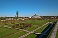
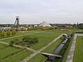
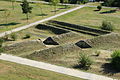
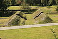
Deutsch: Das Gelände der ehemaligen Zeche Osterfeld (Schacht 1, 2, 3 und angeschlossene Kokerei) wurde 1999 im Rahmen einer Landesgartenausstellung zu einem Park umgestaltet.
 | |||||
| Upload media | |||||
| Instance of | |||||
|---|---|---|---|---|---|
| Location | Oberhausen, Düsseldorf Government Region, North Rhine-Westphalia, Germany | ||||
| Point in time |
| ||||
| Date of official opening |
| ||||
| Date of official closure |
| ||||
| Follows | |||||
| Followed by |
| ||||
 | |||||
Subcategories
This category has the following 5 subcategories, out of 5 total.
A
B
- Bahnhof Oberhausen Dom (1 F)
F
- Fußgängerbrücke OLGA-Park (7 F)
G
- Gartendom OLGA-Park (16 F)
M
- Monsterburg im OLGA-Park (4 F)
Media in category "OLGA-Park"
The following 98 files are in this category, out of 98 total.
-
 5B Gasometer Olgapark Ruhrstadt Oberhausen.jpg 2,551 × 1,928; 3.75 MB
-
 LG Olga1.jpg 1,000 × 667; 116 KB
-
 NRW, Oberhausen - OLGA-park 01.jpg 3,264 × 2,448; 4.42 MB
-
 Oberhausen + OLGA-Park (Gasometer) 01 ies.jpg 5,616 × 3,744; 14.63 MB
-
 Oberhausen + OLGA-Park (Gasometer) 02 ies.jpg 15,000 × 3,500; 39.17 MB
-
 Oberhausen + OLGA-Park (Gasometer) 03 ies.jpg 5,616 × 3,744; 13.55 MB
-
 Oberhausen + OLGA-Park + Halde Haniel (Gasometer) 01 ies.jpg 5,616 × 3,744; 18.25 MB
-
 Oberhausen + OLGA-Park + Halde Haniel (Gasometer) 02 ies.jpg 5,500 × 9,000; 30.8 MB
-
 Oberhausen - Bottroper Straße - Fußgängerbrücke OLGA-Park+OLGA-Park 01 ies.jpg 5,616 × 3,744; 12.29 MB
-
 Oberhausen - Bottroper Straße - Fußgängerbrücke OLGA-Park+OLGA-Park 02 ies.jpg 3,744 × 5,616; 9.44 MB
-
 Oberhausen - Bottroper Straße - Fußgängerbrücke OLGA-Park+OLGA-Park 03 ies.jpg 5,616 × 3,744; 7.82 MB
-
 Oberhausen - Bottroper Straße+Fußgängerbrücke OLGA-Park+Olga-Park 01 ies.jpg 5,616 × 3,744; 7.59 MB
-
 Oberhausen - Bottroper Straße+Fußgängerbrücke OLGA-Park+Olga-Park 02 ies.jpg 5,616 × 3,744; 9.25 MB
-
 Oberhausen - Bottroper Straße+Olga-Park 01 ies.jpg 5,616 × 3,744; 7.62 MB
-
 Oberhausen - Olga-Park (Aussichtsturm Olga-Park) 01 ies.jpg 5,616 × 3,744; 13.1 MB
-
 Oberhausen - Olga-Park (Aussichtsturm Olga-Park) 02 ies.jpg 5,616 × 3,744; 14.41 MB
-
 Oberhausen - Olga-Park (Aussichtsturm Olga-Park) 03 ies.jpg 5,616 × 3,744; 13.43 MB
-
 Oberhausen - Olga-Park (Aussichtsturm Olga-Park) 04 ies.jpg 5,616 × 3,744; 15.11 MB
-
 Oberhausen - Olga-Park (Aussichtsturm Olga-Park) 05 ies.jpg 5,616 × 3,744; 14.57 MB
-
 Oberhausen - Olga-Park (Aussichtsturm Olga-Park) 06 ies.jpg 5,616 × 3,744; 8.01 MB
-
 Oberhausen - Olga-Park (Aussichtsturm Olga-Park) 07 ies.jpg 5,616 × 3,744; 11.85 MB
-
 Oberhausen - Olga-Park (Aussichtsturm Olga-Park) 08 ies.jpg 5,616 × 3,744; 14.43 MB
-
 Oberhausen - Olga-Park (Aussichtsturm Olga-Park) 09 ies.jpg 5,616 × 3,744; 15 MB
-
 Oberhausen - Olga-Park (Aussichtsturm Olga-Park) 10 ies.jpg 5,616 × 3,744; 12.73 MB
-
 Oberhausen - Olga-Park (Aussichtsturm Olga-Park) 11 ies.jpg 5,616 × 3,744; 12.84 MB
-
 Oberhausen - Olga-Park + Schacht3 + Gartendom (Aussichtsturm Olga-Park) 01 ies.jpg 5,616 × 3,744; 12.82 MB
-
 Oberhausen - Olga-Park + Schacht3 + Gartendom (Aussichtsturm Olga-Park) 02 ies.jpg 5,616 × 3,744; 8.51 MB
-
 Oberhausen - Olga-Park + Schacht3 + Gartendom 01 ies.jpg 5,616 × 3,744; 9.59 MB
-
 Oberhausen - Olga-Park + Schacht3 + Gartendom 02 ies.jpg 5,616 × 3,744; 10.57 MB
-
 Oberhausen - Olga-Park + Schacht3 01 ies.jpg 5,616 × 3,744; 10.72 MB
-
 Oberhausen - Olga-Park + Schacht3 02 ies.jpg 5,616 × 3,744; 11.89 MB
-
 Oberhausen - Olga-Park - Alberti 01 ies.jpg 5,616 × 3,744; 12.37 MB
-
 Oberhausen - Olga-Park - Alberti 02 ies.jpg 5,616 × 3,744; 12.1 MB
-
 Oberhausen - Olga-Park - Alberti 03 ies.jpg 5,616 × 3,744; 11.52 MB
-
 Oberhausen - Olga-Park - Alberti 04 ies.jpg 5,616 × 3,744; 11.26 MB
-
 Oberhausen - Olga-Park 01 ies.jpg 5,616 × 3,744; 6.36 MB
-
 Oberhausen - Olga-Park 02 ies.jpg 5,616 × 3,744; 5.13 MB
-
 Oberhausen - Olga-Park 03 ies.jpg 5,616 × 3,744; 12.36 MB
-
 Oberhausen - Olga-Park 04 ies.jpg 3,744 × 5,616; 11.07 MB
-
 Oberhausen - Olga-Park 05 ies.jpg 5,616 × 3,744; 8.85 MB
-
 Oberhausen - Olga-Park 06 ies.jpg 5,616 × 3,744; 12.78 MB
-
 Oberhausen - Olga-Park 07 ies.jpg 5,616 × 3,744; 10.42 MB
-
 Oberhausen - Olga-Park 08 ies.jpg 5,616 × 3,744; 11.62 MB
-
 Oberhausen - Olga-Park 09 ies.jpg 5,616 × 3,744; 12.03 MB
-
 Oberhausen - Olga-Park 10 ies.jpg 5,616 × 3,744; 13.93 MB
-
 Oberhausen - Olga-Park 11 ies.jpg 5,616 × 3,744; 11.78 MB
-
 Oberhausen - Olga-Park 12 ies.jpg 5,616 × 3,744; 14.09 MB
-
 Oberhausen - Olga-Park 13 ies.jpg 3,744 × 5,616; 6.13 MB
-
 Oberhausen - Olga-Park 14 ies.jpg 5,616 × 3,744; 13.23 MB
-
 Oberhausen - Olga-Park 15 ies.jpg 5,616 × 3,744; 11 MB
-
 Oberhausen - Olga-Park 16 ies.jpg 5,616 × 3,744; 11.23 MB
-
 Oberhausen - Olga-Park 17 ies.jpg 5,616 × 3,744; 10.49 MB
-
 Oberhausen - Olga-Park 18 ies.jpg 5,616 × 3,744; 10.29 MB
-
 Oberhausen - Olga-Park 19 ies.jpg 5,616 × 3,744; 9.29 MB
-
 Oberhausen - Olga-Park 20 ies.jpg 5,616 × 3,744; 8.86 MB
-
 Oberhausen - Olga-Park 21 ies.jpg 5,616 × 3,744; 10.62 MB
-
 Oberhausen - Olga-Park 22 ies.jpg 5,616 × 3,744; 12.05 MB
-
 Oberhausen - Olga-Park 23 ies.jpg 5,616 × 3,744; 6.41 MB
-
 Oberhausen - Olga-Park 24 ies.jpg 5,616 × 3,744; 8.6 MB
-
 Oberhausen - Olga-Park 25 ies.jpg 5,616 × 3,744; 10.56 MB
-
 Oberhausen - Olga-Park 26 ies.jpg 5,616 × 3,744; 10.76 MB
-
 Oberhausen - Olga-Park 27 ies.jpg 3,744 × 5,616; 10.21 MB
-
 Oberhausen - Olga-Park 28 ies.jpg 5,616 × 3,744; 12.32 MB
-
 Oberhausen - Olga-Park 29 ies.jpg 5,616 × 3,744; 13.18 MB
-
 Oberhausen - Olga-Park 30 ies.jpg 5,616 × 3,744; 10.46 MB
-
 Oberhausen - Olga-Park 31 ies.jpg 5,616 × 3,744; 8.87 MB
-
 Oberhausen - Olga-Park 32 ies.jpg 3,744 × 5,616; 11.53 MB
-
 Oberhausen - Olga-Park 33 ies.jpg 5,616 × 3,744; 15.59 MB
-
 Oberhausen - Olga-Park 34 ies.jpg 5,616 × 3,744; 14.6 MB
-
 Oberhausen - Olga-Park 35 ies.jpg 5,616 × 3,744; 14.14 MB
-
 Oberhausen - Olga-Park 36 ies.jpg 5,616 × 3,744; 8.35 MB
-
 Oberhausen - Olga-Park 37 ies.jpg 5,616 × 3,744; 6 MB
-
 Oberhausen - Olga-Park 38 ies.jpg 5,616 × 3,744; 10.61 MB
-
 Oberhausen - Olga-Park 39 ies.jpg 5,616 × 3,744; 16.56 MB
-
 Oberhausen - Olga-Park 40 ies.jpg 3,744 × 5,616; 8.12 MB
-
 Oberhausen - Olga-Park 41 ies.jpg 5,616 × 3,744; 9.32 MB
-
 Oberhausen - Olga-Park 42 ies.jpg 5,616 × 3,744; 12.01 MB
-
 Oberhausen - Olga-Park 43 ies.jpg 5,616 × 3,744; 12.53 MB
-
 Oberhausen - Olga-Park 44 ies.jpg 5,616 × 3,744; 9.8 MB
-
 Oberhausen - Olga-Park 45 ies.jpg 5,616 × 3,744; 9.86 MB
-
 Oberhausen - Olga-Park 46 ies.jpg 5,616 × 3,744; 9.25 MB
-
 Oberhausen - Olga-Park 47 ies.jpg 5,616 × 3,744; 9.18 MB
-
 Oberhausen - Olga-Park 48 ies.jpg 5,616 × 3,744; 10.01 MB
-
 Oberhausen - Olga-Park 49 ies.jpg 5,616 × 3,744; 11.58 MB
-
 Oberhausen - Olga-Park 50 ies.jpg 5,616 × 3,744; 14.91 MB
-
 Oberhausen - Olga-Park 51 ies.jpg 5,616 × 3,744; 13.21 MB
-
 Oberhausen - Olga-Park 52 ies.jpg 5,616 × 3,744; 11.79 MB
-
 Oberhausen - Olga-Park 53 ies.jpg 5,616 × 3,744; 10.23 MB
-
 Oberhausen - Vestische Straße - Zeche Osterfeld - Gartendom 08 ies.jpg 5,616 × 3,744; 12.28 MB
-
 Oberhausen - Zeche Osterfeld+Halde Haniel (Aussichtsturm Knappenhalde) 01 ies.jpg 5,616 × 3,744; 10.84 MB
-
 Oberhausen,OLGA-park.jpg 3,264 × 2,448; 3.87 MB
-
 Olga Park (164804913).jpeg 2,048 × 1,356; 667 KB
-
 Skulptur Betonwürfel, OLGA Park.jpg 2,477 × 1,549; 992 KB
-
 Skulptur Bunte Würfel, OLGA Park.jpg 2,118 × 1,431; 987 KB
-
 Skulptur Bäume, OLGA Park.jpg 2,362 × 1,618; 905 KB
-
 Skulptur Kreaturen, OLGA Park.jpg 2,592 × 1,728; 1.44 MB
-
 Skulptur Stahl und Spiegel, OLGA Park.jpg 1,477 × 2,060; 905 KB
-
 Оберхаузен - OLGA-парк (панорама).jpg 7,001 × 2,285; 10.07 MB


_01_ies.jpg)
_03_ies.jpg)
_01_ies.jpg)
_02_ies.jpg)


_01_ies.jpg)
_02_ies.jpg)
_03_ies.jpg)
_04_ies.jpg)
_05_ies.jpg)
_06_ies.jpg)
_07_ies.jpg)
_08_ies.jpg)
_09_ies.jpg)
_10_ies.jpg)
_11_ies.jpg)
_01_ies.jpg)
_02_ies.jpg)


_01_ies.jpg)

.jpeg)


_02_ies.jpg)
.jpg)