Category:Nutfield, Surrey
Jump to navigation
Jump to search
English: Nutfield is a village and civil parish in the Tandridge district of Surrey. It has a population of 2,728 The parish council chair person is Sheila Coombs and the clerk Helen Corrigan .
village and civil parish in Surrey, United Kingdom .JPG) | |||||
| Upload media | |||||
| Instance of | |||||
|---|---|---|---|---|---|
| Location | Tandridge, Surrey, South East England, England | ||||
| Area |
| ||||
| Said to be the same as | Nutfield (Wikimedia duplicated page, civil parish) | ||||
 | |||||
Subcategories
This category has the following 4 subcategories, out of 4 total.
Media in category "Nutfield, Surrey"
The following 200 files are in this category, out of 318 total.
(previous page) (next page)-
 A high bridge over M23 - geograph.org.uk - 1175496.jpg 640 × 479; 58 KB
-
 A25 bridge across M23 - geograph.org.uk - 6200447.jpg 1,024 × 684; 308 KB
-

-
 A25 bridge, M23 - geograph.org.uk - 3656152.jpg 640 × 430; 53 KB
-
 A25 Garage, Nutfield - geograph.org.uk - 6102957.jpg 1,024 × 768; 226 KB
-
 Across Nutfield Marsh Road - geograph.org.uk - 5665707.jpg 1,000 × 665; 832 KB
-
 Aqua Sports, Mercers Park - geograph.org.uk - 5783450.jpg 1,024 × 678; 706 KB
-
 As much as you can see of Mercers Lake - geograph.org.uk - 6158820.jpg 6,000 × 4,000; 7.41 MB
-
 Avenue Cottage - geograph.org.uk - 1761865.jpg 640 × 426; 95 KB
-
 Avenue House - geograph.org.uk - 1761816.jpg 640 × 426; 113 KB
-
 Barn near Henhaw Farm - geograph.org.uk - 3550326.jpg 640 × 430; 74 KB
-
 Below the M23 - geograph.org.uk - 5098821.jpg 640 × 355; 34 KB
-
 Below the M23 - geograph.org.uk - 5135652.jpg 640 × 426; 33 KB
-
 Big tree. - panoramio.jpg 384 × 512; 66 KB
-
 Bike Shed, Nutfield Station - geograph.org.uk - 4792708.jpg 640 × 426; 57 KB
-
 Bike shed, Nutfield Station - geograph.org.uk - 4955526.jpg 640 × 426; 51 KB
-
 Bletchingley Road - geograph.org.uk - 3373790.jpg 1,600 × 1,200; 436 KB
-
 Bower Hill Farm - geograph.org.uk - 3373686.jpg 640 × 430; 44 KB
-
 Bower Hill Farm - geograph.org.uk - 3948590.jpg 640 × 430; 73 KB
-
 Bray's Farm - geograph.org.uk - 1871643.jpg 640 × 426; 96 KB
-
 Bray's Farm - geograph.org.uk - 2934861.jpg 640 × 430; 65 KB
-
 Bray's Farm - geograph.org.uk - 3948589.jpg 640 × 430; 53 KB
-
 Bridge and stile on landfill site - geograph.org.uk - 1997087.jpg 640 × 428; 114 KB
-
 Bridleway towards Nutfield - geograph.org.uk - 5613151.jpg 1,280 × 851; 443 KB
-
 Brookside Cottage, Crab Hill Lane - geograph.org.uk - 2100653.jpg 640 × 480; 98 KB
-
 Bundles - geograph.org.uk - 1762257.jpg 640 × 434; 109 KB
-
 Burnt out car - geograph.org.uk - 2328958.jpg 640 × 425; 79 KB
-
 By the Tandridge Border Path - geograph.org.uk - 3549880.jpg 640 × 430; 79 KB
-
 Café at Mercers Park Country Park, Nutfield Marsh, Surrey - geograph.org.uk - 3774320.jpg 4,000 × 2,249; 6.55 MB
-
 Camomile House - geograph.org.uk - 1761779.jpg 640 × 426; 85 KB
-

-
 Capenor outbuildings, Nutfield - geograph.org.uk - 6102962.jpg 1,024 × 684; 202 KB
-
 Charman Cottage, Nutfield Marsh Road - geograph.org.uk - 5029995.jpg 640 × 428; 92 KB
-
 Chilmead Lane towards Chilmead Farm - geograph.org.uk - 5480172.jpg 5,202 × 3,465; 3.87 MB
-
 Church Hill, Nutfield - geograph.org.uk - 6200437.jpg 1,024 × 684; 420 KB
-
 Church Hill, Nutfield, Surrey - geograph.org.uk - 3374835.jpg 1,024 × 769; 183 KB
-
 Clay Lane railway bridge - geograph.org.uk - 1762265.jpg 426 × 640; 103 KB
-
 Clay Lane, South Nutfield - geograph.org.uk - 1333810.jpg 640 × 480; 119 KB
-
 Clay Lane, South Nutfield - geograph.org.uk - 4803796.jpg 1,280 × 960; 617 KB
-
 Clay Lane, South Nutfield - geograph.org.uk - 4808292.jpg 1,987 × 1,441; 661 KB
-
 Converted barn - geograph.org.uk - 3549909.jpg 640 × 430; 70 KB
-
 Cooper's Hill Rd - geograph.org.uk - 3549898.jpg 640 × 430; 76 KB
-
 Cooper's Hill Rd - geograph.org.uk - 3549902.jpg 640 × 430; 105 KB
-
 Cooper's Hill Road - geograph.org.uk - 5209275.jpg 1,024 × 802; 142 KB
-
 Cooper's Hill Road - geograph.org.uk - 6200091.jpg 1,024 × 684; 323 KB
-
 Cooper's Hill Road - geograph.org.uk - 6200423.jpg 1,024 × 684; 456 KB
-
 Cooper's Hill Road - geograph.org.uk - 6200427.jpg 1,024 × 684; 520 KB
-
 Cooper's Hill Road passes under the M23 - geograph.org.uk - 6200095.jpg 1,024 × 684; 323 KB
-
 Cooper's Hill Road, South Nutfield - geograph.org.uk - 4803770.jpg 1,280 × 960; 566 KB
-
 Coopers Hill Road - geograph.org.uk - 2327920.jpg 640 × 425; 60 KB
-
 Corner shop, Nutfield Cross - geograph.org.uk - 6102916.jpg 1,024 × 768; 226 KB
-
 Cottage on Church Hill, Nutfield - geograph.org.uk - 4807155.jpg 2,063 × 1,547; 890 KB
-
 Cottages and Old Bakery, Nutfield - geograph.org.uk - 6102033.jpg 1,024 × 684; 193 KB
-
 Cottages, Nutfield - geograph.org.uk - 6102024.jpg 1,024 × 768; 215 KB
-
 Countryside by the railway - geograph.org.uk - 2265467.jpg 640 × 430; 113 KB
-
 Countryside east of Nutfield - geograph.org.uk - 2934843.jpg 640 × 430; 78 KB
-
 Countryside near Chilmead Farm - geograph.org.uk - 5882790.jpg 1,024 × 769; 183 KB
-
 Countryside near South Nutfield - geograph.org.uk - 2265469.jpg 640 × 430; 109 KB
-
 Crab Hill Lane at the junction of Moats Lane - geograph.org.uk - 4803737.jpg 1,280 × 960; 490 KB
-
 Crab Hill Lane crossing the M23 - geograph.org.uk - 4803751.jpg 1,280 × 960; 480 KB
-
 Crab Hill Lane junction - geograph.org.uk - 2100650.jpg 640 × 427; 101 KB
-
 Crab Hill Lane near South Nutfield - geograph.org.uk - 2187938.jpg 1,024 × 768; 221 KB
-
 Crab Hill Lane, South Nutfield - geograph.org.uk - 4803792.jpg 1,280 × 960; 661 KB
-
 Crab Hill Lane, South Nutfield - geograph.org.uk - 4807691.jpg 2,063 × 1,547; 1.16 MB
-
 Crab Hill Lane, South Nutfield - geograph.org.uk - 4807692.jpg 2,063 × 1,547; 1.05 MB
-
 Crown Vet Clinic, Nutfield Cross - geograph.org.uk - 6102949.jpg 1,024 × 684; 179 KB
-
 Crown Veterinary Clinic, Nutfield - geograph.org.uk - 2187978.jpg 1,024 × 768; 133 KB
-
 Culverted stream under landfill - geograph.org.uk - 1997112.jpg 640 × 428; 161 KB
-
 Cycle shed, Nutfield Station - geograph.org.uk - 5340052.jpg 640 × 426; 57 KB
-
 Dead tree - geograph.org.uk - 2336347.jpg 425 × 640; 86 KB
-
 Dead tree near Chilmead Farm - geograph.org.uk - 5480177.jpg 5,202 × 3,465; 4.58 MB
-
 Doggets - geograph.org.uk - 3550330.jpg 640 × 430; 52 KB
-
 Donkeys - geograph.org.uk - 3550332.jpg 640 × 430; 94 KB
-
 Eastfield Road - the really private bit - geograph.org.uk - 1961806.jpg 640 × 428; 174 KB
-
 Eastfield Road meets Philanthropic Road - geograph.org.uk - 5759132.jpg 640 × 428; 166 KB
-
 Egg Arch Farm - geograph.org.uk - 1762272.jpg 640 × 435; 81 KB
-
 Essex Skipper on thistle - geograph.org.uk - 5760412.jpg 640 × 640; 103 KB
-
 Farmland by the M23 - geograph.org.uk - 3549891.jpg 640 × 430; 62 KB
-
 Farmland by the M23 - geograph.org.uk - 3550351.jpg 640 × 430; 64 KB
-
 Farmland near South Nutfield - geograph.org.uk - 3948577.jpg 640 × 430; 49 KB
-

-
 Field by Cooper's Hill Road, South Nutfield - geograph.org.uk - 4807675.jpg 1,841 × 1,183; 634 KB
-
 Footbridge over the M23 - geograph.org.uk - 3656151.jpg 640 × 430; 49 KB
-
 Footbridge, Nutfield Station - geograph.org.uk - 3546733.jpg 640 × 430; 100 KB
-
 Footpath crossing the Redhill Line - geograph.org.uk - 3962582.jpg 640 × 430; 108 KB
-
 Footpath junction, Henhaw Farm - geograph.org.uk - 3550322.jpg 640 × 430; 106 KB
-
 Footpath towards Canada Road - geograph.org.uk - 5760253.jpg 640 × 428; 148 KB
-
 Footpath towards King's Mill Lane - geograph.org.uk - 5760236.jpg 640 × 428; 140 KB
-
 Former Crown Public House - geograph.org.uk - 2220137.jpg 640 × 425; 67 KB
-
 Former Doods Brow School - geograph.org.uk - 1566270.jpg 640 × 426; 84 KB
-

-

-
 Halfway House - geograph.org.uk - 1564760.jpg 640 × 426; 82 KB
-
 Hall Lands Cottage - geograph.org.uk - 5475391.jpg 5,202 × 3,465; 2.47 MB
-
 Hatch Lane, Outwood - geograph.org.uk - 4405590.jpg 2,560 × 1,920; 2 MB
-
 Hatch Lane, Outwood - geograph.org.uk - 4405594.jpg 2,560 × 1,920; 2.06 MB
-
 Henhaw Farm Cottages - geograph.org.uk - 3549905.jpg 640 × 430; 60 KB
-
 Henhaw Farmhouse - geograph.org.uk - 3549903.jpg 640 × 430; 68 KB
-
 High Street - geograph.org.uk - 1565956.jpg 640 × 426; 99 KB
-
 High Street - geograph.org.uk - 1565962.jpg 640 × 426; 83 KB
-
 High Street - geograph.org.uk - 1566259.jpg 640 × 426; 85 KB
-
 High Street, Nutfield - geograph.org.uk - 1590300.jpg 640 × 480; 72 KB
-
 Holmesdale Rd - geograph.org.uk - 3546735.jpg 640 × 430; 84 KB
-
 Horses grazing - geograph.org.uk - 3546743.jpg 640 × 430; 81 KB
-
 House by Lyttel Hall, South Nutfield - geograph.org.uk - 4807017.jpg 2,063 × 1,547; 1.03 MB
-
 House by Nutfield Station - geograph.org.uk - 2265472.jpg 640 × 430; 125 KB
-
 House entrance on Cooper's Hill Road, Nutfield - geograph.org.uk - 4807451.jpg 2,063 × 1,547; 1.41 MB
-
 House in the trees - geograph.org.uk - 3550344.jpg 640 × 430; 73 KB
-
 House on Church Hill, Nutfield - geograph.org.uk - 4807161.jpg 2,063 × 1,547; 889 KB
-
 House on Cooper's Hill Road, South Nutfield - geograph.org.uk - 4806991.jpg 2,063 × 1,547; 902 KB
-
 House on High Street, Nutfield - geograph.org.uk - 6102967.jpg 1,024 × 768; 209 KB
-
 House on Mid Street, South Nutfield - geograph.org.uk - 4808270.jpg 2,063 × 1,547; 1.34 MB
-
 Houses on Hawthorn Way - geograph.org.uk - 5759160.jpg 640 × 428; 133 KB
-
 Houses on Kings Cross Lane - geograph.org.uk - 2100643.jpg 640 × 320; 73 KB
-
 Houses on Kings Cross Lane, South Nutfield - geograph.org.uk - 4808288.jpg 2,063 × 1,547; 898 KB
-
 Hunters Mead and West Lodge - geograph.org.uk - 1363545.jpg 640 × 426; 126 KB
-
 I see Llamas - geograph.org.uk - 3549874.jpg 640 × 430; 83 KB
-
 In the bleak midwinter... Redhill Aerodrome - geograph.org.uk - 2188345.jpg 1,024 × 768; 103 KB
-
 Inn On the Pond, Nutfield Marsh - geograph.org.uk - 5480160.jpg 5,202 × 3,465; 4.35 MB
-
 Ivy Hatch Residential Site - geograph.org.uk - 2744499.jpg 640 × 430; 84 KB
-
 Kilronan - geograph.org.uk - 1761879.jpg 640 × 426; 107 KB
-

-
 Kings Cross Lane, South Nutfield - geograph.org.uk - 1733205.jpg 640 × 480; 108 KB
-
 Kings Mill Cottage - geograph.org.uk - 1761757.jpg 640 × 426; 114 KB
-
 Kings Mill House - geograph.org.uk - 1761738.jpg 640 × 426; 138 KB
-
 Kings Mill Lane - geograph.org.uk - 2100640.jpg 640 × 480; 74 KB
-
 Lake at Mercers Country Park - geograph.org.uk - 3581165.jpg 640 × 427; 71 KB
-
 Lake at Mercers Country Park, Nutfield Marsh, Surrey - geograph.org.uk - 3774307.jpg 4,000 × 2,666; 6.69 MB
-
 Lake in Mercers Country Park - geograph.org.uk - 847947.jpg 640 × 480; 56 KB
-
 Lane to the lake - geograph.org.uk - 2265474.jpg 640 × 430; 138 KB
-
 Laurel Cottage and Rose Cottage - geograph.org.uk - 2220011.jpg 640 × 431; 111 KB
-

-
 Looking North along the M23 in 1979 - geograph.org.uk - 2466792.jpg 424 × 640; 80 KB
-
 Looking South along the M23 in 1979 - geograph.org.uk - 2466774.jpg 640 × 423; 68 KB
-
 M23 - geograph.org.uk - 3549887.jpg 640 × 430; 61 KB
-
 M23 - geograph.org.uk - 3549888.jpg 640 × 430; 53 KB
-
 M23 and Coopers Hill Road - geograph.org.uk - 2336136.jpg 640 × 425; 68 KB
-
 M23 beside Hatch Lane - geograph.org.uk - 4737112.jpg 1,920 × 1,120; 482 KB
-
 M23 bridge - geograph.org.uk - 3373680.jpg 640 × 430; 59 KB
-
 M23 bridge over the railway - geograph.org.uk - 2265461.jpg 640 × 430; 115 KB
-
 M23 crosses Cooper's Hill Rd - geograph.org.uk - 2265463.jpg 640 × 430; 101 KB
-
 M23 flyover - geograph.org.uk - 3948560.jpg 640 × 426; 44 KB
-
 M23 northbound - geograph.org.uk - 2866346.jpg 640 × 480; 60 KB
-
 M23 run off pond - geograph.org.uk - 2379334.jpg 640 × 425; 108 KB
-
 Maple Farm - geograph.org.uk - 1762163.jpg 640 × 426; 122 KB
-
 Mercers Country Park - derelict building - geograph.org.uk - 5475410.jpg 5,202 × 3,465; 3.37 MB
-
 Mercers Country Park cafe - geograph.org.uk - 5475407.jpg 5,202 × 3,465; 3.57 MB
-
 Mercers Country Park lake jetty - geograph.org.uk - 5475408.jpg 5,202 × 3,465; 3.48 MB
-
 Mercers Lake - geograph.org.uk - 6037005.jpg 5,472 × 3,648; 6.13 MB
-
 Mercers Lake - geograph.org.uk - 6037008.jpg 5,472 × 3,648; 6.4 MB
-
 Mercers Lake - geograph.org.uk - 6158825.jpg 6,000 × 4,000; 5.87 MB
-
 Mercers Lake - geograph.org.uk - 6158829.jpg 6,000 × 4,000; 6 MB
-
 Mercers Lake - geograph.org.uk - 6158841.jpg 6,000 × 4,000; 6.56 MB
-
 Mercers Park - geograph.org.uk - 5782313.jpg 1,024 × 678; 672 KB
-
 Mercers Park - geograph.org.uk - 5782317.jpg 1,024 × 678; 746 KB
-
 Mercers Park - geograph.org.uk - 5782328.jpg 1,024 × 678; 422 KB
-
 Mercers Park - geograph.org.uk - 5782335.jpg 1,024 × 678; 558 KB
-
 Mercers Park - geograph.org.uk - 5782601.jpg 1,024 × 678; 659 KB
-
 Mercers Park - geograph.org.uk - 5782606.jpg 1,024 × 678; 747 KB
-
 Mercers Park - geograph.org.uk - 5783442.jpg 1,024 × 678; 912 KB
-
 Mercers Park Country Park, Merstham, Surrey - geograph.org.uk - 3774295.jpg 4,000 × 2,666; 6.79 MB
-
 Mercers Park Country Park, Nutfield Marsh, Surrey - geograph.org.uk - 3774343.jpg 4,000 × 2,666; 7.3 MB
-
 Mercers Park Country Park, Nutfield Marsh, Surrey - geograph.org.uk - 3774355.jpg 4,000 × 2,666; 7.54 MB
-
 Mercers Park lake from the footpath on the south side - geograph.org.uk - 5475405.jpg 5,202 × 3,465; 3.94 MB
-
 Mid Street - geograph.org.uk - 3373683.jpg 640 × 356; 76 KB
-
 Mid Street - geograph.org.uk - 3546736.jpg 640 × 430; 88 KB
-
 Mid Street, South Nutfield - geograph.org.uk - 2265471.jpg 640 × 430; 153 KB
-
 Moats Lane - geograph.org.uk - 2336244.jpg 640 × 425; 146 KB
-
 Moats Lane - geograph.org.uk - 2336336.jpg 640 × 425; 120 KB
-
 Morris Road - geograph.org.uk - 1761835.jpg 640 × 426; 103 KB
-
 Near South Nutfield - geograph.org.uk - 3358740.jpg 640 × 430; 41 KB
-
 Netherleigh - geograph.org.uk - 1761891.jpg 640 × 426; 108 KB
-
 Netherleigh Lodge - geograph.org.uk - 1762105.jpg 640 × 426; 98 KB
-
 New plantings, Thepps Shaw - geograph.org.uk - 3546819.jpg 640 × 430; 79 KB
-
 North Station Approach, South Nutfield - geograph.org.uk - 4803795.jpg 1,250 × 920; 351 KB
-
 Crest on West Lodge - geograph.org.uk - 1363550.jpg 640 × 426; 87 KB
-
 Nutfield cricket ground - geograph.org.uk - 5480153.jpg 5,202 × 3,465; 3.68 MB
-
 Nutfield Landscape - geograph.org.uk - 1933500.jpg 1,024 × 681; 170 KB
-
 Nutfield Marsh - geograph.org.uk - 5480148.jpg 4,431 × 2,923; 2.38 MB
-
 Nutfield Marsh - geograph.org.uk - 5609074.jpg 1,280 × 851; 467 KB
-
 Nutfield Marsh - geograph.org.uk - 5882945.jpg 1,024 × 805; 163 KB
-
 Nutfield Marsh Cricket Ground - geograph.org.uk - 5665704.jpg 1,000 × 665; 662 KB
-
 Nutfield Marsh Pond - geograph.org.uk - 2382949.jpg 1,024 × 768; 607 KB
-
 Nutfield Marsh Road - geograph.org.uk - 4806741.jpg 2,063 × 1,547; 1.2 MB
-
 Nutfield Marsh Road - geograph.org.uk - 4806743.jpg 2,063 × 1,547; 1.01 MB
-
 Nutfield Marsh Road - geograph.org.uk - 5480156.jpg 5,202 × 3,465; 3.61 MB
-
 Nutfield Marsh, Surrey (2) - geograph.org.uk - 3335799.jpg 1,024 × 649; 139 KB
-
 Nutfield Marsh, Surrey - geograph.org.uk - 3335798.jpg 640 × 422; 84 KB
-
 Nutfield Marsh, The 'Inn on the Pond' - geograph.org.uk - 4208479.jpg 2,816 × 2,112; 1.29 MB
-
 Nutfield Park Farm - geograph.org.uk - 3549877.jpg 640 × 430; 104 KB
-
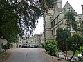 Nutfield Priory hotel, Nutfield, Surrey - geograph.org.uk - 5915787.jpg 4,000 × 3,000; 5.03 MB
-
 Nutfield RH1, UK - panoramio (1).jpg 384 × 512; 36 KB
-
 Nutfield RH1, UK - panoramio.jpg 134 × 512; 33 KB
-
 Nutfield Station - geograph.org.uk - 5340051.jpg 640 × 426; 95 KB
-
 Nutfield Station - geograph.org.uk - 5659989.jpg 640 × 426; 119 KB
-
 Nutfield Station - geograph.org.uk - 5664967.jpg 640 × 426; 87 KB
-
 Nutfield station, 2004 - geograph.org.uk - 5609181.jpg 2,353 × 1,278; 3.02 MB
-
 Nutfield war memorial - geograph.org.uk - 6102971.jpg 1,024 × 684; 268 KB
-
 Nutfield, The 'Queen's Head' - geograph.org.uk - 4208533.jpg 3,384 × 2,442; 5.34 MB
-
 Nutfield, The Crown Veterinary Clinic - geograph.org.uk - 4208530.jpg 3,802 × 2,747; 4.41 MB


_-_geograph.org.uk_-_3335799.jpg)


.jpg)


