Category:Notre-Dame de l'Assomption (La Roche)
Jump to navigation
Jump to search
| Object location | | View all coordinates using: OpenStreetMap |
|---|
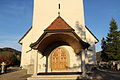
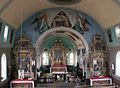
church building in La Roche in the canton of Fribourg, Switzerland   | |||||
| Upload media | |||||
| Instance of | |||||
|---|---|---|---|---|---|
| Part of | |||||
| Location | La Roche, Gruyère District, Canton of Fribourg, Switzerland | ||||
| Street address |
| ||||
| Heritage designation | |||||
 | |||||
Media in category "Notre-Dame de l'Assomption (La Roche)"
The following 13 files are in this category, out of 13 total.
-
 Church La Roche FR 22 11 2014 01.jpg 3,456 × 5,184; 5.53 MB
-
 Church La Roche FR 22 11 2014 02.jpg 3,456 × 5,184; 4.97 MB
-
 Church La Roche FR 22 11 2014 03.jpg 3,456 × 5,184; 4.57 MB
-
 Church La Roche FR 22 11 2014 04.jpg 3,456 × 5,184; 5.26 MB
-
 Church La Roche FR 22 11 2014 05.jpg 5,184 × 3,456; 5.72 MB
-
 Church La Roche FR 22 11 2014 06.jpg 5,184 × 3,456; 4.51 MB
-
 Church La Roche FR 22 11 2014 07.jpg 3,456 × 5,184; 6.17 MB
-
 Church La Roche FR 22 11 2014 08.jpg 3,456 × 5,184; 7.03 MB
-
 Church La Roche FR 22 11 2014 09.jpg 3,456 × 5,184; 4.99 MB
-
 Church La Roche FR 22 11 2014 10.jpg 5,184 × 3,456; 7.61 MB
-
 Church Notre-Dame de l’Assomption in La Roche FR (15699938777).jpg 3,456 × 5,184; 5.31 MB
-
 La roche kirche.jpg 629 × 460; 241 KB
-
 Église Notre-Dame de l’Assomption de La Roche.jpg 6,172 × 4,115; 21.13 MB


.jpg)
