Category:Northampton
Jump to navigation
Jump to search

town and civil parish in Northamptonshire, England, UK  | |||||
| Upload media | |||||
| Pronunciation audio | |||||
|---|---|---|---|---|---|
| Instance of |
| ||||
| Location | West Northamptonshire, Northamptonshire, East Midlands, England | ||||
| Inception |
| ||||
| Population |
| ||||
| Area |
| ||||
| Elevation above sea level |
| ||||
| Different from | |||||
| official website | |||||
 | |||||

Subcategories
This category has the following 23 subcategories, out of 23 total.
A
B
- Barnes Meadow (17 F)
C
- Cotton End, Northampton (1 F)
D
- Duston Mill Meadow (3 F)
E
H
K
M
O
P
- Postcards of Northampton (1 F)
R
- River Nene at Northampton (63 F)
S
- Storton's Pits (7 F)
T
W
Media in category "Northampton"
The following 200 files are in this category, out of 1,395 total.
(previous page) (next page)-
 A sunny March Sunday in Bostock Avenue - geograph.org.uk - 6085192.jpg 1,600 × 1,200; 512 KB
-
 A508 Horse Shoe Street, Northampton - geograph.org.uk - 6192308.jpg 1,024 × 684; 386 KB
-
 Abbey Court - geograph.org.uk - 4333499.jpg 640 × 480; 60 KB
-
 Abington Avenue - geograph.org.uk - 2415366.jpg 640 × 480; 60 KB
-
 Abington Avenue - geograph.org.uk - 2620832.jpg 640 × 480; 75 KB
-
 Abington Avenue - geograph.org.uk - 2644773.jpg 640 × 480; 66 KB
-
 Abington Avenue - geograph.org.uk - 4681944.jpg 640 × 480; 87 KB
-
 Abington Avenue, Northampton - geograph.org.uk - 5613724.jpg 1,280 × 851; 390 KB
-
 Abington Park Crescent - geograph.org.uk - 2504814.jpg 640 × 480; 70 KB
-
 Abington Park Crescent - geograph.org.uk - 4161277.jpg 640 × 480; 59 KB
-
 Abington Square - geograph.org.uk - 2461051.jpg 640 × 480; 65 KB
-
 Abington Street - geograph.org.uk - 2415790.jpg 640 × 480; 67 KB
-
 Abington Street, Northampton - geograph.org.uk - 3033059.jpg 640 × 480; 95 KB
-
 Abington Tennis Club - geograph.org.uk - 3167942.jpg 2,560 × 1,920; 1.09 MB
-
 Abington Vale - geograph.org.uk - 2426093.jpg 480 × 640; 78 KB
-
 Abington Vale - geograph.org.uk - 2426098.jpg 640 × 480; 73 KB
-
 Abington, Northampton, aerial 2014 - geograph.org.uk - 4054780.jpg 640 × 427; 93 KB
-
 Abington, Northampton, aerial 2015 - geograph.org.uk - 4501732.jpg 640 × 427; 110 KB
-

-
 Advertising hoarding on Towcester Road - geograph.org.uk - 3533543.jpg 2,000 × 1,500; 1.01 MB
-
 Age Concern Northamptonshire - geograph.org.uk - 2622332.jpg 640 × 480; 87 KB
-
 Ainsdale Close - geograph.org.uk - 3930949.jpg 640 × 480; 47 KB
-
 Albert Place - geograph.org.uk - 2525833.jpg 640 × 480; 69 KB
-
 Albion Brewery Bar, Northampton - geograph.org.uk - 5550402.jpg 1,280 × 861; 390 KB
-
 Albion Place - geograph.org.uk - 2049913.jpg 640 × 480; 98 KB
-
 Albion Place - geograph.org.uk - 2049924.jpg 640 × 480; 102 KB
-
 Albion Place car park - geograph.org.uk - 3532648.jpg 2,000 × 1,328; 1,013 KB
-
 Allen Road - geograph.org.uk - 3928873.jpg 640 × 480; 62 KB
-
 Allen Road - geograph.org.uk - 4346613.jpg 640 × 480; 81 KB
-
 Alliston Gardens - geograph.org.uk - 4050592.jpg 640 × 480; 79 KB
-
 Annesley Close - geograph.org.uk - 4567719.jpg 640 × 480; 82 KB
-
 Ardington Road - geograph.org.uk - 1841526.jpg 640 × 480; 57 KB
-
 Ardington Road from above - geograph.org.uk - 2932787.jpg 1,189 × 1,792; 1.72 MB
-
 Argyle Street - geograph.org.uk - 4268521.jpg 640 × 480; 52 KB
-
 Argyle Street - geograph.org.uk - 5072715.jpg 4,000 × 3,000; 2.52 MB
-
 Art Nouveau window, Adelaide Street, Northampton - geograph.org.uk - 2276652.jpg 1,200 × 1,600; 463 KB
-
 Arthur Longland - geograph.org.uk - 2335479.jpg 640 × 480; 77 KB
-
 Arthur Street - geograph.org.uk - 3311923.jpg 480 × 640; 58 KB
-
 Artizan Road - geograph.org.uk - 6020388.jpg 640 × 360; 51 KB
-
 Ashburnham Road - geograph.org.uk - 2557278.jpg 640 × 480; 59 KB
-
 Ashcroft Gardens - geograph.org.uk - 1972659.jpg 640 × 480; 70 KB
-
 Ashcroft Gardens - geograph.org.uk - 2503372.jpg 640 × 480; 70 KB
-
 Ashcroft Gardens - geograph.org.uk - 2503373.jpg 640 × 480; 61 KB
-
 Ashley Way - geograph.org.uk - 4699821.jpg 640 × 480; 86 KB
-
 Ashley Way, Weston Favell, Northampton - geograph.org.uk - 2581415.jpg 2,000 × 1,500; 965 KB
-
 ATS on Harborough Road, Northampton - geograph.org.uk - 5400334.jpg 2,256 × 1,662; 977 KB
-
 Auctioneers Way - geograph.org.uk - 3884848.jpg 640 × 480; 59 KB
-
 Autocare - geograph.org.uk - 2618363.jpg 640 × 480; 65 KB
-
 Avalon - geograph.org.uk - 6110391.jpg 640 × 480; 66 KB
-
 Back Alley from Broadway - geograph.org.uk - 6085067.jpg 1,600 × 1,066; 413 KB
-
 Baldwin Close - geograph.org.uk - 3568789.jpg 640 × 478; 72 KB
-
 Banbury Lane Bridge - geograph.org.uk - 7789.jpg 640 × 480; 98 KB
-
 Barnes Meadow Interchange - geograph.org.uk - 1883160.jpg 480 × 640; 77 KB
-
 Barry Road - geograph.org.uk - 4516438.jpg 640 × 480; 85 KB
-
 Barry Road Schools Swimming Pool - geograph.org.uk - 2543920.jpg 958 × 1,280; 347 KB
-
 Barry Road, Northampton postbox (ref. NN1 567) - geograph.org.uk - 2543939.jpg 1,280 × 959; 463 KB
-
 Bathing geese at Billing Aquadrome - geograph.org.uk - 3171397.jpg 640 × 427; 77 KB
-
 Battle of Northampton - geograph.org.uk - 1882184.jpg 640 × 480; 84 KB
-
 Beacon Bingo on Weedon Road, Northampton - geograph.org.uk - 5402629.jpg 2,304 × 1,728; 1,016 KB
-
 Bearded Dragons - geograph.org.uk - 3169541.jpg 640 × 480; 103 KB
-
 Beaumont Drive - geograph.org.uk - 1877196.jpg 640 × 480; 56 KB
-
 Beaumont Drive - geograph.org.uk - 4743029.jpg 640 × 480; 81 KB
-
 Becket's Park - geograph.org.uk - 3447344.jpg 640 × 478; 128 KB
-
 Becket's Park - geograph.org.uk - 3526105.jpg 640 × 478; 65 KB
-
 Becket's Park Marina - geograph.org.uk - 3445614.jpg 640 × 478; 75 KB
-
 Becketts Park - geograph.org.uk - 2568260.jpg 640 × 480; 68 KB
-
 Becketts Park Lock - geograph.org.uk - 1410947.jpg 640 × 480; 96 KB
-
 Becketts Park Lock - geograph.org.uk - 1410962.jpg 640 × 480; 106 KB
-
 Bedford Road - geograph.org.uk - 1817994.jpg 640 × 480; 93 KB
-
 Beech Avenue - geograph.org.uk - 1972661.jpg 640 × 480; 59 KB
-
 Beech Avenue - geograph.org.uk - 1972669.jpg 640 × 480; 69 KB
-
 Beech Avenue - geograph.org.uk - 2146937.jpg 640 × 480; 67 KB
-
 Bell Kitchens, Northampton - geograph.org.uk - 6199742.jpg 2,034 × 1,526; 1.78 MB
-
 Beverley Crescent, c.1950 - geograph.org.uk - 3647900.jpg 640 × 427; 50 KB
-
 Billing Arbours - geograph.org.uk - 2898653.jpg 640 × 480; 132 KB
-
 Billing Mill pub - geograph.org.uk - 5972988.jpg 1,600 × 1,066; 602 KB
-
 Birchfield Road East - geograph.org.uk - 2981158.jpg 640 × 480; 57 KB
-
 Birds Hill Walk - geograph.org.uk - 2899023.jpg 640 × 480; 82 KB
-
 Black Lion Hill, Northampton - geograph.org.uk - 865084.jpg 640 × 480; 119 KB
-
 BMWs, Cliftonville Road and A428 junction - geograph.org.uk - 5075451.jpg 4,000 × 3,000; 2.66 MB
-

-
 Booth Rise - geograph.org.uk - 1928905.jpg 640 × 480; 72 KB
-
 Boothville - geograph.org.uk - 3297436.jpg 640 × 480; 60 KB
-
 Boothville - geograph.org.uk - 4736130.jpg 640 × 480; 81 KB
-
 Boothville, Northampton, aerial 2015 - geograph.org.uk - 4501698.jpg 640 × 427; 80 KB
-
 Bostock Avenue - geograph.org.uk - 3525757.jpg 640 × 478; 72 KB
-
 Bottoms up^ - geograph.org.uk - 5549634.jpg 1,280 × 849; 395 KB
-
 Bougainvillea Drive - geograph.org.uk - 3814690.jpg 640 × 480; 55 KB
-
 Boundary marker, Weston Favell - geograph.org.uk - 5990008.jpg 851 × 1,280; 369 KB
-
 BP petrol station on St James Road, Northampton - geograph.org.uk - 5402684.jpg 2,304 × 1,728; 1.43 MB
-
 BP petrol station on St James Road, Northampton - geograph.org.uk - 5402685.jpg 2,304 × 1,728; 1.41 MB
-
 Brad Street - geograph.org.uk - 4255122.jpg 640 × 480; 48 KB
-
 Bradshaw Street - geograph.org.uk - 3104134.jpg 640 × 480; 73 KB
-
 Briar Hill - geograph.org.uk - 2981339.jpg 640 × 480; 59 KB
-
 Bridge 9B, Grand Junction Canal - Northampton Arm - geograph.org.uk - 3952800.jpg 4,000 × 3,000; 5.14 MB
-
 Bridge Street at the junction of St Peter's Way - geograph.org.uk - 3073380.jpg 1,600 × 1,200; 255 KB
-
 Bridge Street, Aladdins Balti - geograph.org.uk - 5884855.jpg 800 × 533; 551 KB
-
 Bridgewater Drive - geograph.org.uk - 2426105.jpg 640 × 480; 74 KB
-
 Bridgewater Drive - geograph.org.uk - 2426109.jpg 640 × 480; 61 KB
-
 Bridgewater Drive - geograph.org.uk - 4109018.jpg 640 × 480; 63 KB
-
 Bridleway - geograph.org.uk - 207269.jpg 640 × 480; 95 KB
-
 Bridleway - geograph.org.uk - 324339.jpg 640 × 427; 89 KB
-
 Broadmead Avenue - geograph.org.uk - 1939948.jpg 640 × 480; 72 KB
-
 Broadmead Avenue Allotments - geograph.org.uk - 2904772.jpg 640 × 480; 130 KB
-
 Broadmead Avenue Allotments - geograph.org.uk - 2906097.jpg 640 × 480; 124 KB
-
 Broadway East - geograph.org.uk - 2953553.jpg 640 × 480; 63 KB
-
 Broughton Place - geograph.org.uk - 3569450.jpg 640 × 478; 46 KB
-
 Building at Chapel Place - geograph.org.uk - 2544255.jpg 1,280 × 959; 311 KB
-

-
 Buildings on Barrack Road, Northampton - geograph.org.uk - 6192317.jpg 1,024 × 684; 271 KB
-
 Bull Ring - geograph.org.uk - 3590422.jpg 640 × 478; 122 KB
-
 Bungalows in the mist - geograph.org.uk - 4725431.jpg 640 × 480; 85 KB
-

-
-
 Bush Hill - geograph.org.uk - 4943456.jpg 640 × 480; 71 KB
-
 Bushland Road - geograph.org.uk - 3905431.jpg 640 × 480; 59 KB
-
 Butterfly - geograph.org.uk - 3527791.jpg 640 × 478; 80 KB
-
 Byron Street - geograph.org.uk - 3594661.jpg 640 × 478; 101 KB
-
 Castilian Court - geograph.org.uk - 4938785.jpg 640 × 480; 55 KB
-
 Castilian Street - geograph.org.uk - 2049909.jpg 640 × 480; 69 KB
-
 Castilian Street - geograph.org.uk - 2544318.jpg 1,280 × 959; 338 KB
-
 Castilian Street - geograph.org.uk - 4938777.jpg 640 × 480; 76 KB
-
 Castle Inn - geograph.org.uk - 2492161.jpg 640 × 480; 81 KB
-
 Castle Station - geograph.org.uk - 2524009.jpg 640 × 480; 71 KB
-
 Castle Station - geograph.org.uk - 2618354.jpg 640 × 480; 58 KB
-
 Castle Station - geograph.org.uk - 3555271.jpg 640 × 478; 63 KB
-
 Cedar Gate - geograph.org.uk - 4698560.jpg 640 × 480; 84 KB
-
 Cedar Road - geograph.org.uk - 2335309.jpg 640 × 480; 67 KB
-
 Cedar Road - geograph.org.uk - 2445688.jpg 640 × 480; 75 KB
-
 Cedar Road - geograph.org.uk - 2461041.jpg 640 × 480; 51 KB
-
 Cedar Road East - geograph.org.uk - 3929445.jpg 640 × 480; 55 KB
-
 Cemetery of The Sisters of Notre Dame - geograph.org.uk - 2525823.jpg 640 × 480; 118 KB
-
 Chameleon - geograph.org.uk - 3169539.jpg 640 × 427; 104 KB
-
 Chatsworth Avenue - geograph.org.uk - 4613119.jpg 640 × 480; 83 KB
-
 Cherry Lodge - geograph.org.uk - 1877194.jpg 480 × 640; 75 KB
-
 Chestnut in the woods - Salcey Forest - July 2009 - panoramio.jpg 1,712 × 2,288; 1.49 MB
-
 Cheyne Walk - geograph.org.uk - 1862407.jpg 640 × 480; 102 KB
-

-
 Children's playground on the Racecourse - geograph.org.uk - 6085230.jpg 1,600 × 1,066; 425 KB
-
 Christchurch Road - geograph.org.uk - 2533477.jpg 640 × 480; 100 KB
-
 Church Green - geograph.org.uk - 4342285.jpg 640 × 480; 62 KB
-
 Church Way - geograph.org.uk - 1880422.jpg 640 × 480; 89 KB
-
 Church Way - geograph.org.uk - 1881971.jpg 640 × 480; 77 KB
-
 Church Way - geograph.org.uk - 1902441.jpg 480 × 640; 54 KB
-
 Church Way Close - geograph.org.uk - 1918497.jpg 640 × 480; 98 KB
-
 Church's shoe factory - geograph.org.uk - 2487875.jpg 640 × 480; 86 KB
-
 Churchill Avenue - geograph.org.uk - 3718634.jpg 640 × 478; 93 KB
-
 Churchway, Weston Favell - geograph.org.uk - 5991129.jpg 1,280 × 851; 654 KB
-
 City Buildings - geograph.org.uk - 2544296.jpg 959 × 1,280; 333 KB
-
 Class 350 Desiro - geograph.org.uk - 2450997.jpg 640 × 480; 90 KB
-
 Clifford Hill Lock - geograph.org.uk - 6207722.jpg 480 × 640; 37 KB
-
 Cliftonville Care - geograph.org.uk - 2404170.jpg 640 × 480; 81 KB
-

-

-
 Co-op delivery robots (50750224957).jpg 4,032 × 3,024; 6.35 MB
-
 Collingwood Road - geograph.org.uk - 1812924.jpg 640 × 480; 74 KB
-
 Colne Way, King's Heath - geograph.org.uk - 2796889.jpg 640 × 480; 77 KB
-
 Colour me red - geograph.org.uk - 2544377.jpg 1,280 × 959; 361 KB
-
 Colwyn Road - geograph.org.uk - 3929322.jpg 640 × 480; 73 KB
-
 Colwyn Road - geograph.org.uk - 4945891.jpg 640 × 480; 66 KB
-
 Communication Mast - geograph.org.uk - 4167376.jpg 640 × 480; 56 KB
-
 Construction site, Cliftonville Road - geograph.org.uk - 5075455.jpg 4,000 × 3,000; 2.48 MB
-
 Coppice Drive - geograph.org.uk - 3295562.jpg 640 × 480; 67 KB
-
 Corner of The Racecourse - geograph.org.uk - 2796893.jpg 640 × 480; 106 KB
-
 Corner of Weston Way and Ridgeway - geograph.org.uk - 1826083.jpg 640 × 480; 46 KB
-
 Cottingham Drive - geograph.org.uk - 4050584.jpg 640 × 480; 47 KB
-
 Cotton End into Bridge Street - geograph.org.uk - 4056142.jpg 640 × 427; 73 KB
-
 Countess Road - geograph.org.uk - 3928852.jpg 640 × 480; 45 KB
-
 Countess Road - geograph.org.uk - 4816818.jpg 640 × 480; 52 KB
-
 Countess Road - geograph.org.uk - 4816820.jpg 640 × 480; 43 KB
-
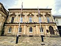 County Hall, George Row, Northampton.jpg 4,032 × 3,024; 2.8 MB
-
 County Infirmary, Northampton. View of a ward. Wellcome L0005442.jpg 1,760 × 1,084; 1,013 KB
-
 Covered Reservoir - geograph.org.uk - 4167379.jpg 640 × 480; 60 KB
-
 Covington Street - geograph.org.uk - 2543914.jpg 1,280 × 959; 279 KB
-
 Cransley Walk - geograph.org.uk - 4167399.jpg 640 × 480; 105 KB
-
 Crayfish in the Grand Union Canal - geograph.org.uk - 3175918.jpg 640 × 480; 89 KB
-
 Crayfish in the Grand Union Canal - geograph.org.uk - 3175920.jpg 640 × 480; 60 KB
-
 Crestline Court - geograph.org.uk - 4938772.jpg 640 × 480; 101 KB
-
 Crestwood Close - geograph.org.uk - 4777194.jpg 640 × 480; 87 KB
-
 Cripps Leisure Centre - geograph.org.uk - 2451506.jpg 640 × 480; 66 KB
-
 Crow Lane Industrial Estate - geograph.org.uk - 1894063.jpg 640 × 480; 81 KB
-
 Crow Lane Industrial Estate - geograph.org.uk - 2942655.jpg 640 × 480; 128 KB
-
 Cultural Quarter - geograph.org.uk - 3884793.jpg 640 × 480; 96 KB
-
 Cultural Quarter sign.jpg 962 × 1,575; 661 KB
-
 Cycleway through Housing Estates - geograph.org.uk - 174003.jpg 640 × 480; 122 KB
-
 Cyclists beware - geograph.org.uk - 2603023.jpg 640 × 480; 140 KB
-
 Cynthia Spencer Day Hospice - geograph.org.uk - 3619405.jpg 640 × 478; 79 KB
-
 Cynthia Spencer Hospice - geograph.org.uk - 3619409.jpg 640 × 478; 67 KB
-
 Cynthia Spencer Hospice - geograph.org.uk - 3718599.jpg 640 × 478; 114 KB
-
 Daimler Close - geograph.org.uk - 6027340.jpg 640 × 360; 42 KB
-
 Dallington Brook - geograph.org.uk - 1918388.jpg 480 × 640; 107 KB
-
 Dallington Lawn Tennis Club - geograph.org.uk - 1918473.jpg 640 × 480; 85 KB
-
 Dallington Road, Northampton - geograph.org.uk - 5857930.jpg 1,024 × 768; 160 KB
-
 Dallington Road, Northampton, c.1968 - geograph.org.uk - 2261235.jpg 640 × 419; 61 KB
-
 Dallington village green, Northampton - geograph.org.uk - 5857944.jpg 1,024 × 768; 224 KB
-
 Dandelions - geograph.org.uk - 1827345.jpg 640 × 480; 131 KB
-
 Danefield Road - geograph.org.uk - 2949702.jpg 640 × 480; 91 KB
-
 Danefield Road - geograph.org.uk - 2971937.jpg 640 × 480; 78 KB
-
 Danes Camp - geograph.org.uk - 2981386.jpg 640 × 480; 117 KB
-
 Danes Camp Earthworks Northampton.jpg 2,379 × 3,250; 1.83 MB


_-_geograph.org.uk_-_2543939.jpg)


_-_geograph.org.uk_-_2077682.jpg)


.jpg)


