Category:Normanton, Rutland
Jump to navigation
Jump to search
village and civil parish in Rutland, United Kingdom  | |||||
| Upload media | |||||
| Instance of | |||||
|---|---|---|---|---|---|
| Location | Rutland, East Midlands, England | ||||
| Area |
| ||||
 | |||||
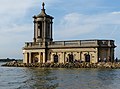
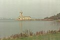
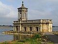
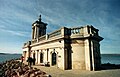
English: Normanton is a village and civil parish on the eastern shore of Rutland Water in the county of Rutland in the East Midlands of England.
Subcategories
This category has the following 2 subcategories, out of 2 total.
N
- Normanton Church (42 F)
- Normanton Hall (2 F)
Media in category "Normanton, Rutland"
The following 200 files are in this category, out of 228 total.
(previous page) (next page)-
 A bend in Normanton Park Road - geograph.org.uk - 4007616.jpg 640 × 480; 57 KB
-
 A flower bed near Normanton Church, Rutland Water - geograph.org.uk - 4837817.jpg 1,600 × 1,017; 350 KB
-
 A seat out of the wind - geograph.org.uk - 4839922.jpg 970 × 1,280; 348 KB
-
 About to set sail - geograph.org.uk - 4839908.jpg 1,280 × 882; 378 KB
-

-
 Across Rutland Water - geograph.org.uk - 5183164.jpg 1,024 × 732; 929 KB
-
 Aeration for the nation - geograph.org.uk - 2115936.jpg 2,592 × 1,944; 2.05 MB
-
 Along the southeast shore of Rutland Water - geograph.org.uk - 3724865.jpg 1,600 × 1,064; 502 KB
-

-
 Bare field, north of the airfield - geograph.org.uk - 2320751.jpg 1,024 × 768; 158 KB
-
 Bench mark, Normanton Park - geograph.org.uk - 4839910.jpg 960 × 1,280; 414 KB
-
 Bench mark, Oak Farm, Normanton - geograph.org.uk - 4849014.jpg 960 × 1,280; 280 KB
-
 Between Normanton jetty and Howells Inlet - geograph.org.uk - 3082389.jpg 1,024 × 768; 132 KB
-
 Boiler house chimney at Normanton Lodge Farm - geograph.org.uk - 3569666.jpg 4,320 × 3,240; 6.38 MB
-
 Bracknell House, Normanton - geograph.org.uk - 4849018.jpg 1,280 × 847; 406 KB
-
 Breakers on the beach - geograph.org.uk - 4839917.jpg 960 × 1,280; 485 KB
-
 By Rutland Water - geograph.org.uk - 4724338.jpg 640 × 427; 189 KB
-
 Concrete block on the shores of Rutland Water - geograph.org.uk - 4839903.jpg 1,280 × 872; 228 KB
-
 Crop field and woodland - geograph.org.uk - 4007623.jpg 640 × 480; 60 KB
-
 Cycle path along the shore of Rutland Water - geograph.org.uk - 3286835.jpg 4,000 × 3,000; 3.62 MB
-
 Entrance to Normanton Lodge Farm - geograph.org.uk - 3569629.jpg 4,208 × 3,086; 5.65 MB
-
 Estate boundary wall, Normanton Lodge - geograph.org.uk - 4827462.jpg 1,280 × 960; 635 KB
-

-

-
-

-

-
-

-
-

-

-

-

-

-

-

-

-
 Fingerpost near Normanton Lodge - geograph.org.uk - 4791903.jpg 1,280 × 960; 422 KB
-
 Fingerpost near Normanton Lodge - geograph.org.uk - 4791906.jpg 1,280 × 960; 349 KB
-

-
 Getting that sinking feeling^ - geograph.org.uk - 4839828.jpg 1,280 × 960; 293 KB
-
 Green lane - geograph.org.uk - 2320769.jpg 1,024 × 768; 188 KB
-
 Hambleton Peninsula - geograph.org.uk - 2399457.jpg 640 × 427; 46 KB
-
 Houses at the road junction - geograph.org.uk - 2320755.jpg 1,024 × 768; 120 KB
-
 Jetty - geograph.org.uk - 2911787.jpg 1,024 × 768; 219 KB
-
 Ketton Road passes through New Wood - geograph.org.uk - 2629082.jpg 4,000 × 3,000; 4.09 MB
-
 Ketton, Scene towards the Ketton stone quarry - geograph.org.uk - 4499012.jpg 4,836 × 2,700; 7.15 MB
-
 Landing stage for the Rutland Belle - geograph.org.uk - 1005123.jpg 640 × 467; 77 KB
-
 Lane alongside Normanton Lodge Farm - geograph.org.uk - 4121170.jpg 4,000 × 3,000; 4.27 MB
-
 Left for Ketton, right for Edith Weston - geograph.org.uk - 2320753.jpg 1,024 × 768; 125 KB
-
 MacMillan Way and refreshment cabin - geograph.org.uk - 6073145.jpg 1,024 × 768; 183 KB
-
 Mallard Ducks on Rutland Water - geograph.org.uk - 4724581.jpg 640 × 480; 299 KB
-
 More ivy than tree (almost) - geograph.org.uk - 2320754.jpg 1,024 × 768; 179 KB
-
 No wind today - geograph.org.uk - 4724588.jpg 479 × 640; 285 KB
-
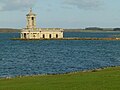
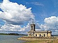
 Normanton church - geograph.org.uk - 2399452.jpg 640 × 427; 57 KB
-
 Normanton Church - geograph.org.uk - 2911757.jpg 1,024 × 768; 134 KB
-
 Normanton Church - geograph.org.uk - 2911759.jpg 1,024 × 768; 200 KB
-
 Normanton Church - geograph.org.uk - 2911781.jpg 3,264 × 2,448; 4.81 MB
-
 Normanton Church - geograph.org.uk - 3281068.jpg 1,539 × 1,324; 519 KB
-
 Normanton Church - geograph.org.uk - 3286846.jpg 2,537 × 1,776; 1.09 MB
-
 Normanton Church - geograph.org.uk - 3286853.jpg 3,833 × 2,852; 3.41 MB
-
 Normanton Church - geograph.org.uk - 3286866.jpg 2,969 × 3,287; 2.98 MB
-
 Normanton Church - geograph.org.uk - 3391445.jpg 4,320 × 3,240; 6.62 MB
-
 Normanton Church - geograph.org.uk - 3551623.jpg 1,600 × 1,000; 383 KB
-
 Normanton Church - geograph.org.uk - 4049245.jpg 640 × 427; 46 KB
-
 Normanton church - geograph.org.uk - 4636278.jpg 4,272 × 2,848; 4.62 MB
-
 Normanton church - geograph.org.uk - 5139894.jpg 2,000 × 1,345; 203 KB
-
 Normanton Church - geograph.org.uk - 5838975.jpg 1,024 × 683; 154 KB
-
 Normanton Church - geograph.org.uk - 5910320.jpg 640 × 570; 71 KB
-
 Normanton Church - geograph.org.uk - 6168596.jpg 480 × 640; 41 KB
-
 Normanton Church and ferry jetty - geograph.org.uk - 4049249.jpg 640 × 427; 54 KB
-
 Normanton Church and Rutland Belle jetty - geograph.org.uk - 3286893.jpg 4,000 × 3,000; 3.96 MB
-
 Normanton Church and Rutland Water - geograph.org.uk - 3724840.jpg 1,600 × 1,037; 364 KB
-
 Normanton Church and Rutland Water - geograph.org.uk - 5178020.jpg 800 × 782; 82 KB
-
 Normanton Church at Rutland Water - geograph.org.uk - 5178021.jpg 800 × 667; 111 KB
-
 Normanton Church in the snow - geograph.org.uk - 3772342.jpg 1,600 × 1,029; 435 KB
-
 Normanton Church Museum - geograph.org.uk - 2382473.jpg 640 × 480; 64 KB
-
 Normanton Church Museum - geograph.org.uk - 3446817.jpg 1,024 × 768; 295 KB
-
 Normanton Church tower - geograph.org.uk - 4839905.jpg 960 × 1,280; 280 KB
-
 Normanton Church tower - geograph.org.uk - 4839919.jpg 1,035 × 1,280; 338 KB
-
 Normanton church, Rutland Water - geograph.org.uk - 2902173.jpg 1,600 × 1,067; 375 KB
-
 Normanton Church, Rutland Water - geograph.org.uk - 4088161.jpg 640 × 491; 207 KB
-
 Normanton Church, Rutland Water - geograph.org.uk - 4724377.jpg 640 × 427; 199 KB
-
 Normanton Church, Rutland Water - geograph.org.uk - 4831525.jpg 1,600 × 1,067; 306 KB
-
 Normanton Church, Rutland Water - geograph.org.uk - 4837765.jpg 1,600 × 1,029; 354 KB
-
 Normanton jetty, Rutland Water - geograph.org.uk - 3082369.jpg 1,024 × 768; 135 KB
-
 Normanton Lodge - geograph.org.uk - 4827416.jpg 1,280 × 960; 477 KB
-
 Normanton Lodge and the Works - geograph.org.uk - 4827480.jpg 1,280 × 766; 232 KB
-
 Normanton Lodge Farm - geograph.org.uk - 2320762.jpg 1,024 × 768; 164 KB
-
 Normanton Lodge Farm - geograph.org.uk - 4121164.jpg 4,000 × 3,000; 4.38 MB
-
 Normanton Lodge Farm - geograph.org.uk - 4121167.jpg 4,000 × 3,000; 4.11 MB
-
 Normanton Lodge Farm - geograph.org.uk - 4121172.jpg 4,000 × 3,000; 4.12 MB
-
 Normanton Lodge Farm - geograph.org.uk - 5836523.jpg 3,776 × 2,520; 3.51 MB
-
 Normanton Lodge Farm buildings - geograph.org.uk - 4827425.jpg 1,280 × 960; 417 KB
-
 Normanton Lodge Farm buildings - geograph.org.uk - 4827429.jpg 1,280 × 960; 459 KB
-
 Normanton Lodge Farm buildings - geograph.org.uk - 4827434.jpg 1,280 × 960; 247 KB
-
 Normanton Lodge Farm buildings - geograph.org.uk - 4827437.jpg 1,280 × 960; 473 KB
-
 Normanton Lodge Farm buildings - geograph.org.uk - 4827474.jpg 1,280 × 960; 369 KB
-
 Normanton Lodge near Rutland Water - geograph.org.uk - 3569638.jpg 4,320 × 3,240; 5.58 MB
-
 Normanton Lodge postbox ref LE15 56 - geograph.org.uk - 4827447.jpg 960 × 1,280; 386 KB
-
 Normanton Park grounds - geograph.org.uk - 4839915.jpg 1,280 × 884; 528 KB
-
 Normanton Park Hotel - geograph.org.uk - 3391462.jpg 4,320 × 3,240; 6.84 MB
-
 Normanton Park Hotel - geograph.org.uk - 3448526.jpg 1,024 × 765; 228 KB
-
 Normanton Park Hotel - geograph.org.uk - 3569597.jpg 4,320 × 3,240; 6.13 MB
-
 Normanton Park Hotel - geograph.org.uk - 4121242.jpg 4,000 × 3,000; 4.44 MB
-
 Normanton Park Hotel - geograph.org.uk - 4839923.jpg 1,280 × 876; 426 KB
-
 Normanton Park Hotel - geograph.org.uk - 5983155.jpg 640 × 480; 70 KB
-
 Normanton Park Road - geograph.org.uk - 4007618.jpg 640 × 480; 45 KB
-
 Normanton Park Road - geograph.org.uk - 6250004.jpg 640 × 480; 64 KB
-
 Normanton Park stable block - geograph.org.uk - 4839909.jpg 952 × 1,280; 322 KB
-
 Normanton Park stable block - geograph.org.uk - 4839913.jpg 1,280 × 960; 323 KB
-
 Normanton Works - geograph.org.uk - 4827451.jpg 960 × 1,280; 399 KB
-
 Normanton Works - geograph.org.uk - 4827452.jpg 1,280 × 938; 292 KB
-
 Normanton Works - geograph.org.uk - 4827456.jpg 1,280 × 960; 472 KB
-
 Normanton Works - geograph.org.uk - 4827459.jpg 960 × 1,280; 512 KB
-
 Normanton Works - geograph.org.uk - 4827472.jpg 960 × 1,280; 314 KB
-
 Normanton Works - geograph.org.uk - 4827483.jpg 1,280 × 960; 311 KB
-
 Normanton, Rutland Water - geograph.org.uk - 4664499.jpg 640 × 426; 101 KB
-
 Normanton, Rutland Water - geograph.org.uk - 4665042.jpg 426 × 640; 119 KB
-
 Normanton, Rutland Water - geograph.org.uk - 4665051.jpg 640 × 426; 98 KB
-
 Normanton, Rutland Water - geograph.org.uk - 4665055.jpg 426 × 640; 120 KB
-
 Normanton, Rutland Water - geograph.org.uk - 4665072.jpg 640 × 426; 108 KB
-
 Normanton, St Matthew - geograph.org.uk - 5569416.jpg 1,024 × 768; 1.01 MB
-
 Not test match cricket at Rutland Water - geograph.org.uk - 3568997.jpg 4,320 × 3,240; 5.83 MB
-
 Oak Farm, Normanton - geograph.org.uk - 4849015.jpg 1,280 × 960; 356 KB
-
 Oak tree at Rutland Water - geograph.org.uk - 4724599.jpg 640 × 427; 322 KB
-
 Old style road sign near Normanton, Rutland - geograph.org.uk - 3569284.jpg 4,320 × 3,240; 5.68 MB
-
 On the South shore, Rutland Water - geograph.org.uk - 4724596.jpg 640 × 427; 218 KB
-
 Osprey Final Fling - geograph.org.uk - 5583350.jpg 2,816 × 1,584; 1.87 MB
-
 Path on the shore near Normanton - geograph.org.uk - 3286810.jpg 4,000 × 3,000; 3.37 MB
-
 Probably a potting shed - geograph.org.uk - 2320772.jpg 1,024 × 768; 146 KB
-
 Public footpath near Top Cottages - geograph.org.uk - 2727569.jpg 960 × 1,280; 602 KB
-
 Rescue Launch - geograph.org.uk - 1400247.jpg 640 × 480; 67 KB
-
 Rise Up^ - geograph.org.uk - 2727562.jpg 1,198 × 899; 393 KB
-
 Road at the tip of the Hambleton peninsula - geograph.org.uk - 3286881.jpg 3,000 × 2,303; 2.27 MB
-
 Row, Row, Row the Boat - geograph.org.uk - 1400257.jpg 640 × 480; 77 KB
-
 Rutland Belle at Normanton Church - geograph.org.uk - 5571045.jpg 800 × 561; 101 KB
-
 Rutland Water - 1981 - geograph.org.uk - 2244766.jpg 1,514 × 2,272; 666 KB
-
 Rutland Water - 1983 - geograph.org.uk - 2227083.jpg 2,272 × 1,514; 284 KB
-
 Rutland Water - geograph.org.uk - 3082344.jpg 1,024 × 768; 125 KB
-
 Rutland Water - geograph.org.uk - 4121236.jpg 4,000 × 3,000; 3.89 MB
-
 Rutland Water - geograph.org.uk - 4724389.jpg 640 × 427; 156 KB
-
 Rutland Water - geograph.org.uk - 4724504.jpg 640 × 427; 196 KB
-
 Rutland Water - geograph.org.uk - 4724535.jpg 640 × 427; 132 KB
-
 Rutland Water and Normanton Church - geograph.org.uk - 4121224.jpg 4,000 × 3,000; 4.21 MB
-
 Rutland Water at Normanton - geograph.org.uk - 4121232.jpg 4,000 × 3,000; 3.89 MB
-
 Rutland Water Circular Route - geograph.org.uk - 3286779.jpg 4,000 × 3,000; 3.58 MB
-
 Rutland Water Reservoir - geograph.org.uk - 2911767.jpg 3,264 × 2,448; 5.2 MB
-
 Rutland Water Shoreline - geograph.org.uk - 900387.jpg 640 × 480; 77 KB
-
 Rutland Water shoreline at Normanton - geograph.org.uk - 3286885.jpg 3,659 × 2,739; 3 MB
-
 Rutland Water, aerial 2017 (2) - geograph.org.uk - 5436083.jpg 1,024 × 683; 83 KB
-
 Sailing boats near Normanton Park Hotel - geograph.org.uk - 3281074.jpg 2,690 × 2,171; 1.36 MB
-
 Sailing boats on Rutland Water - geograph.org.uk - 3286816.jpg 3,099 × 2,514; 2.38 MB
-
 Sailing boats on Rutland Water - geograph.org.uk - 3286822.jpg 3,084 × 2,050; 1.88 MB
-
 Sailing boats on Rutland Water - geograph.org.uk - 3724852.jpg 1,600 × 1,113; 366 KB
-
 Semi-circular portico - geograph.org.uk - 2911772.jpg 2,448 × 3,264; 5.3 MB
-
 Signpost to a non-existent village - geograph.org.uk - 4121178.jpg 4,000 × 3,000; 4.27 MB
-
 Snowdrops by the path to Normanton Church - geograph.org.uk - 661866.jpg 640 × 480; 202 KB
-
 Southern approach to Normanton near Rutland Water - geograph.org.uk - 3569274.jpg 4,320 × 3,240; 5.68 MB
-
 Spring has sprung - geograph.org.uk - 3448539.jpg 1,024 × 768; 299 KB
-
 St Matthew's Church, Normanton.jpg 4,000 × 3,000; 2.11 MB
-
 Stable block at Bracknell House - geograph.org.uk - 4849021.jpg 1,280 × 960; 524 KB
-
 Swans near Normanton Church, Rutland Water - geograph.org.uk - 3569017.jpg 4,320 × 3,240; 5.55 MB
-
 Swarm of Hornets - geograph.org.uk - 5583371.jpg 2,816 × 1,584; 1.57 MB
-
 Sweeping bend in Normanton Park Road - geograph.org.uk - 4007624.jpg 640 × 480; 57 KB
-
 Sycamore at Rutland Water - geograph.org.uk - 4724515.jpg 509 × 640; 568 KB
-
 The 'Rutland Belle' berthing at Normanton Church - geograph.org.uk - 5835122.jpg 3,776 × 2,520; 3.1 MB
-
 The edge of New Wood - geograph.org.uk - 2629087.jpg 4,000 × 3,000; 4.36 MB
-
 The edge of New Wood - geograph.org.uk - 2629095.jpg 4,000 × 3,000; 4.3 MB
-
 The edge of Rutland Water - geograph.org.uk - 6073080.jpg 1,024 × 768; 148 KB
-
-
 The former Normanton Church - geograph.org.uk - 3082360.jpg 1,024 × 768; 119 KB
-
 The former road from Upper Hambleton to Ketton - geograph.org.uk - 6069941.jpg 1,024 × 768; 403 KB
-
 The former St Matthew's Church Normanton - geograph.org.uk - 3065913.jpg 4,000 × 3,000; 3.49 MB
-
 The Normanton shore of Rutland Water - geograph.org.uk - 3082350.jpg 1,024 × 768; 111 KB
-
 The road to Normanton Lodge Farm - geograph.org.uk - 4121209.jpg 4,000 × 3,000; 4.39 MB
-
 The Rutland Belle - geograph.org.uk - 4049246.jpg 640 × 427; 77 KB
-

-
 The Rutland Belle at Normanton - geograph.org.uk - 5571004.jpg 800 × 572; 136 KB
-
 The site of Normanton Village - geograph.org.uk - 4121222.jpg 4,000 × 3,000; 4 MB
-
 Three large sheds (2) - geograph.org.uk - 2320748.jpg 1,024 × 768; 166 KB
-
 Three large sheds - geograph.org.uk - 2320746.jpg 1,024 × 768; 110 KB
-
 Track with cattle grid - geograph.org.uk - 4007614.jpg 640 × 480; 85 KB
-
 Tree-lined road - geograph.org.uk - 2320767.jpg 1,024 × 768; 201 KB
-
 Turkey Tail fungus (Trametes versicolor) - geograph.org.uk - 4827466.jpg 1,280 × 852; 456 KB
-
 Turkey Tail fungus (Trametes versicolor) - geograph.org.uk - 4827469.jpg 960 × 1,280; 609 KB
-
 Two churches and Rutland Water - geograph.org.uk - 5177932.jpg 800 × 557; 50 KB
-
 Vantage point - geograph.org.uk - 2744359.jpg 2,592 × 1,944; 1.93 MB
-
 View across Rutland Water to Normanton Church - geograph.org.uk - 3281064.jpg 3,343 × 2,227; 2.22 MB
-
 View northwest across Rutland Water - geograph.org.uk - 3724872.jpg 1,600 × 1,325; 471 KB
-

-

-

-

-

-
 View of boats on Rutland Water from Normanton Church - geograph.org.uk - 5535120.jpg 3,872 × 2,592; 1.72 MB
-

-
 View of Egleton from Normanton Church - geograph.org.uk - 5535127.jpg 3,124 × 2,092; 711 KB
-
 View of Gunthorpe from Normanton Church - geograph.org.uk - 5535122.jpg 3,872 × 2,592; 1.55 MB


_-_geograph.org.uk_-_2484750.jpg)
_-_geograph.org.uk_-_2490977.jpg)
_-_geograph.org.uk_-_2490982.jpg)
_-_geograph.org.uk_-_2490991.jpg)
_-_geograph.org.uk_-_2491086.jpg)
_-_geograph.org.uk_-_2491095.jpg)
_-_geograph.org.uk_-_2491103.jpg)
_-_geograph.org.uk_-_2491117.jpg)
_-_geograph.org.uk_-_2484751.jpg)
_-_geograph.org.uk_-_2484752.jpg)
_-_geograph.org.uk_-_2484753.jpg)
_-_geograph.org.uk_-_2484754.jpg)
_-_geograph.org.uk_-_2485730.jpg)
_-_geograph.org.uk_-_2489320.jpg)
_-_geograph.org.uk_-_2489328.jpg)
_-_geograph.org.uk_-_2490969.jpg)


_-_geograph.org.uk_-_2320754.jpg)


_-_geograph.org.uk_-_5436083.jpg)


_-_geograph.org.uk_-_2320748.jpg)


_-_geograph.org.uk_-_4827466.jpg)
_-_geograph.org.uk_-_4827469.jpg)


