Category:Nieuwstad 24 (Hindeloopen)
Jump to navigation
Jump to search
| Object location | | View all coordinates using: OpenStreetMap |
|---|
 | |||||
| Upload media | |||||
| Instance of |
| ||||
|---|---|---|---|---|---|
| Location | Hindeloopen, Hindeloopen | ||||
| Located on street | |||||
| Heritage designation |
| ||||
 | |||||
|
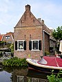
This is a category about rijksmonument number 22186
|
| Address |
|
Media in category "Nieuwstad 24 (Hindeloopen)"
The following 4 files are in this category, out of 4 total.
-
 Aanzicht - Hindeloopen - 20113547 - RCE.jpg 1,200 × 805; 186 KB
-
 Nieuwstad24 Hindeloopen.jpg 2,668 × 3,558; 818 KB
-
 Tuin- of zomerhuisje - Hindeloopen - 20113593 - RCE.jpg 1,200 × 872; 218 KB
-
 Zomerhuisjes, woonhuizen - Hindeloopen - 20113598 - RCE.jpg 960 × 1,200; 298 KB


