Category:Nieuwstad 12 (Hindeloopen)
Jump to navigation
Jump to search
| Object location | | View all coordinates using: OpenStreetMap |
|---|
 | |||||
| Upload media | |||||
| Instance of |
| ||||
|---|---|---|---|---|---|
| Location | Hindeloopen, Hindeloopen | ||||
| Located on street | |||||
| Heritage designation |
| ||||
 | |||||
|
This is a category about rijksmonument number 22184
|
| Address |
|
Media in category "Nieuwstad 12 (Hindeloopen)"
The following 6 files are in this category, out of 6 total.
-
 8713 Hindeloopen, Netherlands - panoramio (24).jpg 1,375 × 2,048; 629 KB
-
 Aanzicht - Hindeloopen - 20113540 - RCE.jpg 803 × 1,200; 191 KB
-
 Grootschippershuis - Hindeloopen - 20525068 - RCE.jpg 1,200 × 900; 107 KB
-
 Linker zijgevel - Hindeloopen - 20113541 - RCE.jpg 839 × 1,200; 248 KB
-
 Nieuwstad12 Hindeloopen.jpg 2,736 × 3,296; 862 KB
-
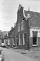
 Overzicht Nieuwstad - Hindeloopen - 20113463 - RCE.jpg 1,200 × 819; 266 KB
.jpg)


