Category:Nieuwe Geertruidkerk (Ouwerkerk)
Jump to navigation
Jump to search
| Object location | | View all coordinates using: OpenStreetMap |
|---|
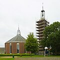
Nederlands: Ouwerkerk, Ring 48 - Geertruidkerk - anno 1956
Media in category "Nieuwe Geertruidkerk (Ouwerkerk)"
The following 4 files are in this category, out of 4 total.
-
 Nieuwe Geertruidkerk Ouwerkerk-0188.jpg 2,163 × 2,160; 1.35 MB
-
 Nieuwe Geertruidkerk Ouwerkerk-0189.jpg 2,457 × 2,160; 1.7 MB
-
 Ouwerkerk - kerk.jpg 2,448 × 3,264; 2.39 MB
-
 Ouwerkerk new Geertruidkerk.JPG 2,735 × 2,712; 1.24 MB


