Category:Newton-le-Willows, North Yorkshire
Jump to navigation
Jump to search
village and civil parish in the Richmondshire district of North Yorkshire, England  | |||||
| Upload media | |||||
| Instance of | |||||
|---|---|---|---|---|---|
| Location | Richmondshire, North Yorkshire, Yorkshire and the Humber, England | ||||
| Different from | |||||
 | |||||
English: Newton-le-Willows is a village and civil parish in the Richmondshire district of North Yorkshire, England, west of Bedale.
Media in category "Newton-le-Willows, North Yorkshire"
The following 108 files are in this category, out of 108 total.
-
 'Oak House', Aysgarth School - geograph.org.uk - 4327976.jpg 1,024 × 683; 185 KB
-
 'Woodbine House' - geograph.org.uk - 4328004.jpg 1,024 × 683; 142 KB
-
 10th Green on the Wensleydale Golf Course - geograph.org.uk - 5564948.jpg 5,184 × 3,456; 6.57 MB
-
 A row of hawthorn trees beside footpath - geograph.org.uk - 4327979.jpg 1,024 × 683; 218 KB
-
 Access Track to Lindale Lodge - geograph.org.uk - 5564681.jpg 5,184 × 3,456; 5.89 MB
-
 After the harvest, Cocked Hat - geograph.org.uk - 2587855.jpg 3,206 × 1,632; 1.07 MB
-
 Approaching Newton Gill - geograph.org.uk - 5564884.jpg 5,184 × 3,456; 5.8 MB
-
 Arable land near Finghall - geograph.org.uk - 5858031.jpg 1,024 × 768; 95 KB
-
 Aysgarth School - geograph.org.uk - 331003.jpg 640 × 480; 104 KB
-
 Aysgarth School, tower and sports field - geograph.org.uk - 4327272.jpg 694 × 1,024; 187 KB
-
 Barn, Primrose Farm - geograph.org.uk - 5533151.jpg 640 × 375; 41 KB
-
 Benchmark at Cocked Hat Farm - geograph.org.uk - 4328007.jpg 683 × 1,024; 280 KB
-
 Benchmark on 'Oak House' - geograph.org.uk - 4327947.jpg 683 × 1,024; 302 KB
-
 Benchmark on Aysgarth School Lodge - geograph.org.uk - 4327564.jpg 683 × 1,024; 266 KB
-
 Benchmark on former Methodist Chapel - geograph.org.uk - 4327533.jpg 683 × 1,024; 315 KB
-
-
 Benchmark on Woodbine House annex - geograph.org.uk - 4328002.jpg 683 × 1,024; 280 KB
-
 Benchmark on ^1 Brompton Road - geograph.org.uk - 4314579.jpg 683 × 1,024; 288 KB
-
 Bridge for Brompton Road over Newton Beck - geograph.org.uk - 4314549.jpg 1,024 × 683; 193 KB
-
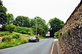
 Bridge for Wensleydale Railway over Bedale Road - geograph.org.uk - 4327478.jpg 1,024 × 683; 195 KB
-
 Bridleway at Ashley Hill - geograph.org.uk - 2587837.jpg 2,448 × 3,264; 2.62 MB
-
 Bus stop and departing bus, Newton-le-Willows - geograph.org.uk - 2294781.jpg 1,024 × 768; 140 KB
-
 Car on a country lane, Wensleydale - geograph.org.uk - 5858036.jpg 1,027 × 768; 132 KB
-
 Cattle Grange Farm - geograph.org.uk - 5533129.jpg 640 × 410; 48 KB
-
 Cocked Hat - geograph.org.uk - 2380833.jpg 640 × 480; 98 KB
-
 Cocked Hat - geograph.org.uk - 2587868.jpg 3,264 × 2,448; 2.16 MB
-
 Cocked Hat Farm - geograph.org.uk - 5563989.jpg 5,184 × 3,456; 7.72 MB
-
 Cocked Hat Farm, No Man's Moor Lane - geograph.org.uk - 4328008.jpg 1,024 × 683; 180 KB
-
 Croft House - geograph.org.uk - 4556045.jpg 4,000 × 2,659; 2.6 MB
-
 Crossing The Railway - geograph.org.uk - 5951960.jpg 640 × 465; 168 KB
-
 Entrance track to Ruswick Manor - geograph.org.uk - 4328006.jpg 1,024 × 683; 215 KB
-
 Farm Outbuilding off Moor End Lane - geograph.org.uk - 5563896.jpg 5,069 × 3,422; 6.71 MB
-
 Farm Track Crossing The Railway - geograph.org.uk - 5954307.jpg 640 × 432; 99 KB
-
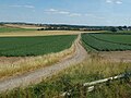
 Farmland south of No Man's Moor Lane - geograph.org.uk - 5699161.jpg 1,024 × 768; 246 KB
-
 Field opposite Ashley Carr - geograph.org.uk - 5564027.jpg 5,184 × 3,456; 3.89 MB
-
 Fields and Pastures by Lindale Lodge - geograph.org.uk - 5564679.jpg 5,184 × 3,456; 5.77 MB
-
 Fields Near Newton-le-Willows - geograph.org.uk - 5954317.jpg 640 × 462; 91 KB
-

-
 Former Methodist Chapel - geograph.org.uk - 4327552.jpg 1,024 × 683; 172 KB
-
 Grange Farm - geograph.org.uk - 5533132.jpg 640 × 371; 49 KB
-
 Grange farm Crossing - geograph.org.uk - 2389293.jpg 640 × 412; 82 KB
-

-
 Grazing near Grange Farm - geograph.org.uk - 5533126.jpg 640 × 357; 47 KB
-
 Grazing near Newton-le-Willows - geograph.org.uk - 5533137.jpg 640 × 390; 67 KB
-
 Grazing near Ruswick Manor - geograph.org.uk - 5533153.jpg 640 × 370; 56 KB
-
 Hill Top East farm sign - geograph.org.uk - 5699182.jpg 1,024 × 768; 179 KB
-

-
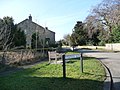
 Houses at Stubbing Nook - geograph.org.uk - 2380853.jpg 640 × 480; 90 KB
-
 Houses at Stubbing Nook - geograph.org.uk - 3101555.jpg 800 × 586; 98 KB
-
 Houses at the south end of Brompton Road - geograph.org.uk - 4314592.jpg 1,024 × 653; 152 KB
-
 Imposing building, Newton-le-Willows - geograph.org.uk - 2294786.jpg 1,024 × 768; 135 KB
-
 Lane at Newton le Willows - geograph.org.uk - 2589192.jpg 2,178 × 1,632; 634 KB
-
 Lodge at entrance to Aysgarth School - geograph.org.uk - 4327579.jpg 1,024 × 683; 208 KB
-

-
 Lumley Terrace, Newton-le-Willows - geograph.org.uk - 5564701.jpg 5,184 × 3,456; 5.32 MB
-
 Methodist chapel, Newton le Willows - geograph.org.uk - 2589209.jpg 3,264 × 2,448; 2.28 MB
-
 Minor Road Near Cocked hat - geograph.org.uk - 6220921.jpg 1,024 × 768; 185 KB
-
 Moor End Lane - geograph.org.uk - 5563899.jpg 5,184 × 3,456; 6.77 MB
-

-
 Newton le Willows - geograph.org.uk - 6220331.jpg 1,024 × 768; 196 KB
-
 Newton Le Willows ahead - geograph.org.uk - 2389315.jpg 640 × 387; 81 KB
-
 Newton-le-Willows Cricket Pavilion - geograph.org.uk - 5564692.jpg 5,184 × 3,456; 7.04 MB
-
 Newton-le-Willows MMB 01.jpg 4,082 × 2,031; 2.59 MB
-
 Newton-le-Willows MMB 02.jpg 4,093 × 2,205; 2.91 MB
-
 Newton-le-Willows View - geograph.org.uk - 5954311.jpg 640 × 521; 123 KB
-
 Newton-le-Willows.jpg 640 × 480; 88 KB
-
 No Man's Moor Lane - geograph.org.uk - 2380848.jpg 640 × 480; 135 KB
-
 No Man's Moor Lane - geograph.org.uk - 2587823.jpg 3,264 × 2,448; 1.55 MB
-
 No Man's Moor Lane at Cocked Hat - geograph.org.uk - 6220923.jpg 1,024 × 768; 178 KB
-
 No Man's Moor Lane at Stubbing Nook - geograph.org.uk - 5564034.jpg 5,156 × 3,151; 7.09 MB
-
 No Man's Moor Lane by Cocked Hat Farm - geograph.org.uk - 5563990.jpg 5,184 × 3,456; 5.8 MB
-
 No pints available here - geograph.org.uk - 2589251.jpg 3,264 × 2,448; 1.28 MB
-
 Pasture to the South of Lindale Lodge - geograph.org.uk - 5564687.jpg 5,184 × 3,456; 5.92 MB
-
 Path between Newton le Willows and Crakehall looking East - geograph.org.uk - 5630729.jpg 5,184 × 3,456; 5.76 MB
-
 Path between Newton le Willows and Crakehall looking West - geograph.org.uk - 5630727.jpg 5,184 × 3,456; 5.64 MB
-
 Primrose Farm - geograph.org.uk - 5533150.jpg 640 × 363; 42 KB
-
 Public Footpath heading East towards Newton-le-Willows - geograph.org.uk - 5564888.jpg 5,184 × 3,456; 6.51 MB
-
 Road junction, No Man's Moor Lane - geograph.org.uk - 5699157.jpg 1,024 × 768; 151 KB
-
 Ruswick Manor farm - geograph.org.uk - 1956504.jpg 800 × 533; 170 KB
-
 Ruswick Manor Farm - geograph.org.uk - 5564890.jpg 5,184 × 3,456; 7.04 MB
-
 Shallow valley south-east of Lindale Hill - geograph.org.uk - 5699145.jpg 1,024 × 768; 265 KB
-
 Sheep dip near Newton-le-Willows, Wensleydale - geograph.org.uk - 5858034.jpg 1,024 × 768; 207 KB
-
 Sheep grazing at Hill Top East - geograph.org.uk - 5699197.jpg 1,024 × 615; 264 KB
-
 Sheep pastures, Newton le Willows - geograph.org.uk - 2589273.jpg 2,178 × 1,632; 709 KB
-
 Sheep pen - geograph.org.uk - 1956507.jpg 800 × 533; 154 KB
-
 Site of Jervaulx station, Newton-le-Willows 2000 - geograph.org.uk - 5432850.jpg 2,238 × 1,470; 3.58 MB
-
 Small pond at side of golf course - geograph.org.uk - 1956476.jpg 800 × 533; 185 KB
-
 Station Road, Newton-le-Willows - geograph.org.uk - 2294783.jpg 1,024 × 768; 171 KB
-

-
 Stone Hag Wood - geograph.org.uk - 4556058.jpg 4,000 × 2,250; 1.53 MB
-
 Stubble field, Newton-le-Willows - geograph.org.uk - 5533145.jpg 640 × 427; 68 KB
-

-
 The annex at 'Woodbine House' - geograph.org.uk - 4328003.jpg 1,024 × 683; 143 KB
-
 The Granary at Cocked Hat Farm - geograph.org.uk - 3101506.jpg 800 × 600; 107 KB
-
 The highest point of the golf course - geograph.org.uk - 1956491.jpg 800 × 533; 82 KB
-
 The Wensleydale Railway at Newton-le-Willows - geograph.org.uk - 5564697.jpg 5,184 × 3,456; 7 MB
-
 Tornado at Newton-le-Willows (Yorkshire).jpg 3,000 × 1,800; 3.73 MB
-
 Track from Primrose Farm - geograph.org.uk - 5855202.jpg 1,024 × 768; 179 KB
-
 Track over Ashley Hill - geograph.org.uk - 5564030.jpg 5,184 × 3,456; 7.32 MB
-

-
 Tree on a field and district boundary - geograph.org.uk - 5699168.jpg 1,024 × 768; 230 KB
-
 Valley of Moor Beck - geograph.org.uk - 5564896.jpg 5,184 × 3,456; 5.94 MB
-
 View towards Sand Hill Farm - geograph.org.uk - 5564025.jpg 5,184 × 3,456; 5.49 MB
-

-
 Village houses, Newton le Willows - geograph.org.uk - 2589231.jpg 2,844 × 2,039; 1.02 MB
-
 Wensleydale Railway above Moor Beck - geograph.org.uk - 5564944.jpg 5,184 × 3,456; 7.25 MB
-
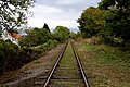
 Wensleydale Railway line - geograph.org.uk - 1956484.jpg 800 × 533; 214 KB
-
 Winter trees, Lindale Hill - geograph.org.uk - 5699153.jpg 1,024 × 768; 207 KB


.jpg)


