Category:Nene Way
Jump to navigation
Jump to search
Long-distance footpath in England .JPG) | |||||
| Upload media | |||||
| Instance of |
| ||||
|---|---|---|---|---|---|
| Location | Northamptonshire, East Midlands, England | ||||
| Length |
| ||||
| Terminus | |||||
 | |||||

Media in category "Nene Way"
The following 150 files are in this category, out of 150 total.
-
 A Field of Wheat - geograph.org.uk - 191985.jpg 640 × 480; 75 KB
-
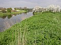
 A high tide on The River Nene - geograph.org.uk - 1736038.jpg 2,848 × 2,136; 3.05 MB
-
 A stand of Willow trees near Barnwell - geograph.org.uk - 1339864.jpg 640 × 480; 104 KB
-
 All Saints church, Flore - geograph.org.uk - 490001.jpg 640 × 477; 124 KB
-

-
 Alwalton Lock - geograph.org.uk - 1318889.jpg 640 × 480; 90 KB
-
 Ashton Lock - River Nene - Oundle - July 2014 - panoramio.jpg 4,000 × 3,000; 1.61 MB
-
 Barns - geograph.org.uk - 191979.jpg 640 × 502; 92 KB
-
 Barnwell lower lock - geograph.org.uk - 1339967.jpg 640 × 480; 89 KB
-
 Baulks Lane, Aldwincle - geograph.org.uk - 1377975.jpg 640 × 480; 116 KB
-
 Beside the River Nene near Ashton Viillage - Juy 2014 - panoramio.jpg 2,669 × 2,331; 1.04 MB
-

-
 Bluebell Walk along River Nene - panoramio.jpg 2,048 × 1,536; 1.88 MB
-
 Bluebells - panoramio (1).jpg 2,048 × 1,536; 1.92 MB
-

-
 Bridge over Back Dyke - geograph.org.uk - 1318902.jpg 640 × 480; 123 KB
-
 Buttercup covered meadow on the Nene Way - geograph.org.uk - 1319544.jpg 640 × 480; 101 KB
-
 Byway alongside Park Spinney - geograph.org.uk - 1319959.jpg 640 × 480; 111 KB
-
 Cogenhoe Mill - geograph.org.uk - 162050.jpg 640 × 480; 89 KB
-
 Dismantled Railway-Cycle Track - geograph.org.uk - 186440.jpg 640 × 480; 109 KB
-
 Entering Cogenhoe along the Nene Way - geograph.org.uk - 171401.jpg 640 × 480; 100 KB
-
 Fancy a walk^ - geograph.org.uk - 1549860.jpg 640 × 480; 84 KB
-
 Feed me - geograph.org.uk - 1319417.jpg 640 × 480; 127 KB
-
 Field access track, Nassington - geograph.org.uk - 1319849.jpg 640 × 480; 71 KB
-
 Follow the arrow, Nene Way, Woodford - geograph.org.uk - 1381864.jpg 640 × 480; 119 KB
-
 Footbridge across the River Nene - geograph.org.uk - 178740.jpg 640 × 480; 118 KB
-
 Footbridge for the Nene way - geograph.org.uk - 1339947.jpg 640 × 480; 85 KB
-
 Footbridge near Denford - geograph.org.uk - 1381804.jpg 640 × 480; 147 KB
-
 Footbridge on the Nene Way - geograph.org.uk - 1319401.jpg 640 × 480; 140 KB
-

-
 Footbridge over Broadholm Weir - geograph.org.uk - 120187.jpg 640 × 480; 88 KB
-
-
 Footpath T junction near Castor - geograph.org.uk - 1317348.jpg 640 × 480; 100 KB
-
 Footpath through Wheat - geograph.org.uk - 196729.jpg 640 × 480; 94 KB
-
 Footpath to Irthlingborough - geograph.org.uk - 1382275.jpg 640 × 480; 96 KB
-
 Footpath To the Addingtons - geograph.org.uk - 1382043.jpg 640 × 480; 88 KB
-
 Galvanised stile on the Nene Way - geograph.org.uk - 1317418.jpg 640 × 480; 156 KB
-
 Grazed tree on the Nene Way - geograph.org.uk - 1318926.jpg 640 × 480; 96 KB
-
 Handrail deep in the Linches - geograph.org.uk - 1340211.jpg 640 × 480; 153 KB
-
 Impaled fence on the Nene Way - geograph.org.uk - 1320537.jpg 640 × 480; 132 KB
-
 Irchester Country Park - geograph.org.uk - 27406.jpg 640 × 480; 286 KB
-
 Kissing gates on the Nene way near Aston - geograph.org.uk - 1339786.jpg 640 × 480; 102 KB
-
 Marsh Lane - geograph.org.uk - 96869.jpg 640 × 480; 72 KB
-
 Nene River - geograph.org.uk - 162057.jpg 640 × 480; 112 KB
-
 Nene Way - geograph.org.uk - 1070078.jpg 427 × 640; 113 KB
-
 Nene Way - geograph.org.uk - 529620.jpg 640 × 427; 102 KB
-
 Nene Way - geograph.org.uk - 82961.jpg 640 × 480; 41 KB
-
 Nene Way at Yarwell - geograph.org.uk - 1319557.jpg 640 × 480; 106 KB
-
 Nene Way heading towards Warmington - geograph.org.uk - 1320553.jpg 640 × 480; 92 KB
-

-
 Nene way marker post 30,03,2008 (11).JPG 1,920 × 2,560; 1.09 MB
-
 Nene Way near Sutton - geograph.org.uk - 1319305.jpg 640 × 480; 135 KB
-
 Nene Way near the A605, Oundle - geograph.org.uk - 1339887.jpg 640 × 480; 144 KB
-
 Nene Way near Wansford - geograph.org.uk - 1319430.jpg 640 × 480; 136 KB
-
-
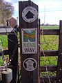
 Nene Way Sign - geograph.org.uk - 835233.jpg 640 × 480; 124 KB
-
 Nene Way towards Nassington - geograph.org.uk - 1319837.jpg 640 × 480; 84 KB
-
 Nene Way, Irthlingborough - geograph.org.uk - 1382447.jpg 640 × 480; 148 KB
-
 Nene Way, Peterborough - geograph.org.uk - 83170.jpg 640 × 480; 149 KB
-
 New stile on The Nene Way, Guyhirn Wash - geograph.org.uk - 1737821.jpg 2,848 × 2,136; 3.05 MB
-

-
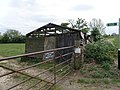 Old shed at Nassington - geograph.org.uk - 1319753.jpg 640 × 480; 86 KB
-

-
 Oundle bypass ex railway bridge - geograph.org.uk - 1339878.jpg 640 × 480; 109 KB
-
 Pedestrian Bridge, Barnwell lower lock - geograph.org.uk - 1339960.jpg 640 × 480; 154 KB
-
 River Nene at Ferry Meadows - geograph.org.uk - 162157.jpg 576 × 432; 279 KB
-
 River Nene, Wisbech - geograph.org.uk - 1350143.jpg 640 × 428; 75 KB
-

-
 Shaded area below Achurch church - geograph.org.uk - 1340234.jpg 640 × 480; 130 KB
-
 Sheep handling facility by the Nene Way - geograph.org.uk - 1320548.jpg 640 × 480; 102 KB
-
 South Bank, Nr Eldernell - geograph.org.uk - 695629.jpg 640 × 426; 110 KB
-
 South Bank, Nr Eldernell - geograph.org.uk - 695635.jpg 640 × 426; 112 KB
-

-
 Stand off beside the Nene - geograph.org.uk - 1339437.jpg 640 × 480; 93 KB
-
 Steps to the Ashton Oundle footbridge - geograph.org.uk - 1339398.jpg 640 × 480; 157 KB
-
 Stibbington boat yard - geograph.org.uk - 1319294.jpg 640 × 480; 81 KB
-
 Stile on the Nene Way - geograph.org.uk - 665763.jpg 640 × 480; 66 KB
-
 Swan on the River Nene - geograph.org.uk - 178905.jpg 640 × 466; 74 KB
-
 Take the Low Road - geograph.org.uk - 665789.jpg 640 × 480; 94 KB
-
 The Nene River - geograph.org.uk - 171696.jpg 640 × 480; 77 KB
-
 The Nene Way - geograph.org.uk - 1071369.jpg 427 × 640; 82 KB
-
 The Nene Way - geograph.org.uk - 1210981.jpg 640 × 480; 116 KB
-
 The Nene Way - geograph.org.uk - 1340134.jpg 640 × 480; 124 KB
-
 The Nene Way - geograph.org.uk - 1528372.jpg 640 × 480; 73 KB
-
 The Nene Way - geograph.org.uk - 490108.jpg 640 × 480; 135 KB
-
 The Nene Way - Guyhirn Wash - The Nene Washes - geograph.org.uk - 1755818.jpg 2,848 × 2,136; 3.01 MB
-

-
 The Nene Way heading into Guyhirn - geograph.org.uk - 1736119.jpg 2,848 × 2,136; 3.03 MB
-
 The Nene Way heading towards Aldwincle - geograph.org.uk - 1377971.jpg 640 × 480; 152 KB
-
 The Nene Way in Islip - geograph.org.uk - 1377984.jpg 640 × 480; 64 KB
-

-
 The Nene Way looking south west - geograph.org.uk - 1319814.jpg 640 × 480; 96 KB
-
 The Nene Way near Bugbrooke Mill - geograph.org.uk - 644834.jpg 640 × 480; 180 KB
-
 The Nene Way near Bugbrooke Mill - geograph.org.uk - 644846.jpg 640 × 480; 108 KB
-
 The Nene Way near Bugbrooke Mill - geograph.org.uk - 644855.jpg 480 × 640; 115 KB
-
 The Nene Way near Castor Mill - geograph.org.uk - 1318964.jpg 640 × 480; 81 KB
-
 The Nene Way near Fotheringhay - geograph.org.uk - 1320671.jpg 640 × 480; 128 KB
-
 The Nene Way near Sutton Bridge - geograph.org.uk - 1513688.jpg 640 × 480; 72 KB
-
 The Nene Way near Wadenhoe - geograph.org.uk - 1377970.jpg 640 × 480; 134 KB
-
 The Nene Way near Walcot lodge - geograph.org.uk - 1320673.jpg 640 × 480; 130 KB
-
 The Nene Way passing through Guyhirn - geograph.org.uk - 1736225.jpg 2,848 × 2,136; 3.05 MB
-
 The Nene way thro Achurch churchyard - geograph.org.uk - 490098.jpg 640 × 480; 108 KB
-
 The Nene Way, Guyhirn Wash - The Nene Washes - geograph.org.uk - 1737591.jpg 2,848 × 2,136; 3.12 MB
-
 The Nene Way, Wisbech - geograph.org.uk - 1504863.jpg 640 × 480; 100 KB
-
 The river bank at Guyhirn - geograph.org.uk - 1736201.jpg 2,848 × 2,136; 3 MB
-
 The River Nene - geograph.org.uk - 266822.jpg 640 × 480; 81 KB
-

-
 Tired shed at Nassington - geograph.org.uk - 1319745.jpg 640 × 480; 105 KB
-
 Towards Elmington Top Lodge - geograph.org.uk - 1339347.jpg 640 × 480; 75 KB
-
 Trailer Chassis by the Roman Road - geograph.org.uk - 1339297.jpg 640 × 480; 101 KB
-
 Transformer by the River Nene - geograph.org.uk - 1528378.jpg 508 × 640; 71 KB
-
 Underpass for the Nene Way - geograph.org.uk - 1252559.jpg 640 × 480; 94 KB
-
 Walk this way and that way - geograph.org.uk - 822730.jpg 480 × 640; 47 KB
-
 Warning sign beside the Nene Way - geograph.org.uk - 1339333.jpg 480 × 640; 107 KB
-

-
 Waymarker on the Nene Way - geograph.org.uk - 1319096.jpg 640 × 480; 155 KB
-
 Weighbridge beside the Nene Way - geograph.org.uk - 1339265.jpg 640 × 480; 84 KB
-
 Weir on the Nene Way - geograph.org.uk - 116706.jpg 640 × 413; 163 KB
-
 Woodford Shrubbery - geograph.org.uk - 1381852.jpg 640 × 480; 167 KB
-
 Yarwell Mill - geograph.org.uk - 1319643.jpg 640 × 480; 83 KB
-
 Yarwell Mill from the Nene Way - geograph.org.uk - 1319624.jpg 640 × 480; 101 KB
-
 A45 Bridge over the Nene River - geograph.org.uk - 178890.jpg 640 × 480; 103 KB
-
 Billing Aquadrome - geograph.org.uk - 171423.jpg 640 × 480; 89 KB
-
 Cattle Grazing - geograph.org.uk - 196742.jpg 640 × 480; 82 KB
-
 Construction Site - geograph.org.uk - 196669.jpg 640 × 480; 95 KB
-
 Construction Site - geograph.org.uk - 196679.jpg 640 × 480; 70 KB
-
 County Council Offices - geograph.org.uk - 178897.jpg 640 × 480; 91 KB
-
 Earls Barton - geograph.org.uk - 111355.jpg 640 × 480; 128 KB
-
 Farmland and Footpaths - geograph.org.uk - 130431.jpg 640 × 480; 63 KB
-
 Farmland near Everdon - geograph.org.uk - 101772.jpg 640 × 225; 36 KB
-
 Footbridge for the Nene Way - geograph.org.uk - 178909.jpg 640 × 480; 90 KB
-
 Footbridge on the Nene Way - geograph.org.uk - 101723.jpg 640 × 480; 71 KB
-
 Footbridge over the A45 - geograph.org.uk - 160381.jpg 640 × 467; 98 KB
-
 Lowick Road Islip - geograph.org.uk - 144224.jpg 640 × 480; 55 KB
-
 Nene Way and Bassenhally Farm - geograph.org.uk - 599796.jpg 640 × 480; 94 KB
-

-
 Nene Way footpath near Little Everdon - geograph.org.uk - 101711.jpg 640 × 480; 136 KB
-
 New Housing - geograph.org.uk - 196689.jpg 640 × 428; 73 KB
-
 North Fen from the flood bank - geograph.org.uk - 393962.jpg 640 × 480; 145 KB
-
 Oundle School Rifle Range - geograph.org.uk - 191974.jpg 640 × 480; 75 KB
-
 Quarry-Lake - geograph.org.uk - 196654.jpg 640 × 480; 81 KB
-
 Slipway, Nene Way, Peterborough - geograph.org.uk - 83173.jpg 640 × 480; 119 KB
-
 St Peter's Farm from the Nene Way - geograph.org.uk - 665783.jpg 640 × 480; 65 KB
-
 Take the High Road - geograph.org.uk - 665793.jpg 640 × 480; 82 KB
-
 The Nene Way - geograph.org.uk - 160384.jpg 640 × 480; 120 KB
-
 Towards Kislingbury - geograph.org.uk - 196734.jpg 480 × 640; 52 KB
-
 Track near Dog-in-a-Doublet bridge - geograph.org.uk - 639400.jpg 640 × 428; 79 KB
-
 Upper Weedon - geograph.org.uk - 304030.jpg 640 × 480; 114 KB
-
 Upton Hall Farm - geograph.org.uk - 196704.jpg 640 × 480; 82 KB
-
 View across a Wheat Field - geograph.org.uk - 191989.jpg 640 × 480; 83 KB


.jpg)


