Category:Neerstraat 34, Roermond
Jump to navigation
Jump to search
| Object location | | View all coordinates using: OpenStreetMap |
|---|
building in Roermond, Netherlands  | |||||
| Upload media | |||||
| Instance of | |||||
|---|---|---|---|---|---|
| Part of |
| ||||
| Location | Roermond, Limburg, Netherlands | ||||
| Street address |
| ||||
| Located on street | |||||
| Heritage designation |
| ||||
 | |||||
Nederlands: Cillekens-Dreessens
|
This is a category about rijksmonumentcomplex number 515684
|
|
This is a category about rijksmonument number 510504
|
|
This is a category about rijksmonument number 515685
|
Pakhuis
|
This is a category about rijksmonument number 515686
|
Werkplaats
|
This is a category about rijksmonument number 515687
|
| Address |
|
Media in category "Neerstraat 34, Roermond"
The following 11 files are in this category, out of 11 total.
-
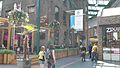
 Neerstraat 34, Roermond.jpg 480 × 640; 105 KB
-
 Overrzicht voorgevel - Roermond - 20533691 - RCE.jpg 875 × 1,200; 218 KB
-
 Overrzicht voorgevel - Roermond - 20533692 - RCE.jpg 809 × 1,200; 209 KB
-
 Overzicht - Roermond - 20189778 - RCE.jpg 1,200 × 788; 221 KB
-
 Pakhuis Cillekens Dreessens.jpg 2,048 × 1,152; 379 KB
-
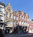
 RM510504 Roermond - Neerstraat 34.jpg 1,944 × 2,592; 1.22 MB
-
 Roermond 069.JPG 640 × 480; 264 KB
-
 Roermond, Neerstraat 34, RM510504.jpg 2,104 × 2,821; 1.82 MB
-
 Roermond, Neerstraat 34-38, RM510504, RM520540.jpg 2,885 × 3,202; 2.44 MB
-
 Werkplaats Cillekens Dreessens.jpg 1,280 × 720; 144 KB
-
 Winkelpui met ingang - Roermond - 20533693 - RCE.jpg 1,200 × 800; 228 KB


