Category:Nedumangad
Jump to navigation
Jump to search
Nedumangad is a town and a municipality in Thiruvananthapurm district in the Indian state of Kerala. It is one of four taluks in the district. It is located around 20 km to the north-east of Thiruvananthapuram city on the Thiruvananthapuram — Thenmala State Highway. It is an important centre for the commercial trade in pepper and rubber.8°36′12″N 77°0′10″E / 8.60333°N 77.0028°E
municipality in Thiruvananthapuram in Kerala, India  | |||||
| Upload media | |||||
| Instance of | |||||
|---|---|---|---|---|---|
| Location | Thiruvananthapuram district, Kerala, India | ||||
| Legislative body |
| ||||
| Population |
| ||||
| Area |
| ||||
| Elevation above sea level |
| ||||
 | |||||
Subcategories
This category has the following 3 subcategories, out of 3 total.
Media in category "Nedumangad"
The following 19 files are in this category, out of 19 total.
-
-
 Fowlea piscator 146129790.jpg 2,048 × 1,536; 1.69 MB
-
 Fowlea piscator 146129816.jpg 2,048 × 1,536; 1.51 MB
-
 Fowlea piscator 146129823.jpg 2,048 × 1,536; 1.35 MB
-
 Img 20170929 112100 Jpg (261210633).jpeg 2,048 × 1,364; 1.46 MB
-
 Img 20170929 112634 Jpg (261210635).jpeg 2,048 × 1,364; 1.45 MB
-
 Img 20170929 115944 Jpg (261210663).jpeg 2,048 × 1,364; 1.96 MB
-
 Img 20170929 120224 Jpg (261210675).jpeg 2,048 × 1,364; 1,001 KB
-
 Img 20170929 120514 Jpg (261210679).jpeg 2,048 × 1,364; 1.31 MB
-
 Img 20170929 121622 Jpg (261210681).jpeg 2,048 × 1,366; 819 KB
-
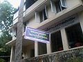 Karakulam study center.jpg 1,600 × 1,200; 750 KB
-
 Kottayam-2006.JPG 1,146 × 567; 109 KB
-
 Nedumangad Revenue Tower.jpg 1,080 × 671; 108 KB
-
 Nedumangad-cmp.JPG 730 × 955; 131 KB
-
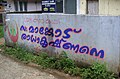
 Nedumangad-cpi.JPG 1,265 × 779; 154 KB
-
 Nedumangad-cpimural.JPG 1,165 × 764; 155 KB
-
 Nedumangad-msc.JPG 1,280 × 960; 467 KB
-
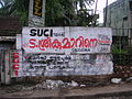 Nedumangad-suci.JPG 1,280 × 960; 470 KB
-
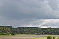
 Sky view of nedumangad town.jpg 1,080 × 720; 62 KB


.jpeg)
.jpeg)
.jpeg)
.jpeg)
.jpeg)
.jpeg)


